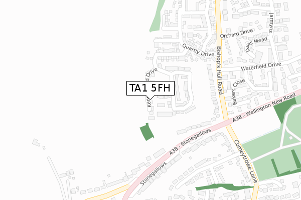
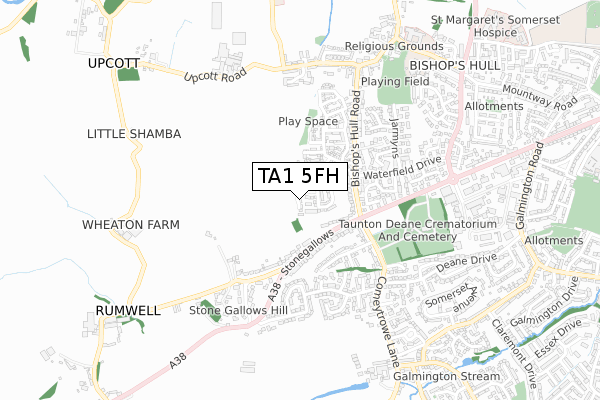
TA1 5FH is located in the Bishop's Hull & Taunton West electoral ward, within the unitary authority of Somerset and the English Parliamentary constituency of Taunton Deane. The Sub Integrated Care Board (ICB) Location is NHS Somerset ICB - 11X and the police force is Avon and Somerset. This postcode has been in use since December 2018.


GetTheData
Source: OS Open Zoomstack (Ordnance Survey)
Licence: Open Government Licence (requires attribution)
Attribution: Contains OS data © Crown copyright and database right 2024
Source: Open Postcode Geo
Licence: Open Government Licence (requires attribution)
Attribution: Contains OS data © Crown copyright and database right 2024; Contains Royal Mail data © Royal Mail copyright and database right 2024; Source: Office for National Statistics licensed under the Open Government Licence v.3.0
| Easting | 320093 |
| Northing | 124113 |
| Latitude | 51.010821 |
| Longitude | -3.140401 |
GetTheData
Source: Open Postcode Geo
Licence: Open Government Licence
| Country | England |
| Postcode District | TA1 |
| ➜ TA1 open data dashboard ➜ See where TA1 is on a map ➜ Where is Taunton? | |
GetTheData
Source: Land Registry Price Paid Data
Licence: Open Government Licence
| Ward | Bishop's Hull & Taunton West |
| Constituency | Taunton Deane |
GetTheData
Source: ONS Postcode Database
Licence: Open Government Licence
| November 2023 | Other theft | On or near Bakers Close | 342m |
| February 2023 | Criminal damage and arson | On or near Bakers Close | 342m |
| November 2022 | Burglary | On or near Bakers Close | 342m |
| ➜ Get more crime data in our Crime section | |||
GetTheData
Source: data.police.uk
Licence: Open Government Licence
| Comeytrowe Lane (Stonegallows) | Taunton | 174m |
| Comeytrowe Lane (Stonegallows) | Taunton | 188m |
| Bishop's Hull Road (Bishop's Hull) | Taunton | 342m |
| Waterfield Drive | Taunton | 347m |
| Crematorium (Wellington New Road) | Taunton | 411m |
| Taunton Station | 3km |
| Bishop's Lydeard | 6.2km |
GetTheData
Source: NaPTAN
Licence: Open Government Licence
| Percentage of properties with Next Generation Access | 100.0% |
| Percentage of properties with Superfast Broadband | 100.0% |
| Percentage of properties with Ultrafast Broadband | 100.0% |
| Percentage of properties with Full Fibre Broadband | 100.0% |
Superfast Broadband is between 30Mbps and 300Mbps
Ultrafast Broadband is > 300Mbps
| Percentage of properties unable to receive 2Mbps | 0.0% |
| Percentage of properties unable to receive 5Mbps | 0.0% |
| Percentage of properties unable to receive 10Mbps | 0.0% |
| Percentage of properties unable to receive 30Mbps | 0.0% |
GetTheData
Source: Ofcom
Licence: Ofcom Terms of Use (requires attribution)
GetTheData
Source: ONS Postcode Database
Licence: Open Government Licence


➜ Get more ratings from the Food Standards Agency
GetTheData
Source: Food Standards Agency
Licence: FSA terms & conditions
| Last Collection | |||
|---|---|---|---|
| Location | Mon-Fri | Sat | Distance |
| Bishops Hull Post Office | 17:00 | 12:00 | 602m |
| Smithy Cottage | 16:00 | 11:30 | 873m |
| Musgrove | 16:30 | 12:00 | 1,005m |
GetTheData
Source: Dracos
Licence: Creative Commons Attribution-ShareAlike
| Facility | Distance |
|---|---|
| Bishops Hull Playing Field Bishops Hull Hill, Bishops Hull, Taunton Grass Pitches | 768m |
| Galmington Playing Fields Belmont Road, Taunton Grass Pitches | 1.2km |
| Bishop Henderson C Of E Primary School Henderson Close, Taunton Grass Pitches | 1.4km |
GetTheData
Source: Active Places
Licence: Open Government Licence
| School | Phase of Education | Distance |
|---|---|---|
| Bishops Hull Primary School Bishops Hull Hill, Bishops Hull, Taunton, TA1 5EB | Primary | 746m |
| Bishop Henderson Church of England Primary School, Taunton Henderson Close, Taunton, TA1 4TU | Primary | 1.4km |
| The Castle School Wellington Road, Taunton, TA1 5AU | Secondary | 1.7km |
GetTheData
Source: Edubase
Licence: Open Government Licence
The below table lists the International Territorial Level (ITL) codes (formerly Nomenclature of Territorial Units for Statistics (NUTS) codes) and Local Administrative Units (LAU) codes for TA1 5FH:
| ITL 1 Code | Name |
|---|---|
| TLK | South West (England) |
| ITL 2 Code | Name |
| TLK2 | Dorset and Somerset |
| ITL 3 Code | Name |
| TLK23 | Somerset CC |
| LAU 1 Code | Name |
| E07000246 | Somerset West and Taunton |
GetTheData
Source: ONS Postcode Directory
Licence: Open Government Licence
The below table lists the Census Output Area (OA), Lower Layer Super Output Area (LSOA), and Middle Layer Super Output Area (MSOA) for TA1 5FH:
| Code | Name | |
|---|---|---|
| OA | E00149041 | |
| LSOA | E01029256 | Taunton Deane 008A |
| MSOA | E02006106 | Taunton Deane 008 |
GetTheData
Source: ONS Postcode Directory
Licence: Open Government Licence
| TA1 5FD | Gwyther Mead | 156m |
| TA1 5JN | Stonegallows | 182m |
| TA1 5ER | Bishops Hull Road | 214m |
| TA1 5JW | Stonegallows | 228m |
| TA1 5JR | Stonegallows | 243m |
| TA1 5BF | Quartly Drive | 284m |
| TA1 5JU | West Field Close | 303m |
| TA1 5JP | Stonegallows | 316m |
| TA1 5HD | Bakers Close | 328m |
| TA1 5FA | Shutewater Orchard | 357m |
GetTheData
Source: Open Postcode Geo; Land Registry Price Paid Data
Licence: Open Government Licence