Bishops Hull Playing Field
Bishops Hull Playing Field is located in Bishops Hull, Taunton (TA1), and offers Grass Pitches.
| Address | Bishops Hull Hill, Bishops Hull, Taunton, TA1 5EB |
| Car Park | Yes |
| Car Park Capacity | 50 |
| Management Type | Trust |
| Management Group | Trust |
| Owner Type | Other |
| Owner Group | Others |
| Education Phase | Not applicable |
Facilities
| Accessibility | Sports Club / Community Association |
| Management Type | Trust |
| Year Built | 1984 |
| Changing Rooms | Yes |
| Year Changing Rooms Refurbished | 2018 |
| Date Record Checked | 10th May 2023 |
| Opening Times | Dawn To Dusk |
Facility specifics
Disabled access
| Disabled Access | Yes |
| Finding/Reaching Entrance | Yes |
| Activity Areas | Yes |
| Spectator Areas | Yes |
| Emergency Exits | Yes |
| Status Notes | 1 grass square inc an artificial wicket
|
| Accessibility | Sports Club / Community Association |
| Management Type | Trust |
| Year Built | 1984 |
| Changing Rooms | Yes |
| Year Changing Rooms Refurbished | 2018 |
| Date Record Checked | 10th May 2023 |
| Opening Times | Dawn To Dusk |
Facility specifics
Disabled access
| Disabled Access | Yes |
| Finding/Reaching Entrance | Yes |
| Activity Areas | Yes |
| Spectator Areas | Yes |
| Emergency Exits | Yes |
| Accessibility | Sports Club / Community Association |
| Management Type | Trust |
| Changing Rooms | Yes |
| Year Changing Rooms Refurbished | 2018 |
| Date Record Created | 8th Dec 2016 |
| Date Record Checked | 10th May 2023 |
| Opening Times | Dawn To Dusk |
Facility specifics
Disabled access
| Disabled Access | Yes |
| Finding/Reaching Entrance | Yes |
| Activity Areas | Yes |
| Spectator Areas | Yes |
| Emergency Exits | Yes |
Contact
Disabled access
Disabled access for Bishops Hull Playing Field
| Disabled Access | Yes |
| Finding/Reaching Entrance | Yes |
| Activity Areas | Yes |
| Spectator Areas | Yes |
| Emergency Exits | Yes |
Where is Bishops Hull Playing Field?
| Sub Building Name | |
| Building Name | |
| Building Number | 0 |
| Dependent Thoroughfare | |
| Thoroughfare Name | BISHOPS HULL HILL |
| Double Dependent Locality | |
| Dependent Locality | BISHOPS HULL |
| PostTown | TAUNTON |
| Postcode | TA1 5EB |
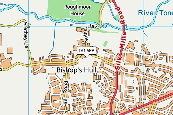
Bishops Hull Playing Field on a map

Bishops Hull Playing Field geodata
| Easting | 320520.09 |
| Northing | 124750.58 |
| Latitude | 51.016618 |
| Longitude | -3.134445 |
| Local Authority Name | Somerset West and Taunton |
| Local Authority Code | E07000246 |
| Parliamentary Constituency Name | Taunton Deane |
| Parliamentary Constituency Code | E14000988 |
| Region Name | South West |
| Region Code | E15000009 |
| Ward Name | Comeytrowe & Bishop's Hull |
| Ward Code | E05012808 |
| Output Area Code | E00149043 |
About this data
This data is open data sourced from Active Places Power and licenced under the Active Places Open Data Licence.
| Created On | 28th Sep 2005 |
| Audited On | 10th May 2023 |
| Checked On | 10th May 2023 |
