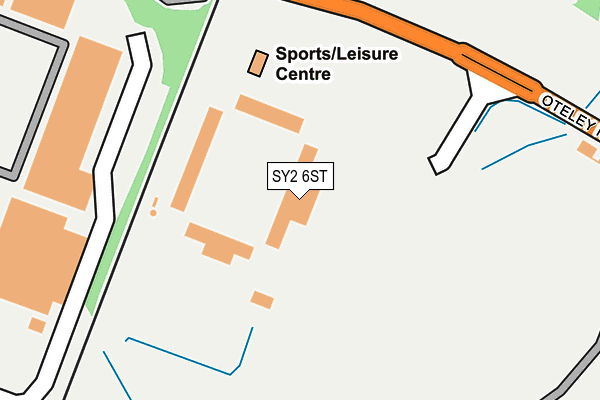
SY2 6ST is located in the Bayston Hill, Column and Sutton electoral ward, within the unitary authority of Shropshire and the English Parliamentary constituency of Shrewsbury and Atcham. The Sub Integrated Care Board (ICB) Location is NHS Shropshire, Telford and Wrekin ICB - M2L0M and the police force is West Mercia. This postcode has been in use since July 2007.


GetTheData
Source: OS OpenMap – Local (Ordnance Survey)
Source: OS VectorMap District (Ordnance Survey)
Licence: Open Government Licence (requires attribution)
| Easting | 349418 |
| Northing | 310291 |
| Latitude | 52.687947 |
| Longitude | -2.749747 |
GetTheData
Source: Open Postcode Geo
Licence: Open Government Licence
| Country | England |
| Postcode District | SY2 |
➜ See where SY2 is on a map | |
GetTheData
Source: Land Registry Price Paid Data
Licence: Open Government Licence
Elevation or altitude of SY2 6ST as distance above sea level:
| Metres | Feet | |
|---|---|---|
| Elevation | 70m | 230ft |
Elevation is measured from the approximate centre of the postcode, to the nearest point on an OS contour line from OS Terrain 50, which has contour spacing of ten vertical metres.
➜ How high above sea level am I? Find the elevation of your current position using your device's GPS.
GetTheData
Source: Open Postcode Elevation
Licence: Open Government Licence
| Ward | Bayston Hill, Column And Sutton |
| Constituency | Shrewsbury And Atcham |
GetTheData
Source: ONS Postcode Database
Licence: Open Government Licence
| Sainsburys (Meole Retail Park) | Meole Brace | 301m |
| Stapleton Road Jct (Moneybrook Way) | Meole Brace | 514m |
| Moneybrook Way Jct (Hereford Road) | Meole Brace | 525m |
| Moneybrook Way Jct (Hereford Road) | Meole Brace | 535m |
| Stapleton Road Jct (Moneybrook Way) | Meole Brace | 569m |
| Shrewsbury Station | 2.7km |
GetTheData
Source: NaPTAN
Licence: Open Government Licence
GetTheData
Source: ONS Postcode Database
Licence: Open Government Licence


➜ Get more ratings from the Food Standards Agency
GetTheData
Source: Food Standards Agency
Licence: FSA terms & conditions
| Last Collection | |||
|---|---|---|---|
| Location | Mon-Fri | Sat | Distance |
| Sainsburys | 18:45 | 11:15 | 240m |
| Sainsburys | 19:15 | 12:00 | 240m |
| Oteley Road | 18:45 | 11:30 | 532m |
GetTheData
Source: Dracos
Licence: Creative Commons Attribution-ShareAlike
The below table lists the International Territorial Level (ITL) codes (formerly Nomenclature of Territorial Units for Statistics (NUTS) codes) and Local Administrative Units (LAU) codes for SY2 6ST:
| ITL 1 Code | Name |
|---|---|
| TLG | West Midlands (England) |
| ITL 2 Code | Name |
| TLG2 | Shropshire and Staffordshire |
| ITL 3 Code | Name |
| TLG22 | Shropshire |
| LAU 1 Code | Name |
| E06000051 | Shropshire |
GetTheData
Source: ONS Postcode Directory
Licence: Open Government Licence
The below table lists the Census Output Area (OA), Lower Layer Super Output Area (LSOA), and Middle Layer Super Output Area (MSOA) for SY2 6ST:
| Code | Name | |
|---|---|---|
| OA | E00147607 | |
| LSOA | E01028986 | Shropshire 022D |
| MSOA | E02006036 | Shropshire 022 |
GetTheData
Source: ONS Postcode Directory
Licence: Open Government Licence
| SY2 6QN | Oteley Road | 361m |
| SY3 9LB | Hereford Road | 433m |
| SY3 9LZ | Knolls Farm Close | 443m |
| SY3 9LE | Hereford Road | 446m |
| SY2 6QH | Oteley Road | 450m |
| SY3 9LA | Hereford Road | 472m |
| SY3 9LJ | Wayford Close | 498m |
| SY3 9LU | Stapleton Road | 500m |
| SY3 9LG | Hereford Road | 500m |
| SY3 9LL | Chilton Close | 504m |
GetTheData
Source: Open Postcode Geo; Land Registry Price Paid Data
Licence: Open Government Licence