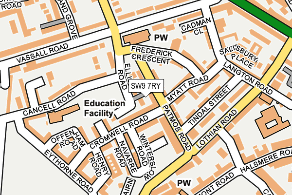
SW9 7RY lies on Foxley Square in London. SW9 7RY is located in the Myatt's Fields electoral ward, within the London borough of Lambeth and the English Parliamentary constituency of Vauxhall. The Sub Integrated Care Board (ICB) Location is NHS South East London ICB - 72Q and the police force is Metropolitan Police. This postcode has been in use since August 1993.


GetTheData
Source: OS OpenMap – Local (Ordnance Survey)
Source: OS VectorMap District (Ordnance Survey)
Licence: Open Government Licence (requires attribution)
| Easting | 531634 |
| Northing | 176976 |
| Latitude | 51.476438 |
| Longitude | -0.105952 |
GetTheData
Source: Open Postcode Geo
Licence: Open Government Licence
| Street | Foxley Square |
| Town/City | London |
| Country | England |
| Postcode District | SW9 |
➜ See where SW9 is on a map ➜ Where is London? | |
GetTheData
Source: Land Registry Price Paid Data
Licence: Open Government Licence
Elevation or altitude of SW9 7RY as distance above sea level:
| Metres | Feet | |
|---|---|---|
| Elevation | 10m | 33ft |
Elevation is measured from the approximate centre of the postcode, to the nearest point on an OS contour line from OS Terrain 50, which has contour spacing of ten vertical metres.
➜ How high above sea level am I? Find the elevation of your current position using your device's GPS.
GetTheData
Source: Open Postcode Elevation
Licence: Open Government Licence
| Ward | Myatt's Fields |
| Constituency | Vauxhall |
GetTheData
Source: ONS Postcode Database
Licence: Open Government Licence
| Myattfield Estate (Patmos Road) | Camberwell | 25m |
| Vassall Rd Camberwell New Rd (Vassall Road) | Camberwell | 236m |
| St John's School (Camberwell New Road) | Camberwell | 274m |
| Vassall Road (Se5) | Camberwell | 274m |
| Vassall Road (Se5) | Camberwell | 293m |
| Oval Underground Station | Oval | 752m |
| Stockwell Underground Station | Stockwell | 1,252m |
| Kennington Underground Station | Kennington | 1,323m |
| Vauxhall Underground Station | Vauxhall | 1,637m |
| Loughborough Junction Station | 1.2km |
| Denmark Hill Station | 1.5km |
| Brixton Station | 1.6km |
GetTheData
Source: NaPTAN
Licence: Open Government Licence
GetTheData
Source: ONS Postcode Database
Licence: Open Government Licence

➜ Get more ratings from the Food Standards Agency
GetTheData
Source: Food Standards Agency
Licence: FSA terms & conditions
| Last Collection | |||
|---|---|---|---|
| Location | Mon-Fri | Sat | Distance |
| 91 Vassall Road | 17:30 | 12:00 | 183m |
| Cormont Road | 17:30 | 12:00 | 234m |
| Post Office | 17:30 | 12:00 | 282m |
GetTheData
Source: Dracos
Licence: Creative Commons Attribution-ShareAlike
The below table lists the International Territorial Level (ITL) codes (formerly Nomenclature of Territorial Units for Statistics (NUTS) codes) and Local Administrative Units (LAU) codes for SW9 7RY:
| ITL 1 Code | Name |
|---|---|
| TLI | London |
| ITL 2 Code | Name |
| TLI4 | Inner London - East |
| ITL 3 Code | Name |
| TLI45 | Lambeth |
| LAU 1 Code | Name |
| E09000022 | Lambeth |
GetTheData
Source: ONS Postcode Directory
Licence: Open Government Licence
The below table lists the Census Output Area (OA), Lower Layer Super Output Area (LSOA), and Middle Layer Super Output Area (MSOA) for SW9 7RY:
| Code | Name | |
|---|---|---|
| OA | E00016067 | |
| LSOA | E01003187 | Lambeth 007E |
| MSOA | E02000624 | Lambeth 007 |
GetTheData
Source: ONS Postcode Directory
Licence: Open Government Licence
| SW9 6FY | Patmos Road | 19m |
| SW9 7BG | Cromwell Road | 35m |
| SW9 6SQ | Patmos Road | 40m |
| SW9 7RX | Foxley Square | 42m |
| SW9 6SF | Patmos Road | 72m |
| SW9 6XL | Frederick Crescent | 85m |
| SW9 7AZ | Fitzpatrick Road | 87m |
| SW9 7BA | Navarre Road | 90m |
| SW9 6XF | Myatt Road | 96m |
| SW9 6SA | Elliott Road | 102m |
GetTheData
Source: Open Postcode Geo; Land Registry Price Paid Data
Licence: Open Government Licence