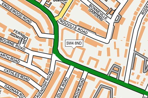
SW4 8ND lies on Oaklands Estate in London. SW4 8ND is located in the Clapham Common & Abbeville electoral ward, within the London borough of Lambeth and the English Parliamentary constituency of Streatham. The Sub Integrated Care Board (ICB) Location is NHS South East London ICB - 72Q and the police force is Metropolitan Police. This postcode has been in use since January 1980.


GetTheData
Source: OS OpenMap – Local (Ordnance Survey)
Source: OS VectorMap District (Ordnance Survey)
Licence: Open Government Licence (requires attribution)
| Easting | 529262 |
| Northing | 174114 |
| Latitude | 51.451264 |
| Longitude | -0.141133 |
GetTheData
Source: Open Postcode Geo
Licence: Open Government Licence
| Street | Oaklands Estate |
| Town/City | London |
| Country | England |
| Postcode District | SW4 |
➜ See where SW4 is on a map ➜ Where is London? | |
GetTheData
Source: Land Registry Price Paid Data
Licence: Open Government Licence
Elevation or altitude of SW4 8ND as distance above sea level:
| Metres | Feet | |
|---|---|---|
| Elevation | 30m | 98ft |
Elevation is measured from the approximate centre of the postcode, to the nearest point on an OS contour line from OS Terrain 50, which has contour spacing of ten vertical metres.
➜ How high above sea level am I? Find the elevation of your current position using your device's GPS.
GetTheData
Source: Open Postcode Elevation
Licence: Open Government Licence
| Ward | Clapham Common & Abbeville |
| Constituency | Streatham |
GetTheData
Source: ONS Postcode Database
Licence: Open Government Licence
| Rudloe Road | Clapham Park | 64m |
| Rudloe Road | Clapham Park | 65m |
| Cavendish Road Police Station | Clapham Park | 180m |
| Cavendish Road Police Station | Clapham Park | 204m |
| Poynders Court (Poynders Road) | Clapham Park | 211m |
| Clapham South Underground Station | Clapham South | 474m |
| Clapham Common Underground Station | Clapham | 1,182m |
| Balham Underground Station | Balham | 1,211m |
| Balham Station | 1.2km |
| Wandsworth Common Station | 1.6km |
| Clapham High Street Station | 1.7km |
GetTheData
Source: NaPTAN
Licence: Open Government Licence
| Percentage of properties with Next Generation Access | 100.0% |
| Percentage of properties with Superfast Broadband | 100.0% |
| Percentage of properties with Ultrafast Broadband | 100.0% |
| Percentage of properties with Full Fibre Broadband | 0.0% |
Superfast Broadband is between 30Mbps and 300Mbps
Ultrafast Broadband is > 300Mbps
| Percentage of properties unable to receive 2Mbps | 0.0% |
| Percentage of properties unable to receive 5Mbps | 0.0% |
| Percentage of properties unable to receive 10Mbps | 0.0% |
| Percentage of properties unable to receive 30Mbps | 0.0% |
GetTheData
Source: Ofcom
Licence: Ofcom Terms of Use (requires attribution)
GetTheData
Source: ONS Postcode Database
Licence: Open Government Licence


➜ Get more ratings from the Food Standards Agency
GetTheData
Source: Food Standards Agency
Licence: FSA terms & conditions
| Last Collection | |||
|---|---|---|---|
| Location | Mon-Fri | Sat | Distance |
| 110 Cavendish Road | 17:30 | 12:00 | 56m |
| Elms Crescent | 17:30 | 12:00 | 193m |
| Post Office | 17:30 | 12:00 | 343m |
GetTheData
Source: Dracos
Licence: Creative Commons Attribution-ShareAlike
The below table lists the International Territorial Level (ITL) codes (formerly Nomenclature of Territorial Units for Statistics (NUTS) codes) and Local Administrative Units (LAU) codes for SW4 8ND:
| ITL 1 Code | Name |
|---|---|
| TLI | London |
| ITL 2 Code | Name |
| TLI4 | Inner London - East |
| ITL 3 Code | Name |
| TLI45 | Lambeth |
| LAU 1 Code | Name |
| E09000022 | Lambeth |
GetTheData
Source: ONS Postcode Directory
Licence: Open Government Licence
The below table lists the Census Output Area (OA), Lower Layer Super Output Area (LSOA), and Middle Layer Super Output Area (MSOA) for SW4 8ND:
| Code | Name | |
|---|---|---|
| OA | E00015277 | |
| LSOA | E01003031 | Lambeth 023A |
| MSOA | E02000640 | Lambeth 023 |
GetTheData
Source: ONS Postcode Directory
Licence: Open Government Licence
| SW4 8NB | Oaklands Estate | 0m |
| SW4 8NF | Oaklands Estate | 0m |
| SW4 8NG | Oaklands Estate | 0m |
| SW4 8NE | Oaklands Estate | 52m |
| SW4 8QL | Trouville Road | 74m |
| SW4 8NX | Poynders Road | 84m |
| SW4 8NA | Oaklands Estate | 94m |
| SW12 0DE | Cavendish Road | 97m |
| SW4 8NQ | Oaklands Estate | 108m |
| SW4 8QW | Cavendish Gardens | 111m |
GetTheData
Source: Open Postcode Geo; Land Registry Price Paid Data
Licence: Open Government Licence