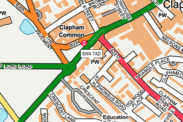
SW4 7AD lies on Clapham Common South Side in London. SW4 7AD is located in the Clapham East electoral ward, within the London borough of Lambeth and the English Parliamentary constituency of Streatham. The Sub Integrated Care Board (ICB) Location is NHS South East London ICB - 72Q and the police force is Metropolitan Police. This postcode has been in use since January 1980.


GetTheData
Source: OS OpenMap – Local (Ordnance Survey)
Source: OS VectorMap District (Ordnance Survey)
Licence: Open Government Licence (requires attribution)
| Easting | 529452 |
| Northing | 175232 |
| Latitude | 51.461268 |
| Longitude | -0.137991 |
GetTheData
Source: Open Postcode Geo
Licence: Open Government Licence
| Street | Clapham Common South Side |
| Town/City | London |
| Country | England |
| Postcode District | SW4 |
➜ See where SW4 is on a map ➜ Where is London? | |
GetTheData
Source: Land Registry Price Paid Data
Licence: Open Government Licence
Elevation or altitude of SW4 7AD as distance above sea level:
| Metres | Feet | |
|---|---|---|
| Elevation | 20m | 66ft |
Elevation is measured from the approximate centre of the postcode, to the nearest point on an OS contour line from OS Terrain 50, which has contour spacing of ten vertical metres.
➜ How high above sea level am I? Find the elevation of your current position using your device's GPS.
GetTheData
Source: Open Postcode Elevation
Licence: Open Government Licence
| Ward | Clapham East |
| Constituency | Streatham |
GetTheData
Source: ONS Postcode Database
Licence: Open Government Licence
| Clapham Common (Clapham Common South Side) | Clapham Common | 32m |
| Clapham Common (Clapham Common South Side) | Clapham Common | 46m |
| Clapham Common (Clapham Common South Side) | Clapham Common | 49m |
| Clapham Common (Clapham Common South Side) | Clapham Common | 56m |
| Clapham Common (The Pavement) | Clapham Common | 83m |
| Clapham Common Underground Station | Clapham | 57m |
| Clapham North Underground Station | Clapham | 701m |
| Clapham South Underground Station | Clapham South | 1,167m |
| Stockwell Underground Station | Stockwell | 1,616m |
| Clapham High Street Station | 0.6km |
| Wandsworth Road Station | 1km |
| Queenstown Road (Battersea) Station | 1.6km |
GetTheData
Source: NaPTAN
Licence: Open Government Licence
GetTheData
Source: ONS Postcode Database
Licence: Open Government Licence


➜ Get more ratings from the Food Standards Agency
GetTheData
Source: Food Standards Agency
Licence: FSA terms & conditions
| Last Collection | |||
|---|---|---|---|
| Location | Mon-Fri | Sat | Distance |
| 15 / 16 Southside | 17:30 | 12:00 | 29m |
| Post Office | 17:30 | 12:00 | 121m |
| 66 Venn Street S W 4 0 A U | 17:30 | 12:00 | 215m |
GetTheData
Source: Dracos
Licence: Creative Commons Attribution-ShareAlike
The below table lists the International Territorial Level (ITL) codes (formerly Nomenclature of Territorial Units for Statistics (NUTS) codes) and Local Administrative Units (LAU) codes for SW4 7AD:
| ITL 1 Code | Name |
|---|---|
| TLI | London |
| ITL 2 Code | Name |
| TLI4 | Inner London - East |
| ITL 3 Code | Name |
| TLI45 | Lambeth |
| LAU 1 Code | Name |
| E09000022 | Lambeth |
GetTheData
Source: ONS Postcode Directory
Licence: Open Government Licence
The below table lists the Census Output Area (OA), Lower Layer Super Output Area (LSOA), and Middle Layer Super Output Area (MSOA) for SW4 7AD:
| Code | Name | |
|---|---|---|
| OA | E00015280 | |
| LSOA | E01003032 | Lambeth 017B |
| MSOA | E02000634 | Lambeth 017 |
GetTheData
Source: ONS Postcode Directory
Licence: Open Government Licence
| SW4 7AA | Clapham Common South Side | 34m |
| SW4 7AB | Clapham Common South Side | 64m |
| SW4 7AW | St Alphonsus Road | 74m |
| SW4 7AE | Crescent Grove | 90m |
| SW4 7AG | Crescent Grove | 105m |
| SW4 7AS | St Alphonsus Road | 111m |
| SW4 7BY | Oaklands Place | 112m |
| SW4 7AX | St Alphonsus Road | 118m |
| SW4 0HY | The Pavement | 125m |
| SW4 7EE | Clapham Park Road | 133m |
GetTheData
Source: Open Postcode Geo; Land Registry Price Paid Data
Licence: Open Government Licence