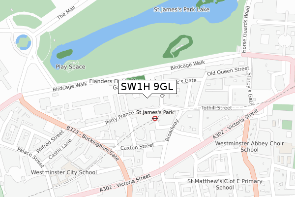
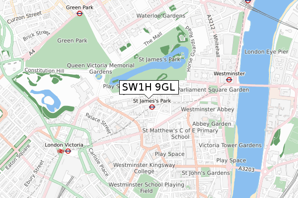
SW1H 9GL is located in the St James's electoral ward, within the London borough of Westminster and the English Parliamentary constituency of Cities of London and Westminster. The Sub Integrated Care Board (ICB) Location is NHS North West London ICB - W2U3Z and the police force is Metropolitan Police. This postcode has been in use since June 2019.


GetTheData
Source: OS Open Zoomstack (Ordnance Survey)
Licence: Open Government Licence (requires attribution)
Attribution: Contains OS data © Crown copyright and database right 2024
Source: Open Postcode Geo
Licence: Open Government Licence (requires attribution)
Attribution: Contains OS data © Crown copyright and database right 2024; Contains Royal Mail data © Royal Mail copyright and database right 2024; Source: Office for National Statistics licensed under the Open Government Licence v.3.0
| Easting | 529576 |
| Northing | 179549 |
| Latitude | 51.500036 |
| Longitude | -0.134600 |
GetTheData
Source: Open Postcode Geo
Licence: Open Government Licence
| Country | England |
| Postcode District | SW1H |
| ➜ SW1H open data dashboard ➜ See where SW1H is on a map ➜ Where is City of Westminster? | |
GetTheData
Source: Land Registry Price Paid Data
Licence: Open Government Licence
| Ward | St James's |
| Constituency | Cities Of London And Westminster |
GetTheData
Source: ONS Postcode Database
Licence: Open Government Licence
| January 2024 | Theft from the person | On or near Park/Open Space | 305m |
| January 2024 | Anti-social behaviour | On or near Artillery Row | 350m |
| January 2024 | Criminal damage and arson | On or near Artillery Row | 350m |
| ➜ Get more crime data in our Crime section | |||
GetTheData
Source: data.police.uk
Licence: Open Government Licence
| St James's Park | St James's Park | 127m |
| St James's Park | St James's Park | 140m |
| St James's Park | St James's Park | 161m |
| Westminster Abbey (Victoria Street) | Westminster | 242m |
| New Scotland Yard (Victoria Street) | St James's Park | 253m |
| St. James's Park Underground Station | St James's Park | 89m |
| Westminster Underground Station | Westminster | 693m |
| Victoria Underground Station | Victoria | 717m |
| Green Park Underground Station | Green Park | 955m |
| Charing Cross Underground Station | Charing Cross | 966m |
| London Victoria Station | 0.9km |
| London Charing Cross Station | 1.1km |
| London Waterloo Station | 1.5km |
GetTheData
Source: NaPTAN
Licence: Open Government Licence
GetTheData
Source: ONS Postcode Database
Licence: Open Government Licence


➜ Get more ratings from the Food Standards Agency
GetTheData
Source: Food Standards Agency
Licence: FSA terms & conditions
| Last Collection | |||
|---|---|---|---|
| Location | Mon-Fri | Sat | Distance |
| 42 Queen Annes Gate | 18:30 | 11:30 | 66m |
| Broadway | 18:45 | 11:30 | 71m |
| 22 Queen Annes Gate | 18:45 | 11:30 | 133m |
GetTheData
Source: Dracos
Licence: Creative Commons Attribution-ShareAlike
| Facility | Distance |
|---|---|
| St Ermin's Hotel (Autograph Collection) Caxton Street, London Health and Fitness Gym | 144m |
| Wellness Centre (Taj 51) Buckingham Gate, London Health and Fitness Gym, Studio | 263m |
| Bis Conference Centre (Closed) Victoria Street, London Health and Fitness Gym, Sports Hall | 290m |
GetTheData
Source: Active Places
Licence: Open Government Licence
| School | Phase of Education | Distance |
|---|---|---|
| Harris Westminster Sixth Form Steel House, 11 Tothill Street, Westminster, London, SW1H 9LH | 16 plus | 245m |
| Westminster Abbey Choir School Dean's Yard, London, SW1P 3NY | Not applicable | 377m |
| St Matthew's School, Westminster 18 Old Pye Street, Westminster, London, SW1P 2DG | Primary | 382m |
GetTheData
Source: Edubase
Licence: Open Government Licence
| Risk of SW1H 9GL flooding from rivers and sea | Very Low |
| ➜ SW1H 9GL flood map | |
GetTheData
Source: Open Flood Risk by Postcode
Licence: Open Government Licence
The below table lists the International Territorial Level (ITL) codes (formerly Nomenclature of Territorial Units for Statistics (NUTS) codes) and Local Administrative Units (LAU) codes for SW1H 9GL:
| ITL 1 Code | Name |
|---|---|
| TLI | London |
| ITL 2 Code | Name |
| TLI3 | Inner London - West |
| ITL 3 Code | Name |
| TLI32 | Westminster |
| LAU 1 Code | Name |
| E09000033 | Westminster |
GetTheData
Source: ONS Postcode Directory
Licence: Open Government Licence
The below table lists the Census Output Area (OA), Lower Layer Super Output Area (LSOA), and Middle Layer Super Output Area (MSOA) for SW1H 9GL:
| Code | Name | |
|---|---|---|
| OA | E00175249 | |
| LSOA | E01004731 | Westminster 020A |
| MSOA | E02000979 | Westminster 020 |
GetTheData
Source: ONS Postcode Directory
Licence: Open Government Licence
| SW1H 9AP | Queen Annes Gate | 55m |
| SW1H 0AA | Palmer Street | 81m |
| SW1H 9BU | Queen Annes Gate | 90m |
| SW1H 0AB | Palmer Street | 107m |
| SW1H 9AB | Queen Annes Gate | 110m |
| SW1H 9HE | Petty France | 147m |
| SW1H 9HF | Petty France | 147m |
| SW1H 9HG | Petty France | 147m |
| SW1H 0AQ | Caxton Street | 150m |
| SW1H 9BL | Dartmouth Street | 161m |
GetTheData
Source: Open Postcode Geo; Land Registry Price Paid Data
Licence: Open Government Licence