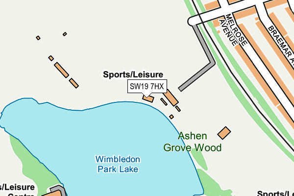
SW19 7HX is located in the Wimbledon Park electoral ward, within the London borough of Merton and the English Parliamentary constituency of Wimbledon. The Sub Integrated Care Board (ICB) Location is NHS South West London ICB - 36L and the police force is Metropolitan Police. This postcode has been in use since January 1980.


GetTheData
Source: OS OpenMap – Local (Ordnance Survey)
Source: OS VectorMap District (Ordnance Survey)
Licence: Open Government Licence (requires attribution)
| Easting | 524785 |
| Northing | 172469 |
| Latitude | 51.437483 |
| Longitude | -0.206108 |
GetTheData
Source: Open Postcode Geo
Licence: Open Government Licence
| Country | England |
| Postcode District | SW19 |
➜ See where SW19 is on a map ➜ Where is Wimbledon? | |
GetTheData
Source: Land Registry Price Paid Data
Licence: Open Government Licence
Elevation or altitude of SW19 7HX as distance above sea level:
| Metres | Feet | |
|---|---|---|
| Elevation | 20m | 66ft |
Elevation is measured from the approximate centre of the postcode, to the nearest point on an OS contour line from OS Terrain 50, which has contour spacing of ten vertical metres.
➜ How high above sea level am I? Find the elevation of your current position using your device's GPS.
GetTheData
Source: Open Postcode Elevation
Licence: Open Government Licence
| Ward | Wimbledon Park |
| Constituency | Wimbledon |
GetTheData
Source: ONS Postcode Database
Licence: Open Government Licence
| Woodspring Road (Wimbledon Park Road) | Southfields | 432m |
| Woodspring Road (Wimbledon Park Road) | Southfields | 452m |
| Bathgate Road | Southfields | 460m |
| Church Road (Sw19) | Southfields | 505m |
| Southdean Gardens (Wimbledon Park Road) | Southfields | 550m |
| Wimbledon Park Underground Station | Wimbledon Park | 550m |
| Southfields Underground Station | Southfields | 845m |
| Earlsfield Station | 1.4km |
| Haydons Road Station | 1.8km |
| Wimbledon Station | 1.8km |
GetTheData
Source: NaPTAN
Licence: Open Government Licence
GetTheData
Source: ONS Postcode Database
Licence: Open Government Licence


➜ Get more ratings from the Food Standards Agency
GetTheData
Source: Food Standards Agency
Licence: FSA terms & conditions
| Last Collection | |||
|---|---|---|---|
| Location | Mon-Fri | Sat | Distance |
| 182 Revelstoke Road | 17:30 | 12:00 | 298m |
| 95 Home Park Road | 17:30 | 12:00 | 490m |
| Wimbledon Park Road | 17:30 | 12:00 | 514m |
GetTheData
Source: Dracos
Licence: Creative Commons Attribution-ShareAlike
The below table lists the International Territorial Level (ITL) codes (formerly Nomenclature of Territorial Units for Statistics (NUTS) codes) and Local Administrative Units (LAU) codes for SW19 7HX:
| ITL 1 Code | Name |
|---|---|
| TLI | London |
| ITL 2 Code | Name |
| TLI6 | Outer London - South |
| ITL 3 Code | Name |
| TLI63 | Merton, Kingston upon Thames and Sutton |
| LAU 1 Code | Name |
| E09000024 | Merton |
GetTheData
Source: ONS Postcode Directory
Licence: Open Government Licence
The below table lists the Census Output Area (OA), Lower Layer Super Output Area (LSOA), and Middle Layer Super Output Area (MSOA) for SW19 7HX:
| Code | Name | |
|---|---|---|
| OA | E00017579 | |
| LSOA | E01003474 | Merton 001C |
| MSOA | E02000689 | Merton 001 |
GetTheData
Source: ONS Postcode Directory
Licence: Open Government Licence
| SW19 8AU | Melrose Avenue | 231m |
| SW18 5NW | Revelstoke Road | 258m |
| SW19 8AX | Melrose Avenue | 260m |
| SW18 5NN | Revelstoke Road | 278m |
| SW18 5NR | Elsenham Street | 282m |
| SW19 8AY | Braemar Avenue | 288m |
| SW19 8AZ | Braemar Avenue | 314m |
| SW18 5NZ | Elsenham Street | 315m |
| SW19 8BA | Normanton Avenue | 353m |
| SW19 8BW | Ashen Grove | 359m |
GetTheData
Source: Open Postcode Geo; Land Registry Price Paid Data
Licence: Open Government Licence