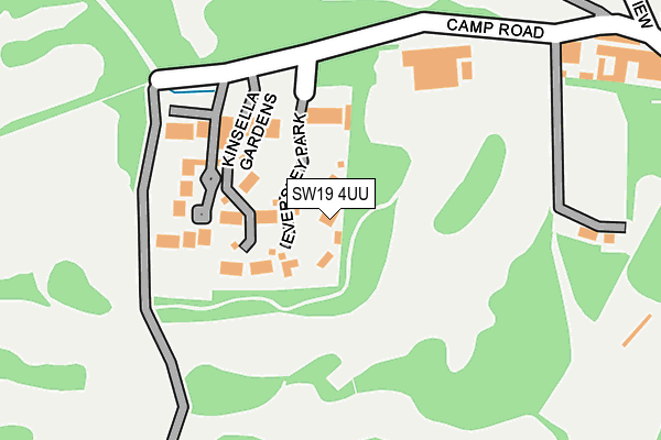
SW19 4UU lies on Eversley Park in London. SW19 4UU is located in the Village electoral ward, within the London borough of Merton and the English Parliamentary constituency of Wimbledon. The Sub Integrated Care Board (ICB) Location is NHS South West London ICB - 36L and the police force is Metropolitan Police. This postcode has been in use since July 1983.


GetTheData
Source: OS OpenMap – Local (Ordnance Survey)
Source: OS VectorMap District (Ordnance Survey)
Licence: Open Government Licence (requires attribution)
| Easting | 522708 |
| Northing | 171002 |
| Latitude | 51.424752 |
| Longitude | -0.236458 |
GetTheData
Source: Open Postcode Geo
Licence: Open Government Licence
| Street | Eversley Park |
| Town/City | London |
| Country | England |
| Postcode District | SW19 |
➜ See where SW19 is on a map ➜ Where is Wimbledon? | |
GetTheData
Source: Land Registry Price Paid Data
Licence: Open Government Licence
Elevation or altitude of SW19 4UU as distance above sea level:
| Metres | Feet | |
|---|---|---|
| Elevation | 50m | 164ft |
Elevation is measured from the approximate centre of the postcode, to the nearest point on an OS contour line from OS Terrain 50, which has contour spacing of ten vertical metres.
➜ How high above sea level am I? Find the elevation of your current position using your device's GPS.
GetTheData
Source: Open Postcode Elevation
Licence: Open Government Licence
| Ward | Village |
| Constituency | Wimbledon |
GetTheData
Source: ONS Postcode Database
Licence: Open Government Licence
2021 9 APR £3,375,000 |
2019 15 NOV £3,050,000 |
2015 20 JUL £2,900,000 |
2010 29 OCT £2,770,000 |
2010 13 SEP £3,300,000 |
2005 16 MAY £1,950,000 |
2001 2 FEB £1,375,000 |
7, EVERSLEY PARK, LONDON, SW19 4UU 2000 20 DEC £85,000 |
8, EVERSLEY PARK, LONDON, SW19 4UU 1997 30 SEP £725,000 |
1996 18 OCT £610,000 |
GetTheData
Source: HM Land Registry Price Paid Data
Licence: Contains HM Land Registry data © Crown copyright and database right 2025. This data is licensed under the Open Government Licence v3.0.
| Atkinson Close Copse Hill | Copse Hill | 753m |
| High Cedar Drive | Copse Hill | 773m |
| Woodhayes Road (Copse Hill) | Copse Hill | 817m |
| Copse Hill Christ Church (Cottenham Park Road) | Copse Hill | 917m |
| Arterberry Road Copse Hill (Ridgway) | Copse Hill | 931m |
| Raynes Park Station | 1.8km |
| Wimbledon Station | 2.1km |
| Wimbledon Chase Station | 2.3km |
GetTheData
Source: NaPTAN
Licence: Open Government Licence
| Percentage of properties with Next Generation Access | 100.0% |
| Percentage of properties with Superfast Broadband | 100.0% |
| Percentage of properties with Ultrafast Broadband | 0.0% |
| Percentage of properties with Full Fibre Broadband | 0.0% |
Superfast Broadband is between 30Mbps and 300Mbps
Ultrafast Broadband is > 300Mbps
| Median download speed | 20.7Mbps |
| Average download speed | 18.6Mbps |
| Maximum download speed | 30.79Mbps |
| Median upload speed | 5.6Mbps |
| Average upload speed | 3.7Mbps |
| Maximum upload speed | 5.76Mbps |
| Percentage of properties unable to receive 2Mbps | 0.0% |
| Percentage of properties unable to receive 5Mbps | 0.0% |
| Percentage of properties unable to receive 10Mbps | 0.0% |
| Percentage of properties unable to receive 30Mbps | 0.0% |
GetTheData
Source: Ofcom
Licence: Ofcom Terms of Use (requires attribution)
GetTheData
Source: ONS Postcode Database
Licence: Open Government Licence


➜ Get more ratings from the Food Standards Agency
GetTheData
Source: Food Standards Agency
Licence: FSA terms & conditions
| Last Collection | |||
|---|---|---|---|
| Location | Mon-Fri | Sat | Distance |
| Camp Road | 17:30 | 12:00 | 181m |
| 9 North View | 17:30 | 12:00 | 492m |
| 20 Wimbledon Common West Side | 17:30 | 12:00 | 564m |
GetTheData
Source: Dracos
Licence: Creative Commons Attribution-ShareAlike
The below table lists the International Territorial Level (ITL) codes (formerly Nomenclature of Territorial Units for Statistics (NUTS) codes) and Local Administrative Units (LAU) codes for SW19 4UU:
| ITL 1 Code | Name |
|---|---|
| TLI | London |
| ITL 2 Code | Name |
| TLI6 | Outer London - South |
| ITL 3 Code | Name |
| TLI63 | Merton, Kingston upon Thames and Sutton |
| LAU 1 Code | Name |
| E09000024 | Merton |
GetTheData
Source: ONS Postcode Directory
Licence: Open Government Licence
The below table lists the Census Output Area (OA), Lower Layer Super Output Area (LSOA), and Middle Layer Super Output Area (MSOA) for SW19 4UU:
| Code | Name | |
|---|---|---|
| OA | E00017537 | |
| LSOA | E01003460 | Merton 002A |
| MSOA | E02000690 | Merton 002 |
GetTheData
Source: ONS Postcode Directory
Licence: Open Government Licence
| SW19 4UB | Kinsella Gardens | 78m |
| SW19 4TE | Cedar Park Gardens | 134m |
| SW19 4UW | Camp Road | 301m |
| SW19 4UL | Camp View | 360m |
| SW19 4UJ | North View | 441m |
| SW20 0HW | Wool Road | 473m |
| SW19 4TU | Beech Close | 473m |
| SW19 4UH | West Place | 507m |
| SW19 4TS | Chester Road | 514m |
| SW19 4UG | The Keir | 528m |
GetTheData
Source: Open Postcode Geo; Land Registry Price Paid Data
Licence: Open Government Licence