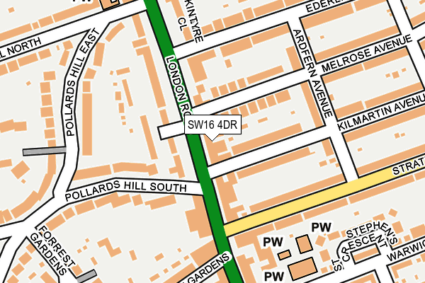
SW16 4DR is located in the Norbury & Pollards Hill electoral ward, within the London borough of Croydon and the English Parliamentary constituency of Croydon North. The Sub Integrated Care Board (ICB) Location is NHS South West London ICB - 36L and the police force is Metropolitan Police. This postcode has been in use since January 1980.


GetTheData
Source: OS OpenMap – Local (Ordnance Survey)
Source: OS VectorMap District (Ordnance Survey)
Licence: Open Government Licence (requires attribution)
| Easting | 530951 |
| Northing | 168798 |
| Latitude | 51.403103 |
| Longitude | -0.118777 |
GetTheData
Source: Open Postcode Geo
Licence: Open Government Licence
| Country | England |
| Postcode District | SW16 |
➜ See where SW16 is on a map ➜ Where is London? | |
GetTheData
Source: Land Registry Price Paid Data
Licence: Open Government Licence
Elevation or altitude of SW16 4DR as distance above sea level:
| Metres | Feet | |
|---|---|---|
| Elevation | 40m | 131ft |
Elevation is measured from the approximate centre of the postcode, to the nearest point on an OS contour line from OS Terrain 50, which has contour spacing of ten vertical metres.
➜ How high above sea level am I? Find the elevation of your current position using your device's GPS.
GetTheData
Source: Open Postcode Elevation
Licence: Open Government Licence
| Ward | Norbury & Pollards Hill |
| Constituency | Croydon North |
GetTheData
Source: ONS Postcode Database
Licence: Open Government Licence
| Ederline Avenue Norbury (London Road) | Norbury | 99m |
| Ederline Avenue Norbury (London Road) | Norbury | 175m |
| Galpins Road (London Road) | Norbury | 199m |
| Galpins Road London Road (Galpin's Road) | Norbury | 262m |
| London Road Galpins Road (London Road) | Norbury | 310m |
| Norbury Station | 1km |
| Thornton Heath Station | 1.4km |
| Streatham Common Station | 2.1km |
GetTheData
Source: NaPTAN
Licence: Open Government Licence
GetTheData
Source: ONS Postcode Database
Licence: Open Government Licence


➜ Get more ratings from the Food Standards Agency
GetTheData
Source: Food Standards Agency
Licence: FSA terms & conditions
| Last Collection | |||
|---|---|---|---|
| Location | Mon-Fri | Sat | Distance |
| London Road | 17:30 | 12:00 | 70m |
| 1208 London Road | 17:30 | 12:00 | 236m |
| Pollards Hill West | 17:30 | 12:00 | 307m |
GetTheData
Source: Dracos
Licence: Creative Commons Attribution-ShareAlike
The below table lists the International Territorial Level (ITL) codes (formerly Nomenclature of Territorial Units for Statistics (NUTS) codes) and Local Administrative Units (LAU) codes for SW16 4DR:
| ITL 1 Code | Name |
|---|---|
| TLI | London |
| ITL 2 Code | Name |
| TLI6 | Outer London - South |
| ITL 3 Code | Name |
| TLI62 | Croydon |
| LAU 1 Code | Name |
| E09000008 | Croydon |
GetTheData
Source: ONS Postcode Directory
Licence: Open Government Licence
The below table lists the Census Output Area (OA), Lower Layer Super Output Area (LSOA), and Middle Layer Super Output Area (MSOA) for SW16 4DR:
| Code | Name | |
|---|---|---|
| OA | E00005416 | |
| LSOA | E01001091 | Croydon 004E |
| MSOA | E02000197 | Croydon 004 |
GetTheData
Source: ONS Postcode Directory
Licence: Open Government Licence
| SW16 4DS | London Road | 7m |
| SW16 4XA | London Road | 59m |
| SW16 4DP | London Road | 61m |
| SW16 4QU | Melrose Avenue | 76m |
| SW16 4RD | Kilmartin Avenue | 81m |
| SW16 4UZ | Somerset Gardens | 85m |
| SW16 4DT | London Road | 89m |
| SW16 4RX | Melrose Avenue | 89m |
| SW16 4RE | Kilmartin Avenue | 103m |
| SW16 4XD | London Road | 111m |
GetTheData
Source: Open Postcode Geo; Land Registry Price Paid Data
Licence: Open Government Licence