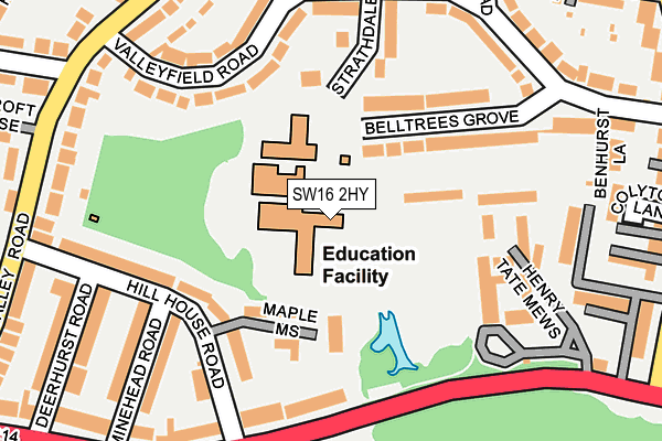
SW16 2HY is located in the Streatham Wells electoral ward, within the London borough of Lambeth and the English Parliamentary constituency of Streatham. The Sub Integrated Care Board (ICB) Location is NHS South East London ICB - 72Q and the police force is Metropolitan Police. This postcode has been in use since January 1980.


GetTheData
Source: OS OpenMap – Local (Ordnance Survey)
Source: OS VectorMap District (Ordnance Survey)
Licence: Open Government Licence (requires attribution)
| Easting | 530893 |
| Northing | 171230 |
| Latitude | 51.424972 |
| Longitude | -0.118739 |
GetTheData
Source: Open Postcode Geo
Licence: Open Government Licence
| Country | England |
| Postcode District | SW16 |
➜ See where SW16 is on a map ➜ Where is Streatham? | |
GetTheData
Source: Land Registry Price Paid Data
Licence: Open Government Licence
Elevation or altitude of SW16 2HY as distance above sea level:
| Metres | Feet | |
|---|---|---|
| Elevation | 80m | 262ft |
Elevation is measured from the approximate centre of the postcode, to the nearest point on an OS contour line from OS Terrain 50, which has contour spacing of ten vertical metres.
➜ How high above sea level am I? Find the elevation of your current position using your device's GPS.
GetTheData
Source: Open Postcode Elevation
Licence: Open Government Licence
| Ward | Streatham Wells |
| Constituency | Streatham |
GetTheData
Source: ONS Postcode Database
Licence: Open Government Licence
| The Rookery | Streatham Common | 182m |
| The Rookery | Streatham Common | 239m |
| Gleneldon Road Grasmere Road | Streatham | 282m |
| Streatham Comn Nleigham Ct Rd | Streatham Common | 282m |
| Deerhurst Road (Sw16) (Streatham Common North) | Streatham Common | 294m |
| Streatham Station | 0.9km |
| West Norwood Station | 1.3km |
| Streatham Common Station | 1.4km |
GetTheData
Source: NaPTAN
Licence: Open Government Licence
GetTheData
Source: ONS Postcode Database
Licence: Open Government Licence


➜ Get more ratings from the Food Standards Agency
GetTheData
Source: Food Standards Agency
Licence: FSA terms & conditions
| Last Collection | |||
|---|---|---|---|
| Location | Mon-Fri | Sat | Distance |
| 49 Valleyfields Road | 17:30 | 12:00 | 222m |
| 231 Valley Road | 17:30 | 12:00 | 264m |
| 34 Streatham Common North | 17:30 | 12:00 | 276m |
GetTheData
Source: Dracos
Licence: Creative Commons Attribution-ShareAlike
The below table lists the International Territorial Level (ITL) codes (formerly Nomenclature of Territorial Units for Statistics (NUTS) codes) and Local Administrative Units (LAU) codes for SW16 2HY:
| ITL 1 Code | Name |
|---|---|
| TLI | London |
| ITL 2 Code | Name |
| TLI4 | Inner London - East |
| ITL 3 Code | Name |
| TLI45 | Lambeth |
| LAU 1 Code | Name |
| E09000022 | Lambeth |
GetTheData
Source: ONS Postcode Directory
Licence: Open Government Licence
The below table lists the Census Output Area (OA), Lower Layer Super Output Area (LSOA), and Middle Layer Super Output Area (MSOA) for SW16 2HY:
| Code | Name | |
|---|---|---|
| OA | E00015935 | |
| LSOA | E01003149 | Lambeth 030D |
| MSOA | E02000647 | Lambeth 030 |
GetTheData
Source: ONS Postcode Directory
Licence: Open Government Licence
| SW16 2AL | Maple Mews | 119m |
| SW16 2HZ | Belltrees Grove | 122m |
| SW16 3HA | Henry Tate Mews | 143m |
| SW16 2HR | Valleyfield Road | 155m |
| SW16 2AQ | Hill House Road | 157m |
| SW16 3HS | Streatham Common North | 162m |
| SW16 2HT | Strathdale | 169m |
| SW16 2AW | Minehead Road | 201m |
| SW16 2HU | Valleyfield Road | 213m |
| SW16 2QW | Benhurst Court | 225m |
GetTheData
Source: Open Postcode Geo; Land Registry Price Paid Data
Licence: Open Government Licence