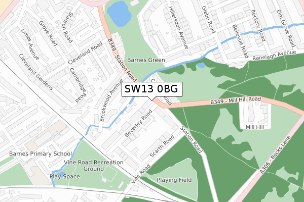
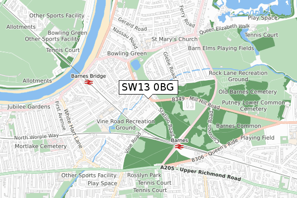
SW13 0BG is located in the Mortlake & Barnes Common electoral ward, within the London borough of Richmond upon Thames and the English Parliamentary constituency of Richmond Park. The Sub Integrated Care Board (ICB) Location is NHS South West London ICB - 36L and the police force is Metropolitan Police. This postcode has been in use since November 2018.


GetTheData
Source: OS Open Zoomstack (Ordnance Survey)
Licence: Open Government Licence (requires attribution)
Attribution: Contains OS data © Crown copyright and database right 2024
Source: Open Postcode Geo
Licence: Open Government Licence (requires attribution)
Attribution: Contains OS data © Crown copyright and database right 2024; Contains Royal Mail data © Royal Mail copyright and database right 2024; Source: Office for National Statistics licensed under the Open Government Licence v.3.0
| Easting | 521985 |
| Northing | 176067 |
| Latitude | 51.470429 |
| Longitude | -0.245108 |
GetTheData
Source: Open Postcode Geo
Licence: Open Government Licence
| Country | England |
| Postcode District | SW13 |
| ➜ SW13 open data dashboard ➜ See where SW13 is on a map ➜ Where is Barnes? | |
GetTheData
Source: Land Registry Price Paid Data
Licence: Open Government Licence
| Ward | Mortlake & Barnes Common |
| Constituency | Richmond Park |
GetTheData
Source: ONS Postcode Database
Licence: Open Government Licence
| December 2023 | Bicycle theft | On or near The Crescent | 349m |
| November 2023 | Public order | On or near The Crescent | 349m |
| November 2023 | Criminal damage and arson | On or near The Crescent | 349m |
| ➜ Get more crime data in our Crime section | |||
GetTheData
Source: data.police.uk
Licence: Open Government Licence
| Beverley Road (Sw13) | Barnes | 11m |
| Beverley Road (Sw13) | Barnes | 17m |
| Barnes Pond | Barnes | 343m |
| Barnes Pond (Church Road) | Barnes | 349m |
| Glebe Road (Church Road) | Barnes | 395m |
| Barnes Station | 0.4km |
| Barnes Bridge Station | 0.5km |
| Mortlake Station | 1.5km |
GetTheData
Source: NaPTAN
Licence: Open Government Licence
| Percentage of properties with Next Generation Access | 100.0% |
| Percentage of properties with Superfast Broadband | 100.0% |
| Percentage of properties with Ultrafast Broadband | 0.0% |
| Percentage of properties with Full Fibre Broadband | 0.0% |
Superfast Broadband is between 30Mbps and 300Mbps
Ultrafast Broadband is > 300Mbps
| Percentage of properties unable to receive 2Mbps | 0.0% |
| Percentage of properties unable to receive 5Mbps | 0.0% |
| Percentage of properties unable to receive 10Mbps | 0.0% |
| Percentage of properties unable to receive 30Mbps | 0.0% |
GetTheData
Source: Ofcom
Licence: Ofcom Terms of Use (requires attribution)
GetTheData
Source: ONS Postcode Database
Licence: Open Government Licence


➜ Get more ratings from the Food Standards Agency
GetTheData
Source: Food Standards Agency
Licence: FSA terms & conditions
| Last Collection | |||
|---|---|---|---|
| Location | Mon-Fri | Sat | Distance |
| Scarth Road | 17:30 | 12:00 | 126m |
| Brookwood Avenue | 17:30 | 12:00 | 132m |
| Glebe Road | 17:30 | 12:00 | 314m |
GetTheData
Source: Dracos
Licence: Creative Commons Attribution-ShareAlike
| Facility | Distance |
|---|---|
| Barnes Common West Vine Road, London Grass Pitches | 273m |
| Barnes Common East Halcyon Close, London Grass Pitches | 545m |
| Kitson Hall Kitson Road, London Sports Hall | 579m |
GetTheData
Source: Active Places
Licence: Open Government Licence
| School | Phase of Education | Distance |
|---|---|---|
| St Osmund's Catholic Primary School Church Road, Barnes, London, SW13 9HQ | Primary | 432m |
| Barnes Primary School Cross Street, Barnes, London, SW13 0QQ | Primary | 445m |
| Paddock School Priory Lane, London, SW15 5RT | Not applicable | 810m |
GetTheData
Source: Edubase
Licence: Open Government Licence
| Risk of SW13 0BG flooding from rivers and sea | Very Low |
| ➜ SW13 0BG flood map | |
GetTheData
Source: Open Flood Risk by Postcode
Licence: Open Government Licence
The below table lists the International Territorial Level (ITL) codes (formerly Nomenclature of Territorial Units for Statistics (NUTS) codes) and Local Administrative Units (LAU) codes for SW13 0BG:
| ITL 1 Code | Name |
|---|---|
| TLI | London |
| ITL 2 Code | Name |
| TLI7 | Outer London - West and North West |
| ITL 3 Code | Name |
| TLI75 | Hounslow and Richmond upon Thames |
| LAU 1 Code | Name |
| E09000027 | Richmond upon Thames |
GetTheData
Source: ONS Postcode Directory
Licence: Open Government Licence
The below table lists the Census Output Area (OA), Lower Layer Super Output Area (LSOA), and Middle Layer Super Output Area (MSOA) for SW13 0BG:
| Code | Name | |
|---|---|---|
| OA | E00019387 | |
| LSOA | E01003853 | Richmond upon Thames 003B |
| MSOA | E02000786 | Richmond upon Thames 003 |
GetTheData
Source: ONS Postcode Directory
Licence: Open Government Licence
| SW13 0LQ | Willow Avenue | 46m |
| SW13 0HP | Cedars Road | 60m |
| SW13 0NB | Station Road | 75m |
| SW13 0NA | Beverley Road | 79m |
| SW13 0LS | Station Road | 95m |
| SW13 0LT | Willow Avenue | 98m |
| SW13 0LX | Beverley Road | 115m |
| SW13 0LR | Brookwood Avenue | 124m |
| SW13 0ND | Scarth Road | 146m |
| SW13 0EQ | Laurel Road | 189m |
GetTheData
Source: Open Postcode Geo; Land Registry Price Paid Data
Licence: Open Government Licence