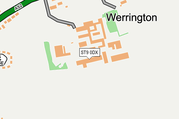
ST9 0DX is located in the Cellarhead electoral ward, within the local authority district of Staffordshire Moorlands and the English Parliamentary constituency of Staffordshire Moorlands. The Sub Integrated Care Board (ICB) Location is NHS Staffordshire and Stoke-on-Trent ICB - 05G and the police force is Staffordshire. This postcode has been in use since January 1980.


GetTheData
Source: OS OpenMap – Local (Ordnance Survey)
Source: OS VectorMap District (Ordnance Survey)
Licence: Open Government Licence (requires attribution)
| Easting | 394227 |
| Northing | 347232 |
| Latitude | 53.022367 |
| Longitude | -2.087512 |
GetTheData
Source: Open Postcode Geo
Licence: Open Government Licence
| Country | England |
| Postcode District | ST9 |
➜ See where ST9 is on a map ➜ Where is Werrington? | |
GetTheData
Source: Land Registry Price Paid Data
Licence: Open Government Licence
Elevation or altitude of ST9 0DX as distance above sea level:
| Metres | Feet | |
|---|---|---|
| Elevation | 240m | 787ft |
Elevation is measured from the approximate centre of the postcode, to the nearest point on an OS contour line from OS Terrain 50, which has contour spacing of ten vertical metres.
➜ How high above sea level am I? Find the elevation of your current position using your device's GPS.
GetTheData
Source: Open Postcode Elevation
Licence: Open Government Licence
| Ward | Cellarhead |
| Constituency | Staffordshire Moorlands |
GetTheData
Source: ONS Postcode Database
Licence: Open Government Licence
| Post Office (Ash Bank Road) | Werrington | 242m |
| Post Office (Ash Bank Road) | Werrington | 252m |
| Shops (Johnstone Avenue) | Werrington | 325m |
| Washerwall Lane (343/345 Ash Bank Rd) | Werrington | 403m |
| St Philips Church (Ash Bank Rd) | Washerwall | 469m |
| Longton Station | 4.9km |
GetTheData
Source: NaPTAN
Licence: Open Government Licence
GetTheData
Source: ONS Postcode Database
Licence: Open Government Licence


➜ Get more ratings from the Food Standards Agency
GetTheData
Source: Food Standards Agency
Licence: FSA terms & conditions
| Last Collection | |||
|---|---|---|---|
| Location | Mon-Fri | Sat | Distance |
| Wendling Close | 17:45 | 09:30 | 2,671m |
| Folly Lane | 09:30 | 09:00 | 4,158m |
| Caverswall Square | 17:00 | 10:45 | 4,372m |
GetTheData
Source: Dracos
Licence: Creative Commons Attribution-ShareAlike
The below table lists the International Territorial Level (ITL) codes (formerly Nomenclature of Territorial Units for Statistics (NUTS) codes) and Local Administrative Units (LAU) codes for ST9 0DX:
| ITL 1 Code | Name |
|---|---|
| TLG | West Midlands (England) |
| ITL 2 Code | Name |
| TLG2 | Shropshire and Staffordshire |
| ITL 3 Code | Name |
| TLG24 | Staffordshire CC |
| LAU 1 Code | Name |
| E07000198 | Staffordshire Moorlands |
GetTheData
Source: ONS Postcode Directory
Licence: Open Government Licence
The below table lists the Census Output Area (OA), Lower Layer Super Output Area (LSOA), and Middle Layer Super Output Area (MSOA) for ST9 0DX:
| Code | Name | |
|---|---|---|
| OA | E00151745 | |
| LSOA | E01029780 | Staffordshire Moorlands 009B |
| MSOA | E02006212 | Staffordshire Moorlands 009 |
GetTheData
Source: ONS Postcode Directory
Licence: Open Government Licence
| ST9 0DU | Ash Bank Road | 259m |
| ST9 0JP | Ash Bank Road | 265m |
| ST9 0DB | Salters Close | 305m |
| ST9 0HB | Drawell Lane | 310m |
| ST9 0DP | Hill Village Road | 328m |
| ST9 0DR | Irvine Road | 362m |
| ST9 0JR | Ash Bank Road | 367m |
| ST9 0DY | Johnstone Avenue | 392m |
| ST9 0DZ | James Crescent | 408m |
| ST9 0BZ | Oak Mount Road | 417m |
GetTheData
Source: Open Postcode Geo; Land Registry Price Paid Data
Licence: Open Government Licence