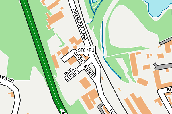
ST6 4PU is located in the Bradwell electoral ward, within the local authority district of Newcastle-under-Lyme and the English Parliamentary constituency of Newcastle-under-Lyme. The Sub Integrated Care Board (ICB) Location is NHS Staffordshire and Stoke-on-Trent ICB - 05G and the police force is Staffordshire. This postcode has been in use since July 1990.


GetTheData
Source: OS OpenMap – Local (Ordnance Survey)
Source: OS VectorMap District (Ordnance Survey)
Licence: Open Government Licence (requires attribution)
| Easting | 385346 |
| Northing | 349763 |
| Latitude | 53.044930 |
| Longitude | -2.220028 |
GetTheData
Source: Open Postcode Geo
Licence: Open Government Licence
| Country | England |
| Postcode District | ST6 |
➜ See where ST6 is on a map ➜ Where is Stoke-on-Trent? | |
GetTheData
Source: Land Registry Price Paid Data
Licence: Open Government Licence
Elevation or altitude of ST6 4PU as distance above sea level:
| Metres | Feet | |
|---|---|---|
| Elevation | 120m | 394ft |
Elevation is measured from the approximate centre of the postcode, to the nearest point on an OS contour line from OS Terrain 50, which has contour spacing of ten vertical metres.
➜ How high above sea level am I? Find the elevation of your current position using your device's GPS.
GetTheData
Source: Open Postcode Elevation
Licence: Open Government Licence
| Ward | Bradwell |
| Constituency | Newcastle-under-lyme |
GetTheData
Source: ONS Postcode Database
Licence: Open Government Licence
| Station Street (Porthill Road) | Longport | 426m |
| Trubshaw Cross (Newcastle Street) | Longport | 503m |
| Longport Road (Porthill Road) | Longport | 518m |
| Longport Road (Porthill Road) | Longport | 529m |
| Trubshaw Cross (Davenport Street) | Longport | 579m |
| Longport Station | 0.4km |
| Stoke-on-Trent Station | 4.9km |
| Kidsgrove Station | 4.9km |
GetTheData
Source: NaPTAN
Licence: Open Government Licence
GetTheData
Source: ONS Postcode Database
Licence: Open Government Licence


➜ Get more ratings from the Food Standards Agency
GetTheData
Source: Food Standards Agency
Licence: FSA terms & conditions
| Last Collection | |||
|---|---|---|---|
| Location | Mon-Fri | Sat | Distance |
| Station Street | 18:30 | 09:15 | 423m |
| Dale Hall Post Office | 18:30 | 09:15 | 968m |
| Pirehill Road | 18:30 | 09:00 | 998m |
GetTheData
Source: Dracos
Licence: Creative Commons Attribution-ShareAlike
The below table lists the International Territorial Level (ITL) codes (formerly Nomenclature of Territorial Units for Statistics (NUTS) codes) and Local Administrative Units (LAU) codes for ST6 4PU:
| ITL 1 Code | Name |
|---|---|
| TLG | West Midlands (England) |
| ITL 2 Code | Name |
| TLG2 | Shropshire and Staffordshire |
| ITL 3 Code | Name |
| TLG24 | Staffordshire CC |
| LAU 1 Code | Name |
| E07000195 | Newcastle-under-Lyme |
GetTheData
Source: ONS Postcode Directory
Licence: Open Government Licence
The below table lists the Census Output Area (OA), Lower Layer Super Output Area (LSOA), and Middle Layer Super Output Area (MSOA) for ST6 4PU:
| Code | Name | |
|---|---|---|
| OA | E00150512 | |
| LSOA | E01029537 | Newcastle-under-Lyme 006A |
| MSOA | E02006163 | Newcastle-under-Lyme 006 |
GetTheData
Source: ONS Postcode Directory
Licence: Open Government Licence
| ST6 4LY | Longshaw Street | 376m |
| ST6 4NA | Station Street | 415m |
| ST5 8SH | Roycroft Close | 429m |
| ST5 8SN | Cotterill Drive | 433m |
| ST6 4ND | Station Street | 435m |
| ST5 8SJ | Colenso Way | 438m |
| ST6 4NB | Station Street | 485m |
| ST5 8SG | Cheswardine Road | 511m |
| ST5 8SQ | Darius Close | 515m |
| ST5 8SP | Onslow Drive | 527m |
GetTheData
Source: Open Postcode Geo; Land Registry Price Paid Data
Licence: Open Government Licence