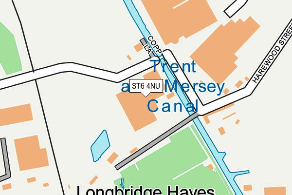
ST6 4NU is located in the Tunstall electoral ward, within the unitary authority of Stoke-on-Trent and the English Parliamentary constituency of Stoke-on-Trent North. The Sub Integrated Care Board (ICB) Location is NHS Staffordshire and Stoke-on-Trent ICB - 05W and the police force is Staffordshire. This postcode has been in use since February 1984.


GetTheData
Source: OS OpenMap – Local (Ordnance Survey)
Source: OS VectorMap District (Ordnance Survey)
Licence: Open Government Licence (requires attribution)
| Easting | 385336 |
| Northing | 350753 |
| Latitude | 53.053846 |
| Longitude | -2.220223 |
GetTheData
Source: Open Postcode Geo
Licence: Open Government Licence
| Country | England |
| Postcode District | ST6 |
➜ See where ST6 is on a map ➜ Where is Stoke-on-Trent? | |
GetTheData
Source: Land Registry Price Paid Data
Licence: Open Government Licence
Elevation or altitude of ST6 4NU as distance above sea level:
| Metres | Feet | |
|---|---|---|
| Elevation | 130m | 427ft |
Elevation is measured from the approximate centre of the postcode, to the nearest point on an OS contour line from OS Terrain 50, which has contour spacing of ten vertical metres.
➜ How high above sea level am I? Find the elevation of your current position using your device's GPS.
GetTheData
Source: Open Postcode Elevation
Licence: Open Government Licence
| Ward | Tunstall |
| Constituency | Stoke-on-trent North |
GetTheData
Source: ONS Postcode Database
Licence: Open Government Licence
| Brownhills Business Park (Brownhills Road) | Brownhills | 646m |
| Brownhills Business Park (Brownhills Road) | Brownhills | 659m |
| White Horse (Brownhills Road) | Tunstall | 663m |
| Highgate (High Street) | Tunstall | 693m |
| Brownhills High School (Brownhills Road) | Brownhills | 709m |
| Longport Station | 1.4km |
| Kidsgrove Station | 4km |
GetTheData
Source: NaPTAN
Licence: Open Government Licence
GetTheData
Source: ONS Postcode Database
Licence: Open Government Licence


➜ Get more ratings from the Food Standards Agency
GetTheData
Source: Food Standards Agency
Licence: FSA terms & conditions
| Last Collection | |||
|---|---|---|---|
| Location | Mon-Fri | Sat | Distance |
| Browhills Road | 18:00 | 10:45 | 659m |
| Tower Square | 18:00 | 795m | |
| Tower Square | 18:00 | 12:15 | 796m |
GetTheData
Source: Dracos
Licence: Creative Commons Attribution-ShareAlike
The below table lists the International Territorial Level (ITL) codes (formerly Nomenclature of Territorial Units for Statistics (NUTS) codes) and Local Administrative Units (LAU) codes for ST6 4NU:
| ITL 1 Code | Name |
|---|---|
| TLG | West Midlands (England) |
| ITL 2 Code | Name |
| TLG2 | Shropshire and Staffordshire |
| ITL 3 Code | Name |
| TLG23 | Stoke-on-Trent |
| LAU 1 Code | Name |
| E06000021 | Stoke-on-Trent |
GetTheData
Source: ONS Postcode Directory
Licence: Open Government Licence
The below table lists the Census Output Area (OA), Lower Layer Super Output Area (LSOA), and Middle Layer Super Output Area (MSOA) for ST6 4NU:
| Code | Name | |
|---|---|---|
| OA | E00072490 | |
| LSOA | E01014356 | Stoke-on-Trent 005C |
| MSOA | E02002955 | Stoke-on-Trent 005 |
GetTheData
Source: ONS Postcode Directory
Licence: Open Government Licence
| ST6 4PB | Chemical Lane | 398m |
| ST6 4SJ | Lake View | 558m |
| ST6 5JG | Clay Hills | 589m |
| ST6 4SB | Cloughwood Way | 600m |
| ST6 5DD | Harewood Street | 614m |
| ST6 5BT | Nash Peake Street | 616m |
| ST6 5JF | Chatterley Road | 621m |
| ST6 4SG | Swan Grove | 621m |
| ST6 5DE | Ladywell Road | 625m |
| ST6 4JU | Brownhills Road | 633m |
GetTheData
Source: Open Postcode Geo; Land Registry Price Paid Data
Licence: Open Government Licence