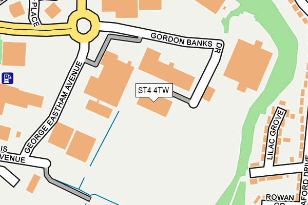
ST4 4TW is located in the Hollybush electoral ward, within the unitary authority of Stoke-on-Trent and the English Parliamentary constituency of Stoke-on-Trent South. The Sub Integrated Care Board (ICB) Location is NHS Staffordshire and Stoke-on-Trent ICB - 05W and the police force is Staffordshire. This postcode has been in use since December 1999.


GetTheData
Source: OS OpenMap – Local (Ordnance Survey)
Source: OS VectorMap District (Ordnance Survey)
Licence: Open Government Licence (requires attribution)
| Easting | 388864 |
| Northing | 343295 |
| Latitude | 52.986891 |
| Longitude | -2.167328 |
GetTheData
Source: Open Postcode Geo
Licence: Open Government Licence
| Country | England |
| Postcode District | ST4 |
➜ See where ST4 is on a map ➜ Where is Stoke-on-Trent? | |
GetTheData
Source: Land Registry Price Paid Data
Licence: Open Government Licence
Elevation or altitude of ST4 4TW as distance above sea level:
| Metres | Feet | |
|---|---|---|
| Elevation | 140m | 459ft |
Elevation is measured from the approximate centre of the postcode, to the nearest point on an OS contour line from OS Terrain 50, which has contour spacing of ten vertical metres.
➜ How high above sea level am I? Find the elevation of your current position using your device's GPS.
GetTheData
Source: Open Postcode Elevation
Licence: Open Government Licence
| Ward | Hollybush |
| Constituency | Stoke-on-trent South |
GetTheData
Source: ONS Postcode Database
Licence: Open Government Licence
| Ageas Factory (Gordon Banks Drive) | Trentham | 167m |
| Cemlyn Avenue | Hollybush | 405m |
| Cemlyn Avenue | Hollybush | 407m |
| Central Drive | Hollybush | 418m |
| Central Drive | Hollybush | 420m |
| Longton Station | 2.1km |
| Stoke-on-Trent Station | 2.5km |
| Wedgwood Station | 4km |
GetTheData
Source: NaPTAN
Licence: Open Government Licence
GetTheData
Source: ONS Postcode Database
Licence: Open Government Licence


➜ Get more ratings from the Food Standards Agency
GetTheData
Source: Food Standards Agency
Licence: FSA terms & conditions
| Last Collection | |||
|---|---|---|---|
| Location | Mon-Fri | Sat | Distance |
| Highfield Drive | 17:30 | 11:00 | 541m |
| Cemlyn Avenue | 17:30 | 11:00 | 620m |
| Heron Cross Post Office | 17:30 | 11:45 | 764m |
GetTheData
Source: Dracos
Licence: Creative Commons Attribution-ShareAlike
The below table lists the International Territorial Level (ITL) codes (formerly Nomenclature of Territorial Units for Statistics (NUTS) codes) and Local Administrative Units (LAU) codes for ST4 4TW:
| ITL 1 Code | Name |
|---|---|
| TLG | West Midlands (England) |
| ITL 2 Code | Name |
| TLG2 | Shropshire and Staffordshire |
| ITL 3 Code | Name |
| TLG23 | Stoke-on-Trent |
| LAU 1 Code | Name |
| E06000021 | Stoke-on-Trent |
GetTheData
Source: ONS Postcode Directory
Licence: Open Government Licence
The below table lists the Census Output Area (OA), Lower Layer Super Output Area (LSOA), and Middle Layer Super Output Area (MSOA) for ST4 4TW:
| Code | Name | |
|---|---|---|
| OA | E00071881 | |
| LSOA | E01014234 | Stoke-on-Trent 026B |
| MSOA | E02002976 | Stoke-on-Trent 026 |
GetTheData
Source: ONS Postcode Directory
Licence: Open Government Licence
| ST3 2AZ | Lilac Grove | 177m |
| ST3 2BA | Hollybush Road | 183m |
| ST3 2BY | Meaford Drive | 220m |
| ST3 2BB | Meaford Drive | 298m |
| ST3 2BX | Highfield Drive | 301m |
| ST3 2AY | Hollybush Road | 326m |
| ST3 2BZ | Seedfields Road | 327m |
| ST3 2AS | Cherry Grove | 331m |
| ST3 2DA | Highfield Drive | 339m |
| ST3 2DF | Central Drive | 360m |
GetTheData
Source: Open Postcode Geo; Land Registry Price Paid Data
Licence: Open Government Licence