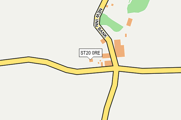
ST20 0RE is located in the Eccleshall electoral ward, within the local authority district of Stafford and the English Parliamentary constituency of Stone. The Sub Integrated Care Board (ICB) Location is NHS Staffordshire and Stoke-on-Trent ICB - 05V and the police force is Staffordshire. This postcode has been in use since January 1980.


GetTheData
Source: OS OpenMap – Local (Ordnance Survey)
Source: OS VectorMap District (Ordnance Survey)
Licence: Open Government Licence (requires attribution)
| Easting | 376954 |
| Northing | 329744 |
| Latitude | 52.864680 |
| Longitude | -2.343769 |
GetTheData
Source: Open Postcode Geo
Licence: Open Government Licence
| Country | England |
| Postcode District | ST20 |
➜ See where ST20 is on a map ➜ Where is Outlands? | |
GetTheData
Source: Land Registry Price Paid Data
Licence: Open Government Licence
Elevation or altitude of ST20 0RE as distance above sea level:
| Metres | Feet | |
|---|---|---|
| Elevation | 120m | 394ft |
Elevation is measured from the approximate centre of the postcode, to the nearest point on an OS contour line from OS Terrain 50, which has contour spacing of ten vertical metres.
➜ How high above sea level am I? Find the elevation of your current position using your device's GPS.
GetTheData
Source: Open Postcode Elevation
Licence: Open Government Licence
| Ward | Eccleshall |
| Constituency | Stone |
GetTheData
Source: ONS Postcode Database
Licence: Open Government Licence
| New Inn Bank (Four Lane Ends) | Outlands | 114m |
| New Inn Bank (Four Lane Ends) | Outlands | 125m |
| Brown Jug Inn Ph (Main Rd) | Bishops Offley | 1,169m |
| Brown Jug Inn Ph (Main Rd) | Bishops Offley | 1,193m |
GetTheData
Source: NaPTAN
Licence: Open Government Licence
| Percentage of properties with Next Generation Access | 100.0% |
| Percentage of properties with Superfast Broadband | 100.0% |
| Percentage of properties with Ultrafast Broadband | 0.0% |
| Percentage of properties with Full Fibre Broadband | 0.0% |
Superfast Broadband is between 30Mbps and 300Mbps
Ultrafast Broadband is > 300Mbps
| Percentage of properties unable to receive 2Mbps | 0.0% |
| Percentage of properties unable to receive 5Mbps | 0.0% |
| Percentage of properties unable to receive 10Mbps | 0.0% |
| Percentage of properties unable to receive 30Mbps | 0.0% |
GetTheData
Source: Ofcom
Licence: Ofcom Terms of Use (requires attribution)
GetTheData
Source: ONS Postcode Database
Licence: Open Government Licence
| Last Collection | |||
|---|---|---|---|
| Location | Mon-Fri | Sat | Distance |
| Haberdashers Arms | 16:00 | 10:15 | 2,773m |
| Copmere End | 15:00 | 07:00 | 3,371m |
| High Offley | 16:45 | 08:00 | 3,851m |
GetTheData
Source: Dracos
Licence: Creative Commons Attribution-ShareAlike
The below table lists the International Territorial Level (ITL) codes (formerly Nomenclature of Territorial Units for Statistics (NUTS) codes) and Local Administrative Units (LAU) codes for ST20 0RE:
| ITL 1 Code | Name |
|---|---|
| TLG | West Midlands (England) |
| ITL 2 Code | Name |
| TLG2 | Shropshire and Staffordshire |
| ITL 3 Code | Name |
| TLG24 | Staffordshire CC |
| LAU 1 Code | Name |
| E07000197 | Stafford |
GetTheData
Source: ONS Postcode Directory
Licence: Open Government Licence
The below table lists the Census Output Area (OA), Lower Layer Super Output Area (LSOA), and Middle Layer Super Output Area (MSOA) for ST20 0RE:
| Code | Name | |
|---|---|---|
| OA | E00151305 | |
| LSOA | E01029696 | Stafford 005B |
| MSOA | E02006192 | Stafford 005 |
GetTheData
Source: ONS Postcode Directory
Licence: Open Government Licence
| ST21 6HD | New Inn Bank | 286m |
| ST21 6HB | 442m | |
| ST21 6PR | 678m | |
| ST20 0RD | Council Houses | 768m |
| ST20 0RB | Lerridge Lane | 986m |
| ST21 6HA | Offley Brook | 1097m |
| ST21 6ET | 1116m | |
| ST20 0RF | Main Road | 1222m |
| ST20 0RG | Doley Road | 1277m |
| ST21 6HE | Offley Marsh | 1652m |
GetTheData
Source: Open Postcode Geo; Land Registry Price Paid Data
Licence: Open Government Licence