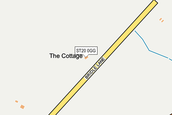
ST20 0GG lies on Bridle Lane in Broad Heath, Stafford. ST20 0GG is located in the Seighford & Church Eaton electoral ward, within the local authority district of Stafford and the English Parliamentary constituency of Stafford. The Sub Integrated Care Board (ICB) Location is NHS Staffordshire and Stoke-on-Trent ICB - 05V and the police force is Staffordshire. This postcode has been in use since September 2009.


GetTheData
Source: OS OpenMap – Local (Ordnance Survey)
Source: OS VectorMap District (Ordnance Survey)
Licence: Open Government Licence (requires attribution)
| Easting | 385515 |
| Northing | 325843 |
| Latitude | 52.829913 |
| Longitude | -2.216430 |
GetTheData
Source: Open Postcode Geo
Licence: Open Government Licence
| Street | Bridle Lane |
| Locality | Broad Heath |
| Town/City | Stafford |
| Country | England |
| Postcode District | ST20 |
➜ See where ST20 is on a map | |
GetTheData
Source: Land Registry Price Paid Data
Licence: Open Government Licence
Elevation or altitude of ST20 0GG as distance above sea level:
| Metres | Feet | |
|---|---|---|
| Elevation | 100m | 328ft |
Elevation is measured from the approximate centre of the postcode, to the nearest point on an OS contour line from OS Terrain 50, which has contour spacing of ten vertical metres.
➜ How high above sea level am I? Find the elevation of your current position using your device's GPS.
GetTheData
Source: Open Postcode Elevation
Licence: Open Government Licence
| Ward | Seighford & Church Eaton |
| Constituency | Stafford |
GetTheData
Source: ONS Postcode Database
Licence: Open Government Licence
| Five Lanes Ends (Hextall Lane) | Broad Heath | 400m |
| Five Lanes Ends (Hextall Lane) | Broad Heath | 422m |
| Airfield Industrial Estate (Newport Rd) | Ladfordfield | 798m |
| Airfield Industrial Estate (Newport Rd) | Ladfordfield | 814m |
| Parish Room (Grange Close) | Ellenhall | 1,190m |
| Norton Bridge Station | 4.4km |
GetTheData
Source: NaPTAN
Licence: Open Government Licence
| Percentage of properties with Next Generation Access | 100.0% |
| Percentage of properties with Superfast Broadband | 0.0% |
| Percentage of properties with Ultrafast Broadband | 0.0% |
| Percentage of properties with Full Fibre Broadband | 0.0% |
Superfast Broadband is between 30Mbps and 300Mbps
Ultrafast Broadband is > 300Mbps
| Percentage of properties unable to receive 2Mbps | 0.0% |
| Percentage of properties unable to receive 5Mbps | 0.0% |
| Percentage of properties unable to receive 10Mbps | 0.0% |
| Percentage of properties unable to receive 30Mbps | 100.0% |
GetTheData
Source: Ofcom
Licence: Ofcom Terms of Use (requires attribution)
GetTheData
Source: ONS Postcode Database
Licence: Open Government Licence


➜ Get more ratings from the Food Standards Agency
GetTheData
Source: Food Standards Agency
Licence: FSA terms & conditions
| Last Collection | |||
|---|---|---|---|
| Location | Mon-Fri | Sat | Distance |
| Ranton | 16:00 | 07:30 | 1,638m |
| Jasmine Road | 17:10 | 07:00 | 2,694m |
| Wooton | 16:30 | 08:45 | 3,168m |
GetTheData
Source: Dracos
Licence: Creative Commons Attribution-ShareAlike
The below table lists the International Territorial Level (ITL) codes (formerly Nomenclature of Territorial Units for Statistics (NUTS) codes) and Local Administrative Units (LAU) codes for ST20 0GG:
| ITL 1 Code | Name |
|---|---|
| TLG | West Midlands (England) |
| ITL 2 Code | Name |
| TLG2 | Shropshire and Staffordshire |
| ITL 3 Code | Name |
| TLG24 | Staffordshire CC |
| LAU 1 Code | Name |
| E07000197 | Stafford |
GetTheData
Source: ONS Postcode Directory
Licence: Open Government Licence
The below table lists the Census Output Area (OA), Lower Layer Super Output Area (LSOA), and Middle Layer Super Output Area (MSOA) for ST20 0GG:
| Code | Name | |
|---|---|---|
| OA | E00151548 | |
| LSOA | E01029742 | Stafford 012E |
| MSOA | E02006199 | Stafford 012 |
GetTheData
Source: ONS Postcode Directory
Licence: Open Government Licence
| ST20 0JG | 282m | |
| ST18 9GZ | Hextall Lane | 836m |
| ST21 6JN | Grange Close | 1142m |
| ST21 6JQ | 1372m | |
| ST18 9JF | Abbeyside | 1472m |
| ST18 9JX | Bourne Avenue | 1490m |
| ST18 9JE | Church Close | 1654m |
| ST18 9JA | Brook Side | 1766m |
| ST18 9JB | Whites Meadow | 1823m |
| ST18 9JU | 1831m |
GetTheData
Source: Open Postcode Geo; Land Registry Price Paid Data
Licence: Open Government Licence