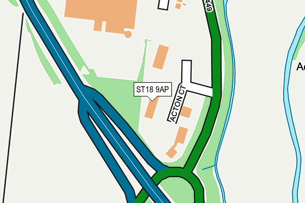
ST18 9AP is located in the Penkridge North & Acton Trussell electoral ward, within the local authority district of South Staffordshire and the English Parliamentary constituency of Stafford. The Sub Integrated Care Board (ICB) Location is NHS Staffordshire and Stoke-on-Trent ICB - 05V and the police force is Staffordshire. This postcode has been in use since December 1997.


GetTheData
Source: OS OpenMap – Local (Ordnance Survey)
Source: OS VectorMap District (Ordnance Survey)
Licence: Open Government Licence (requires attribution)
| Easting | 392789 |
| Northing | 318668 |
| Latitude | 52.765562 |
| Longitude | -2.108308 |
GetTheData
Source: Open Postcode Geo
Licence: Open Government Licence
| Country | England |
| Postcode District | ST18 |
➜ See where ST18 is on a map ➜ Where is Acton Gate? | |
GetTheData
Source: Land Registry Price Paid Data
Licence: Open Government Licence
Elevation or altitude of ST18 9AP as distance above sea level:
| Metres | Feet | |
|---|---|---|
| Elevation | 80m | 262ft |
Elevation is measured from the approximate centre of the postcode, to the nearest point on an OS contour line from OS Terrain 50, which has contour spacing of ten vertical metres.
➜ How high above sea level am I? Find the elevation of your current position using your device's GPS.
GetTheData
Source: Open Postcode Elevation
Licence: Open Government Licence
| Ward | Penkridge North & Acton Trussell |
| Constituency | Stafford |
GetTheData
Source: ONS Postcode Database
Licence: Open Government Licence
| Argos (Wolverhampton Rd) | Acton Gate | 448m |
| School Lane (Stafford Rd) | Dunston | 659m |
| Garage (Wolverhampton Road) | Acton Gate | 669m |
| School Lane (Stafford Rd) | Dunston | 673m |
| Garage (Wolverhampton Rd) | Acton Gate | 693m |
| Stafford Station | 4.4km |
| Penkridge Station | 4.7km |
GetTheData
Source: NaPTAN
Licence: Open Government Licence
GetTheData
Source: ONS Postcode Database
Licence: Open Government Licence


➜ Get more ratings from the Food Standards Agency
GetTheData
Source: Food Standards Agency
Licence: FSA terms & conditions
| Last Collection | |||
|---|---|---|---|
| Location | Mon-Fri | Sat | Distance |
| Acton Gate | 17:15 | 08:45 | 576m |
| Dunston | 17:00 | 08:45 | 762m |
| Acton Trussell | 17:30 | 09:00 | 841m |
GetTheData
Source: Dracos
Licence: Creative Commons Attribution-ShareAlike
The below table lists the International Territorial Level (ITL) codes (formerly Nomenclature of Territorial Units for Statistics (NUTS) codes) and Local Administrative Units (LAU) codes for ST18 9AP:
| ITL 1 Code | Name |
|---|---|
| TLG | West Midlands (England) |
| ITL 2 Code | Name |
| TLG2 | Shropshire and Staffordshire |
| ITL 3 Code | Name |
| TLG24 | Staffordshire CC |
| LAU 1 Code | Name |
| E07000196 | South Staffordshire |
GetTheData
Source: ONS Postcode Directory
Licence: Open Government Licence
The below table lists the Census Output Area (OA), Lower Layer Super Output Area (LSOA), and Middle Layer Super Output Area (MSOA) for ST18 9AP:
| Code | Name | |
|---|---|---|
| OA | E00151098 | |
| LSOA | E01029656 | South Staffordshire 001B |
| MSOA | E02006174 | South Staffordshire 001 |
GetTheData
Source: ONS Postcode Directory
Licence: Open Government Licence
| ST18 9AA | 213m | |
| ST18 9AR | 313m | |
| ST17 0RA | 533m | |
| ST17 0RD | Mill Lane | 743m |
| ST17 9HQ | Moss Pit | 801m |
| ST17 0SW | Ivy Close | 805m |
| ST18 9AF | Church Close | 808m |
| ST17 0SN | Ivy Court | 829m |
| ST17 0SL | Hempits Grove | 835m |
| ST17 0RL | Trussell Close | 872m |
GetTheData
Source: Open Postcode Geo; Land Registry Price Paid Data
Licence: Open Government Licence