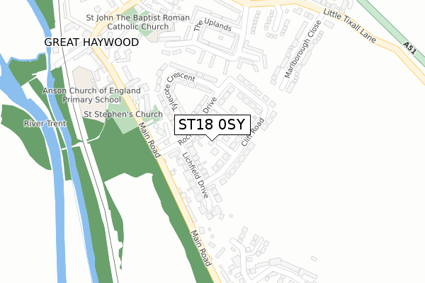
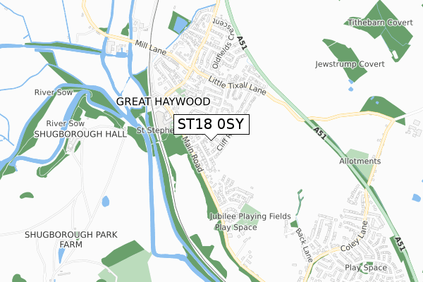
ST18 0SY lies on Oak Close in Great Haywood, Stafford. ST18 0SY is located in the Haywood & Hixon electoral ward, within the local authority district of Stafford and the English Parliamentary constituency of Stafford. The Sub Integrated Care Board (ICB) Location is NHS Staffordshire and Stoke-on-Trent ICB - 05V and the police force is Staffordshire. This postcode has been in use since January 1980.


GetTheData
Source: OS Open Zoomstack (Ordnance Survey)
Licence: Open Government Licence (requires attribution)
Attribution: Contains OS data © Crown copyright and database right 2025
Source: Open Postcode Geo
Licence: Open Government Licence (requires attribution)
Attribution: Contains OS data © Crown copyright and database right 2025; Contains Royal Mail data © Royal Mail copyright and database right 2025; Source: Office for National Statistics licensed under the Open Government Licence v.3.0
| Easting | 399986 |
| Northing | 322448 |
| Latitude | 52.799591 |
| Longitude | -2.001649 |
GetTheData
Source: Open Postcode Geo
Licence: Open Government Licence
| Street | Oak Close |
| Locality | Great Haywood |
| Town/City | Stafford |
| Country | England |
| Postcode District | ST18 |
➜ See where ST18 is on a map ➜ Where is Great Haywood? | |
GetTheData
Source: Land Registry Price Paid Data
Licence: Open Government Licence
Elevation or altitude of ST18 0SY as distance above sea level:
| Metres | Feet | |
|---|---|---|
| Elevation | 90m | 295ft |
Elevation is measured from the approximate centre of the postcode, to the nearest point on an OS contour line from OS Terrain 50, which has contour spacing of ten vertical metres.
➜ How high above sea level am I? Find the elevation of your current position using your device's GPS.
GetTheData
Source: Open Postcode Elevation
Licence: Open Government Licence
| Ward | Haywood & Hixon |
| Constituency | Stafford |
GetTheData
Source: ONS Postcode Database
Licence: Open Government Licence
| Rockhouse Drive (Main Road) | Great Haywood | 134m |
| Rockhouse Drive (Main Road) | Great Haywood | 148m |
| Clifford Arms Ph (Main Road) | Great Haywood | 316m |
| Clifford Arms Ph (Main Rd) | Great Haywood | 377m |
| Abbeyfields (Mill Lane) | Great Haywood | 470m |
| Rugeley Trent Valley Station | 5.9km |
GetTheData
Source: NaPTAN
Licence: Open Government Licence
| Percentage of properties with Next Generation Access | 100.0% |
| Percentage of properties with Superfast Broadband | 100.0% |
| Percentage of properties with Ultrafast Broadband | 100.0% |
| Percentage of properties with Full Fibre Broadband | 0.0% |
Superfast Broadband is between 30Mbps and 300Mbps
Ultrafast Broadband is > 300Mbps
| Percentage of properties unable to receive 2Mbps | 0.0% |
| Percentage of properties unable to receive 5Mbps | 0.0% |
| Percentage of properties unable to receive 10Mbps | 0.0% |
| Percentage of properties unable to receive 30Mbps | 0.0% |
GetTheData
Source: Ofcom
Licence: Ofcom Terms of Use (requires attribution)
Estimated total energy consumption in ST18 0SY by fuel type, 2015.
| Consumption (kWh) | 96,805 |
|---|---|
| Meter count | 7 |
| Mean (kWh/meter) | 13,829 |
| Median (kWh/meter) | 14,824 |
| Consumption (kWh) | 18,338 |
|---|---|
| Meter count | 6 |
| Mean (kWh/meter) | 3,056 |
| Median (kWh/meter) | 3,133 |
GetTheData
Source: Postcode level gas estimates: 2015 (experimental)
Source: Postcode level electricity estimates: 2015 (experimental)
Licence: Open Government Licence
GetTheData
Source: ONS Postcode Database
Licence: Open Government Licence


➜ Get more ratings from the Food Standards Agency
GetTheData
Source: Food Standards Agency
Licence: FSA terms & conditions
| Last Collection | |||
|---|---|---|---|
| Location | Mon-Fri | Sat | Distance |
| Little Tixall Lane | 16:15 | 10:00 | 343m |
| Great Haywood Post Office | 16:40 | 11:15 | 384m |
| Hill Top | 16:45 | 09:00 | 534m |
GetTheData
Source: Dracos
Licence: Creative Commons Attribution-ShareAlike
The below table lists the International Territorial Level (ITL) codes (formerly Nomenclature of Territorial Units for Statistics (NUTS) codes) and Local Administrative Units (LAU) codes for ST18 0SY:
| ITL 1 Code | Name |
|---|---|
| TLG | West Midlands (England) |
| ITL 2 Code | Name |
| TLG2 | Shropshire and Staffordshire |
| ITL 3 Code | Name |
| TLG24 | Staffordshire CC |
| LAU 1 Code | Name |
| E07000197 | Stafford |
GetTheData
Source: ONS Postcode Directory
Licence: Open Government Licence
The below table lists the Census Output Area (OA), Lower Layer Super Output Area (LSOA), and Middle Layer Super Output Area (MSOA) for ST18 0SY:
| Code | Name | |
|---|---|---|
| OA | E00151381 | |
| LSOA | E01029713 | Stafford 008E |
| MSOA | E02006195 | Stafford 008 |
GetTheData
Source: ONS Postcode Directory
Licence: Open Government Licence
| ST18 0TB | Birch Close | 65m |
| ST18 0TD | Rockhouse Drive | 69m |
| ST18 0SZ | Cliff Road | 87m |
| ST18 0TE | Rockhouse Drive | 88m |
| ST18 0SX | Lichfield Drive | 111m |
| ST18 0TA | Tylecote Crescent | 159m |
| ST18 0GS | St Stephens Court | 177m |
| ST18 0TF | Main Road | 187m |
| ST18 0GT | Church View | 199m |
| ST18 0SH | The Uplands | 199m |
GetTheData
Source: Open Postcode Geo; Land Registry Price Paid Data
Licence: Open Government Licence