ST18 0RZ maps, stats, and open data
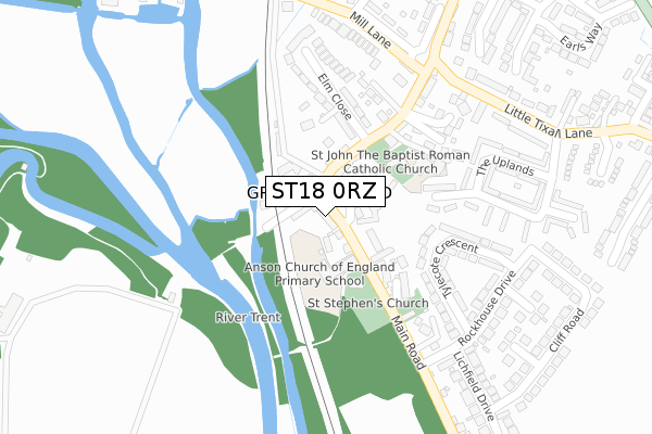
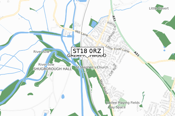
ST18 0RZ lies on Main Road in Great Haywood, Stafford. ST18 0RZ is located in the Haywood & Hixon electoral ward, within the local authority district of Stafford and the English Parliamentary constituency of Stafford. The Sub Integrated Care Board (ICB) Location is NHS Staffordshire and Stoke-on-Trent ICB - 05V and the police force is Staffordshire. This postcode has been in use since December 1995.
ST18 0RZ maps


Licence: Open Government Licence (requires attribution)
Attribution: Contains OS data © Crown copyright and database right 2025
Source: Open Postcode Geo
Licence: Open Government Licence (requires attribution)
Attribution: Contains OS data © Crown copyright and database right 2025; Contains Royal Mail data © Royal Mail copyright and database right 2025; Source: Office for National Statistics licensed under the Open Government Licence v.3.0
ST18 0RZ geodata
| Easting | 399711 |
| Northing | 322645 |
| Latitude | 52.801362 |
| Longitude | -2.005728 |
Where is ST18 0RZ?
| Street | Main Road |
| Locality | Great Haywood |
| Town/City | Stafford |
| Country | England |
| Postcode District | ST18 |
ST18 0RZ Elevation
Elevation or altitude of ST18 0RZ as distance above sea level:
| Metres | Feet | |
|---|---|---|
| Elevation | 80m | 262ft |
Elevation is measured from the approximate centre of the postcode, to the nearest point on an OS contour line from OS Terrain 50, which has contour spacing of ten vertical metres.
➜ How high above sea level am I? Find the elevation of your current position using your device's GPS.
Politics
| Ward | Haywood & Hixon |
|---|---|
| Constituency | Stafford |
Transport
Nearest bus stops to ST18 0RZ
| Clifford Arms Ph (Main Road) | Great Haywood | 26m |
| Clifford Arms Ph (Main Rd) | Great Haywood | 43m |
| Rockhouse Drive (Main Road) | Great Haywood | 250m |
| Rockhouse Drive (Main Road) | Great Haywood | 255m |
| Abbeyfields (Mill Lane) | Great Haywood | 268m |
Broadband
Broadband access in ST18 0RZ (2020 data)
| Percentage of properties with Next Generation Access | 100.0% |
| Percentage of properties with Superfast Broadband | 100.0% |
| Percentage of properties with Ultrafast Broadband | 100.0% |
| Percentage of properties with Full Fibre Broadband | 0.0% |
Superfast Broadband is between 30Mbps and 300Mbps
Ultrafast Broadband is > 300Mbps
Broadband limitations in ST18 0RZ (2020 data)
| Percentage of properties unable to receive 2Mbps | 0.0% |
| Percentage of properties unable to receive 5Mbps | 0.0% |
| Percentage of properties unable to receive 10Mbps | 0.0% |
| Percentage of properties unable to receive 30Mbps | 0.0% |
ST18 0RZ gas and electricity consumption
Estimated total energy consumption in ST18 0RZ by fuel type, 2015.
Gas
| Consumption (kWh) | 62,039 |
|---|---|
| Meter count | 10 |
| Mean (kWh/meter) | 6,204 |
| Median (kWh/meter) | 5,344 |
Electricity
| Consumption (kWh) | 11,757 |
|---|---|
| Meter count | 8 |
| Mean (kWh/meter) | 1,470 |
| Median (kWh/meter) | 1,571 |
- Consumption: The estimated total energy consumption, in kWh, across all meters in ST18 0RZ, for 2015.
- Meter count: The total number of meters in ST18 0RZ.
- Mean: The mean average consumption per meter, in kWh.
- Median: The median average consumption per meter, in kWh.
Source: Postcode level electricity estimates: 2015 (experimental)
Licence: Open Government Licence
Deprivation
24% of English postcodes are less deprived than ST18 0RZ:Food Standards Agency
Three nearest food hygiene ratings to ST18 0RZ (metres)


➜ Get more ratings from the Food Standards Agency
Nearest post box to ST18 0RZ
| Last Collection | |||
|---|---|---|---|
| Location | Mon-Fri | Sat | Distance |
| Great Haywood Post Office | 16:40 | 11:15 | 46m |
| Little Tixall Lane | 16:15 | 10:00 | 351m |
| Essex Drive | 16:40 | 10:00 | 418m |
ST18 0RZ ITL and ST18 0RZ LAU
The below table lists the International Territorial Level (ITL) codes (formerly Nomenclature of Territorial Units for Statistics (NUTS) codes) and Local Administrative Units (LAU) codes for ST18 0RZ:
| ITL 1 Code | Name |
|---|---|
| TLG | West Midlands (England) |
| ITL 2 Code | Name |
| TLG2 | Shropshire and Staffordshire |
| ITL 3 Code | Name |
| TLG24 | Staffordshire CC |
| LAU 1 Code | Name |
| E07000197 | Stafford |
ST18 0RZ census areas
The below table lists the Census Output Area (OA), Lower Layer Super Output Area (LSOA), and Middle Layer Super Output Area (MSOA) for ST18 0RZ:
| Code | Name | |
|---|---|---|
| OA | E00151387 | |
| LSOA | E01029713 | Stafford 008E |
| MSOA | E02006195 | Stafford 008 |
Nearest postcodes to ST18 0RZ
| ST18 0ST | Trent Lane | 55m |
| ST18 0SR | Main Road | 76m |
| ST18 0SS | Trent Close | 76m |
| ST18 0SU | Main Road | 112m |
| ST18 0GT | Church View | 140m |
| ST18 0GS | St Stephens Court | 164m |
| ST18 0SP | Elm Close | 188m |
| ST18 0TA | Tylecote Crescent | 195m |
| ST18 0RY | Abbey Gardens | 205m |
| ST18 0SN | Brewery Lane | 206m |