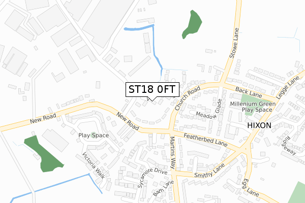
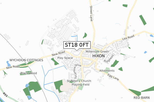
ST18 0FT lies on Vicarage Way in Hixon, Stafford. ST18 0FT is located in the Haywood & Hixon electoral ward, within the local authority district of Stafford and the English Parliamentary constituency of Stafford. The Sub Integrated Care Board (ICB) Location is NHS Staffordshire and Stoke-on-Trent ICB - 05V and the police force is Staffordshire. This postcode has been in use since December 1999.


GetTheData
Source: OS Open Zoomstack (Ordnance Survey)
Licence: Open Government Licence (requires attribution)
Attribution: Contains OS data © Crown copyright and database right 2025
Source: Open Postcode Geo
Licence: Open Government Licence (requires attribution)
Attribution: Contains OS data © Crown copyright and database right 2025; Contains Royal Mail data © Royal Mail copyright and database right 2025; Source: Office for National Statistics licensed under the Open Government Licence v.3.0
| Easting | 400066 |
| Northing | 326023 |
| Latitude | 52.831729 |
| Longitude | -2.000463 |
GetTheData
Source: Open Postcode Geo
Licence: Open Government Licence
| Street | Vicarage Way |
| Locality | Hixon |
| Town/City | Stafford |
| Country | England |
| Postcode District | ST18 |
➜ See where ST18 is on a map ➜ Where is Hixon? | |
GetTheData
Source: Land Registry Price Paid Data
Licence: Open Government Licence
Elevation or altitude of ST18 0FT as distance above sea level:
| Metres | Feet | |
|---|---|---|
| Elevation | 90m | 295ft |
Elevation is measured from the approximate centre of the postcode, to the nearest point on an OS contour line from OS Terrain 50, which has contour spacing of ten vertical metres.
➜ How high above sea level am I? Find the elevation of your current position using your device's GPS.
GetTheData
Source: Open Postcode Elevation
Licence: Open Government Licence
| Ward | Haywood & Hixon |
| Constituency | Stafford |
GetTheData
Source: ONS Postcode Database
Licence: Open Government Licence
2018 3 AUG £230,000 |
2014 4 NOV £140,000 |
2014 31 MAR £233,500 |
2006 29 NOV £230,000 |
2000 24 FEB £91,500 |
2000 28 JAN £133,950 |
1, VICARAGE WAY, HIXON, STAFFORD, ST18 0FT 1999 17 DEC £134,950 |
2, VICARAGE WAY, HIXON, STAFFORD, ST18 0FT 1999 27 AUG £124,000 |
GetTheData
Source: HM Land Registry Price Paid Data
Licence: Contains HM Land Registry data © Crown copyright and database right 2025. This data is licensed under the Open Government Licence v3.0.
| Church Road (New Road) | Hixon | 98m |
| Post Office (Smithy Lane) | Hixon | 270m |
| Post Office (Smithy Lane) | Hixon | 286m |
| Baths Lane (Martins Way) | Hixon | 298m |
| Baths Lane (Martins Way) | Hixon | 298m |
GetTheData
Source: NaPTAN
Licence: Open Government Licence
| Percentage of properties with Next Generation Access | 100.0% |
| Percentage of properties with Superfast Broadband | 100.0% |
| Percentage of properties with Ultrafast Broadband | 100.0% |
| Percentage of properties with Full Fibre Broadband | 0.0% |
Superfast Broadband is between 30Mbps and 300Mbps
Ultrafast Broadband is > 300Mbps
| Median download speed | 80.0Mbps |
| Average download speed | 101.4Mbps |
| Maximum download speed | 200.00Mbps |
| Median upload speed | 20.0Mbps |
| Average upload speed | 14.4Mbps |
| Maximum upload speed | 20.00Mbps |
| Percentage of properties unable to receive 2Mbps | 0.0% |
| Percentage of properties unable to receive 5Mbps | 0.0% |
| Percentage of properties unable to receive 10Mbps | 0.0% |
| Percentage of properties unable to receive 30Mbps | 0.0% |
GetTheData
Source: Ofcom
Licence: Ofcom Terms of Use (requires attribution)
Estimated total energy consumption in ST18 0FT by fuel type, 2015.
| Consumption (kWh) | 189,775 |
|---|---|
| Meter count | 20 |
| Mean (kWh/meter) | 9,489 |
| Median (kWh/meter) | 8,694 |
| Consumption (kWh) | 54,964 |
|---|---|
| Meter count | 17 |
| Mean (kWh/meter) | 3,233 |
| Median (kWh/meter) | 3,064 |
GetTheData
Source: Postcode level gas estimates: 2015 (experimental)
Source: Postcode level electricity estimates: 2015 (experimental)
Licence: Open Government Licence
GetTheData
Source: ONS Postcode Database
Licence: Open Government Licence


➜ Get more ratings from the Food Standards Agency
GetTheData
Source: Food Standards Agency
Licence: FSA terms & conditions
| Last Collection | |||
|---|---|---|---|
| Location | Mon-Fri | Sat | Distance |
| The Barn | 16:00 | 10:30 | 1,380m |
| Ingestre | 16:15 | 08:00 | 2,321m |
| Weston Post Office | 16:45 | 11:00 | 2,652m |
GetTheData
Source: Dracos
Licence: Creative Commons Attribution-ShareAlike
The below table lists the International Territorial Level (ITL) codes (formerly Nomenclature of Territorial Units for Statistics (NUTS) codes) and Local Administrative Units (LAU) codes for ST18 0FT:
| ITL 1 Code | Name |
|---|---|
| TLG | West Midlands (England) |
| ITL 2 Code | Name |
| TLG2 | Shropshire and Staffordshire |
| ITL 3 Code | Name |
| TLG24 | Staffordshire CC |
| LAU 1 Code | Name |
| E07000197 | Stafford |
GetTheData
Source: ONS Postcode Directory
Licence: Open Government Licence
The below table lists the Census Output Area (OA), Lower Layer Super Output Area (LSOA), and Middle Layer Super Output Area (MSOA) for ST18 0FT:
| Code | Name | |
|---|---|---|
| OA | E00151397 | |
| LSOA | E01029712 | Stafford 008D |
| MSOA | E02006195 | Stafford 008 |
GetTheData
Source: ONS Postcode Directory
Licence: Open Government Licence
| ST18 0PD | Lauder Grove | 68m |
| ST18 0FS | Church Road | 75m |
| ST18 0FU | Hall Farm Close | 90m |
| ST18 0QP | Barons Way | 136m |
| ST18 0PE | New Road | 145m |
| ST18 0PB | Church Road | 145m |
| ST18 0FD | Elm Crescent | 187m |
| ST18 0NT | Meadow Glade | 189m |
| ST18 0PW | Martins Way | 196m |
| ST18 0QS | Featherbed Lane | 202m |
GetTheData
Source: Open Postcode Geo; Land Registry Price Paid Data
Licence: Open Government Licence