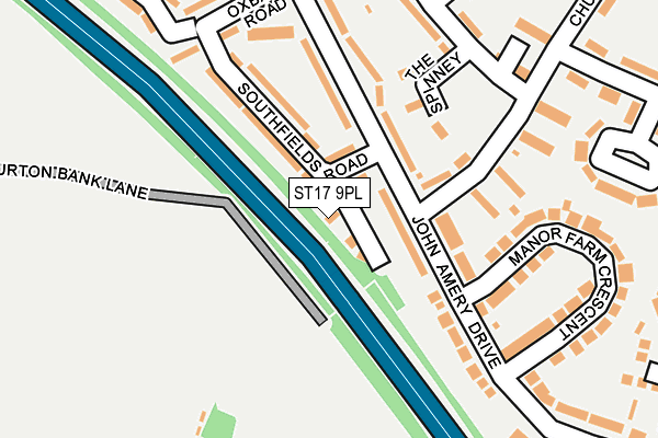
ST17 9PL lies on Southfields Close in Stafford. ST17 9PL is located in the Manor electoral ward, within the local authority district of Stafford and the English Parliamentary constituency of Stafford. The Sub Integrated Care Board (ICB) Location is NHS Staffordshire and Stoke-on-Trent ICB - 05V and the police force is Staffordshire. This postcode has been in use since January 1980.


GetTheData
Source: OS OpenMap – Local (Ordnance Survey)
Source: OS VectorMap District (Ordnance Survey)
Licence: Open Government Licence (requires attribution)
| Easting | 391876 |
| Northing | 320421 |
| Latitude | 52.781307 |
| Longitude | -2.121883 |
GetTheData
Source: Open Postcode Geo
Licence: Open Government Licence
| Street | Southfields Close |
| Town/City | Stafford |
| Country | England |
| Postcode District | ST17 |
➜ See where ST17 is on a map ➜ Where is Stafford? | |
GetTheData
Source: Land Registry Price Paid Data
Licence: Open Government Licence
Elevation or altitude of ST17 9PL as distance above sea level:
| Metres | Feet | |
|---|---|---|
| Elevation | 100m | 328ft |
Elevation is measured from the approximate centre of the postcode, to the nearest point on an OS contour line from OS Terrain 50, which has contour spacing of ten vertical metres.
➜ How high above sea level am I? Find the elevation of your current position using your device's GPS.
GetTheData
Source: Open Postcode Elevation
Licence: Open Government Licence
| Ward | Manor |
| Constituency | Stafford |
GetTheData
Source: ONS Postcode Database
Licence: Open Government Licence
| Churchill Way (John Amery Dr) | Burton Manor | 71m |
| Churchill Way (John Amery Dr) | Burton Manor | 79m |
| Manor Farm Crescent (John Amery Drive) | Moss Pit | 163m |
| Oxbarn Road (John Amery Drive) | Burton Manor | 239m |
| Poplar Way (Churchill Way) | Burton Manor | 248m |
| Stafford Station | 2.5km |
GetTheData
Source: NaPTAN
Licence: Open Government Licence
| Percentage of properties with Next Generation Access | 100.0% |
| Percentage of properties with Superfast Broadband | 100.0% |
| Percentage of properties with Ultrafast Broadband | 100.0% |
| Percentage of properties with Full Fibre Broadband | 0.0% |
Superfast Broadband is between 30Mbps and 300Mbps
Ultrafast Broadband is > 300Mbps
| Percentage of properties unable to receive 2Mbps | 0.0% |
| Percentage of properties unable to receive 5Mbps | 0.0% |
| Percentage of properties unable to receive 10Mbps | 0.0% |
| Percentage of properties unable to receive 30Mbps | 0.0% |
GetTheData
Source: Ofcom
Licence: Ofcom Terms of Use (requires attribution)
GetTheData
Source: ONS Postcode Database
Licence: Open Government Licence


➜ Get more ratings from the Food Standards Agency
GetTheData
Source: Food Standards Agency
Licence: FSA terms & conditions
| Last Collection | |||
|---|---|---|---|
| Location | Mon-Fri | Sat | Distance |
| Uplands Road | 17:15 | 10:45 | 390m |
| Garth Close | 17:15 | 10:30 | 673m |
| Gravel Lane | 17:15 | 10:45 | 939m |
GetTheData
Source: Dracos
Licence: Creative Commons Attribution-ShareAlike
The below table lists the International Territorial Level (ITL) codes (formerly Nomenclature of Territorial Units for Statistics (NUTS) codes) and Local Administrative Units (LAU) codes for ST17 9PL:
| ITL 1 Code | Name |
|---|---|
| TLG | West Midlands (England) |
| ITL 2 Code | Name |
| TLG2 | Shropshire and Staffordshire |
| ITL 3 Code | Name |
| TLG24 | Staffordshire CC |
| LAU 1 Code | Name |
| E07000197 | Stafford |
GetTheData
Source: ONS Postcode Directory
Licence: Open Government Licence
The below table lists the Census Output Area (OA), Lower Layer Super Output Area (LSOA), and Middle Layer Super Output Area (MSOA) for ST17 9PL:
| Code | Name | |
|---|---|---|
| OA | E00151475 | |
| LSOA | E01029728 | Stafford 013E |
| MSOA | E02006200 | Stafford 013 |
GetTheData
Source: ONS Postcode Directory
Licence: Open Government Licence
| ST17 9PD | John Amery Drive | 69m |
| ST17 9PN | Southfields Road | 95m |
| ST17 9PE | John Amery Drive | 119m |
| ST17 9PG | John Amery Drive | 120m |
| ST17 9JL | Burton Bank Lane | 126m |
| ST17 9TF | The Spinney | 139m |
| ST17 9PB | Churchill Way | 161m |
| ST17 9PW | Oxbarn Road | 194m |
| ST17 9JJ | Burton Bank Lane | 194m |
| ST17 9PF | John Amery Drive | 217m |
GetTheData
Source: Open Postcode Geo; Land Registry Price Paid Data
Licence: Open Government Licence