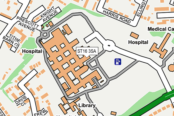
ST16 3SA is located in the Littleworth electoral ward, within the local authority district of Stafford and the English Parliamentary constituency of Stafford. The Sub Integrated Care Board (ICB) Location is NHS Staffordshire and Stoke-on-Trent ICB - 05V and the police force is Staffordshire. This postcode has been in use since July 1983.


GetTheData
Source: OS OpenMap – Local (Ordnance Survey)
Source: OS VectorMap District (Ordnance Survey)
Licence: Open Government Licence (requires attribution)
| Easting | 393506 |
| Northing | 323754 |
| Latitude | 52.811291 |
| Longitude | -2.097785 |
GetTheData
Source: Open Postcode Geo
Licence: Open Government Licence
| Country | England |
| Postcode District | ST16 |
➜ See where ST16 is on a map ➜ Where is Stafford? | |
GetTheData
Source: Land Registry Price Paid Data
Licence: Open Government Licence
Elevation or altitude of ST16 3SA as distance above sea level:
| Metres | Feet | |
|---|---|---|
| Elevation | 90m | 295ft |
Elevation is measured from the approximate centre of the postcode, to the nearest point on an OS contour line from OS Terrain 50, which has contour spacing of ten vertical metres.
➜ How high above sea level am I? Find the elevation of your current position using your device's GPS.
GetTheData
Source: Open Postcode Elevation
Licence: Open Government Licence
| Ward | Littleworth |
| Constituency | Stafford |
GetTheData
Source: ONS Postcode Database
Licence: Open Government Licence
| Stafford General Hospital (Access Road) | Stafford | 49m |
| Coton Avenue (Weston Road) | Littleworth | 248m |
| Bradbury House (Weston Road) | Littleworth | 263m |
| Katherine House (Hospital Access Road) | Stafford | 268m |
| Coton Avenue (Weston Road) | Littleworth | 272m |
| Stafford Station | 1.8km |
GetTheData
Source: NaPTAN
Licence: Open Government Licence
GetTheData
Source: ONS Postcode Database
Licence: Open Government Licence


➜ Get more ratings from the Food Standards Agency
GetTheData
Source: Food Standards Agency
Licence: FSA terms & conditions
| Last Collection | |||
|---|---|---|---|
| Location | Mon-Fri | Sat | Distance |
| Tedder Road | 17:15 | 09:15 | 387m |
| Prospect Road | 17:15 | 09:30 | 398m |
| Marlborough Avenue | 17:30 | 09:45 | 528m |
GetTheData
Source: Dracos
Licence: Creative Commons Attribution-ShareAlike
The below table lists the International Territorial Level (ITL) codes (formerly Nomenclature of Territorial Units for Statistics (NUTS) codes) and Local Administrative Units (LAU) codes for ST16 3SA:
| ITL 1 Code | Name |
|---|---|
| TLG | West Midlands (England) |
| ITL 2 Code | Name |
| TLG2 | Shropshire and Staffordshire |
| ITL 3 Code | Name |
| TLG24 | Staffordshire CC |
| LAU 1 Code | Name |
| E07000197 | Stafford |
GetTheData
Source: ONS Postcode Directory
Licence: Open Government Licence
The below table lists the Census Output Area (OA), Lower Layer Super Output Area (LSOA), and Middle Layer Super Output Area (MSOA) for ST16 3SA:
| Code | Name | |
|---|---|---|
| OA | E00151462 | |
| LSOA | E01029725 | Stafford 009D |
| MSOA | E02006196 | Stafford 009 |
GetTheData
Source: ONS Postcode Directory
Licence: Open Government Licence
| ST16 3QA | Knight Avenue | 207m |
| ST16 3FE | Richards Avenue | 218m |
| ST16 3UW | Armstrong Avenue | 223m |
| ST16 3FB | Frew Close | 227m |
| ST16 3FA | Cowan Drive | 232m |
| ST16 3SZ | Aldrin Close | 264m |
| ST16 3WE | Weston Road | 278m |
| ST16 3FD | Davies Close | 281m |
| ST16 3SY | Helen Sharman Drive | 285m |
| ST16 3RU | Weston Road | 287m |
GetTheData
Source: Open Postcode Geo; Land Registry Price Paid Data
Licence: Open Government Licence