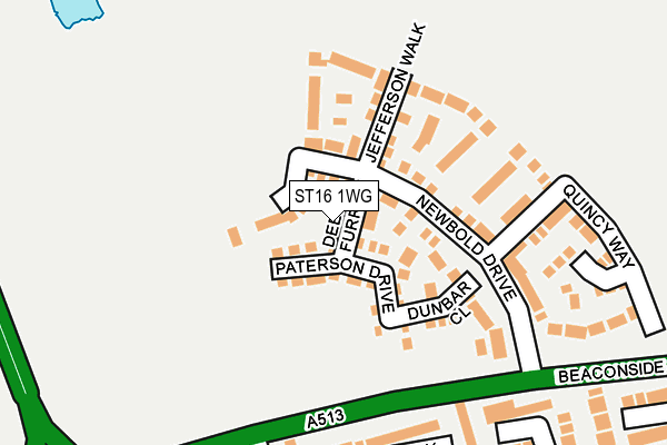
ST16 1WG is located in the Seighford & Church Eaton electoral ward, within the local authority district of Stafford and the English Parliamentary constituency of Stafford. The Sub Integrated Care Board (ICB) Location is NHS Staffordshire and Stoke-on-Trent ICB - 05V and the police force is Staffordshire. This postcode has been in use since January 2017.


GetTheData
Source: OS OpenMap – Local (Ordnance Survey)
Source: OS VectorMap District (Ordnance Survey)
Licence: Open Government Licence (requires attribution)
| Easting | 391446 |
| Northing | 326342 |
| Latitude | 52.834542 |
| Longitude | -2.128412 |
GetTheData
Source: Open Postcode Geo
Licence: Open Government Licence
| Country | England |
| Postcode District | ST16 |
➜ See where ST16 is on a map ➜ Where is Stafford? | |
GetTheData
Source: Land Registry Price Paid Data
Licence: Open Government Licence
Elevation or altitude of ST16 1WG as distance above sea level:
| Metres | Feet | |
|---|---|---|
| Elevation | 100m | 328ft |
Elevation is measured from the approximate centre of the postcode, to the nearest point on an OS contour line from OS Terrain 50, which has contour spacing of ten vertical metres.
➜ How high above sea level am I? Find the elevation of your current position using your device's GPS.
GetTheData
Source: Open Postcode Elevation
Licence: Open Government Licence
| Ward | Seighford & Church Eaton |
| Constituency | Stafford |
GetTheData
Source: ONS Postcode Database
Licence: Open Government Licence
2, DEERE FURROW, STAFFORD, ST16 1WG 2017 24 FEB £257,500 |
7, DEERE FURROW, STAFFORD, ST16 1WG 2017 23 JAN £255,500 |
5, DEERE FURROW, STAFFORD, ST16 1WG 2017 20 JAN £222,500 |
1, DEERE FURROW, STAFFORD, ST16 1WG 2017 20 JAN £257,950 |
6, DEERE FURROW, STAFFORD, ST16 1WG 2017 20 JAN £288,995 |
GetTheData
Source: HM Land Registry Price Paid Data
Licence: Contains HM Land Registry data © Crown copyright and database right 2025. This data is licensed under the Open Government Licence v3.0.
| Barlaston Close (Parkside Avenue) | Parkside | 308m |
| Crab Lane (Stone Road) | Parkside | 428m |
| Crab Lane (Stone Road) | Parkside | 456m |
| Ashridge Walk (Parkside Avenue) | Parkside | 466m |
| Stone Road (Crab Lane) | Trinity Fields | 477m |
| Stafford Station | 3.4km |
| Norton Bridge Station | 5.5km |
GetTheData
Source: NaPTAN
Licence: Open Government Licence
| Percentage of properties with Next Generation Access | 100.0% |
| Percentage of properties with Superfast Broadband | 100.0% |
| Percentage of properties with Ultrafast Broadband | 100.0% |
| Percentage of properties with Full Fibre Broadband | 0.0% |
Superfast Broadband is between 30Mbps and 300Mbps
Ultrafast Broadband is > 300Mbps
| Median download speed | 100.0Mbps |
| Average download speed | 100.0Mbps |
| Maximum download speed | 200.00Mbps |
Ofcom does not currently provide upload speed data for ST16 1WG. This is because there are less than four broadband connections in this postcode.
| Percentage of properties unable to receive 2Mbps | 0.0% |
| Percentage of properties unable to receive 5Mbps | 0.0% |
| Percentage of properties unable to receive 10Mbps | 0.0% |
| Percentage of properties unable to receive 30Mbps | 0.0% |
GetTheData
Source: Ofcom
Licence: Ofcom Terms of Use (requires attribution)
GetTheData
Source: ONS Postcode Database
Licence: Open Government Licence


➜ Get more ratings from the Food Standards Agency
GetTheData
Source: Food Standards Agency
Licence: FSA terms & conditions
| Last Collection | |||
|---|---|---|---|
| Location | Mon-Fri | Sat | Distance |
| Parkside Post Office | 17:00 | 11:15 | 587m |
| Beverley Drive | 17:15 | 09:15 | 648m |
| Trinity Fields | 17:00 | 11:00 | 846m |
GetTheData
Source: Dracos
Licence: Creative Commons Attribution-ShareAlike
The below table lists the International Territorial Level (ITL) codes (formerly Nomenclature of Territorial Units for Statistics (NUTS) codes) and Local Administrative Units (LAU) codes for ST16 1WG:
| ITL 1 Code | Name |
|---|---|
| TLG | West Midlands (England) |
| ITL 2 Code | Name |
| TLG2 | Shropshire and Staffordshire |
| ITL 3 Code | Name |
| TLG24 | Staffordshire CC |
| LAU 1 Code | Name |
| E07000197 | Stafford |
GetTheData
Source: ONS Postcode Directory
Licence: Open Government Licence
The below table lists the Census Output Area (OA), Lower Layer Super Output Area (LSOA), and Middle Layer Super Output Area (MSOA) for ST16 1WG:
| Code | Name | |
|---|---|---|
| OA | E00151547 | |
| LSOA | E01029743 | Stafford 006C |
| MSOA | E02006193 | Stafford 006 |
GetTheData
Source: ONS Postcode Directory
Licence: Open Government Licence
| ST16 1WA | Newbold Drive | 56m |
| ST16 1WF | Jefferson Walk | 112m |
| ST16 1WD | Quincy Way | 186m |
| ST16 1SU | Amblefield Way | 199m |
| ST16 1WE | Randolph Close | 218m |
| ST16 1TS | Lawnsfield Walk | 267m |
| ST16 1UA | Buckland Road | 301m |
| ST16 1UD | Chaulden Road | 309m |
| ST16 1SX | Aldershaw Close | 311m |
| ST16 1SY | Barlaston Close | 359m |
GetTheData
Source: Open Postcode Geo; Land Registry Price Paid Data
Licence: Open Government Licence