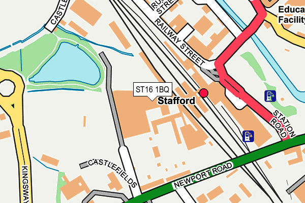
ST16 1BQ is located in the Rowley electoral ward, within the local authority district of Stafford and the English Parliamentary constituency of Stafford. The Sub Integrated Care Board (ICB) Location is NHS Staffordshire and Stoke-on-Trent ICB - 05V and the police force is Staffordshire. This postcode has been in use since January 1980.


GetTheData
Source: OS OpenMap – Local (Ordnance Survey)
Source: OS VectorMap District (Ordnance Survey)
Licence: Open Government Licence (requires attribution)
| Easting | 391735 |
| Northing | 322906 |
| Latitude | 52.803644 |
| Longitude | -2.124037 |
GetTheData
Source: Open Postcode Geo
Licence: Open Government Licence
| Country | England |
| Postcode District | ST16 |
➜ See where ST16 is on a map ➜ Where is Stafford? | |
GetTheData
Source: Land Registry Price Paid Data
Licence: Open Government Licence
Elevation or altitude of ST16 1BQ as distance above sea level:
| Metres | Feet | |
|---|---|---|
| Elevation | 80m | 262ft |
Elevation is measured from the approximate centre of the postcode, to the nearest point on an OS contour line from OS Terrain 50, which has contour spacing of ten vertical metres.
➜ How high above sea level am I? Find the elevation of your current position using your device's GPS.
GetTheData
Source: Open Postcode Elevation
Licence: Open Government Licence
| Ward | Rowley |
| Constituency | Stafford |
GetTheData
Source: ONS Postcode Database
Licence: Open Government Licence
| Railway Station (Station Rd) | Stafford Town Centre | 126m |
| Rowley Avenue (Newport Road) | Stafford | 170m |
| Railway Station (Station Road) | Stafford Town Centre | 180m |
| Rowley Avenue (Newport Road) | Stafford | 198m |
| Kingsway (Newport Road) | Stafford | 333m |
| Stafford Station | 0.1km |
GetTheData
Source: NaPTAN
Licence: Open Government Licence
GetTheData
Source: ONS Postcode Database
Licence: Open Government Licence


➜ Get more ratings from the Food Standards Agency
GetTheData
Source: Food Standards Agency
Licence: FSA terms & conditions
| Last Collection | |||
|---|---|---|---|
| Location | Mon-Fri | Sat | Distance |
| Stafford Railway Station | 17:45 | 11:15 | 101m |
| Castlefields | 19:30 | 12:00 | 189m |
| Stafford Delivery Office | 18:30 | 12:30 | 288m |
GetTheData
Source: Dracos
Licence: Creative Commons Attribution-ShareAlike
The below table lists the International Territorial Level (ITL) codes (formerly Nomenclature of Territorial Units for Statistics (NUTS) codes) and Local Administrative Units (LAU) codes for ST16 1BQ:
| ITL 1 Code | Name |
|---|---|
| TLG | West Midlands (England) |
| ITL 2 Code | Name |
| TLG2 | Shropshire and Staffordshire |
| ITL 3 Code | Name |
| TLG24 | Staffordshire CC |
| LAU 1 Code | Name |
| E07000197 | Stafford |
GetTheData
Source: ONS Postcode Directory
Licence: Open Government Licence
The below table lists the Census Output Area (OA), Lower Layer Super Output Area (LSOA), and Middle Layer Super Output Area (MSOA) for ST16 1BQ:
| Code | Name | |
|---|---|---|
| OA | E00151521 | |
| LSOA | E01029736 | Stafford 012B |
| MSOA | E02006199 | Stafford 012 |
GetTheData
Source: ONS Postcode Directory
Licence: Open Government Licence
| ST16 2DS | Railway Street | 158m |
| ST16 1BA | Newport Road | 171m |
| ST16 2AF | Victoria Road | 198m |
| ST16 2DY | Railway Street | 201m |
| ST16 2DW | South Street | 213m |
| ST16 2DU | Russell Street | 216m |
| ST16 1FA | Hollins Drive | 246m |
| ST16 2BH | Riverbank Mews | 263m |
| ST16 2DZ | Peel Street | 264m |
| ST16 2EA | Railway Street | 271m |
GetTheData
Source: Open Postcode Geo; Land Registry Price Paid Data
Licence: Open Government Licence