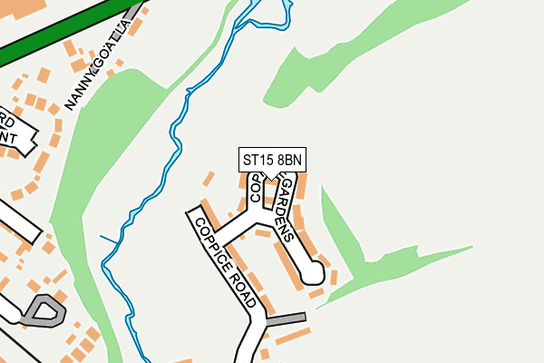
ST15 8BN is located in the St Michael's & Stonefield electoral ward, within the local authority district of Stafford and the English Parliamentary constituency of Stone. The Sub Integrated Care Board (ICB) Location is NHS Staffordshire and Stoke-on-Trent ICB - 05V and the police force is Staffordshire. This postcode has been in use since January 1980.


GetTheData
Source: OS OpenMap – Local (Ordnance Survey)
Source: OS VectorMap District (Ordnance Survey)
Licence: Open Government Licence (requires attribution)
| Easting | 390662 |
| Northing | 334229 |
| Latitude | 52.905412 |
| Longitude | -2.140282 |
GetTheData
Source: Open Postcode Geo
Licence: Open Government Licence
| Country | England |
| Postcode District | ST15 |
➜ See where ST15 is on a map ➜ Where is Stone? | |
GetTheData
Source: Land Registry Price Paid Data
Licence: Open Government Licence
Elevation or altitude of ST15 8BN as distance above sea level:
| Metres | Feet | |
|---|---|---|
| Elevation | 110m | 361ft |
Elevation is measured from the approximate centre of the postcode, to the nearest point on an OS contour line from OS Terrain 50, which has contour spacing of ten vertical metres.
➜ How high above sea level am I? Find the elevation of your current position using your device's GPS.
GetTheData
Source: Open Postcode Elevation
Licence: Open Government Licence
| Ward | St Michael's & Stonefield |
| Constituency | Stone |
GetTheData
Source: ONS Postcode Database
Licence: Open Government Licence
| Lotus Court (Oulton Road) | Oultoncross | 491m |
| Mill Street (Christchurch Way) | Stone Town Centre | 493m |
| Lotus Court (Oulton Road) | Oultoncross | 507m |
| York Street (Oulton Road) | Oultoncross | 520m |
| York Street (Oulton Road) | Oultoncross | 540m |
| Stone Station | 1km |
| Barlaston Station | 4.6km |
| Norton Bridge Station | 5.5km |
GetTheData
Source: NaPTAN
Licence: Open Government Licence
| Percentage of properties with Next Generation Access | 100.0% |
| Percentage of properties with Superfast Broadband | 100.0% |
| Percentage of properties with Ultrafast Broadband | 100.0% |
| Percentage of properties with Full Fibre Broadband | 0.0% |
Superfast Broadband is between 30Mbps and 300Mbps
Ultrafast Broadband is > 300Mbps
| Percentage of properties unable to receive 2Mbps | 0.0% |
| Percentage of properties unable to receive 5Mbps | 0.0% |
| Percentage of properties unable to receive 10Mbps | 0.0% |
| Percentage of properties unable to receive 30Mbps | 0.0% |
GetTheData
Source: Ofcom
Licence: Ofcom Terms of Use (requires attribution)
GetTheData
Source: ONS Postcode Database
Licence: Open Government Licence


➜ Get more ratings from the Food Standards Agency
GetTheData
Source: Food Standards Agency
Licence: FSA terms & conditions
| Last Collection | |||
|---|---|---|---|
| Location | Mon-Fri | Sat | Distance |
| Kings Avenue | 17:30 | 10:30 | 553m |
| Stone Post Office | 18:00 | 11:30 | 574m |
| Oulton Road | 17:45 | 10:30 | 574m |
GetTheData
Source: Dracos
Licence: Creative Commons Attribution-ShareAlike
The below table lists the International Territorial Level (ITL) codes (formerly Nomenclature of Territorial Units for Statistics (NUTS) codes) and Local Administrative Units (LAU) codes for ST15 8BN:
| ITL 1 Code | Name |
|---|---|
| TLG | West Midlands (England) |
| ITL 2 Code | Name |
| TLG2 | Shropshire and Staffordshire |
| ITL 3 Code | Name |
| TLG24 | Staffordshire CC |
| LAU 1 Code | Name |
| E07000197 | Stafford |
GetTheData
Source: ONS Postcode Directory
Licence: Open Government Licence
The below table lists the Census Output Area (OA), Lower Layer Super Output Area (LSOA), and Middle Layer Super Output Area (MSOA) for ST15 8BN:
| Code | Name | |
|---|---|---|
| OA | E00151568 | |
| LSOA | E01029745 | Stafford 003C |
| MSOA | E02006190 | Stafford 003 |
GetTheData
Source: ONS Postcode Directory
Licence: Open Government Licence
| ST15 8BL | Coppice Gardens | 52m |
| ST15 8BJ | Coppice Road | 90m |
| ST15 8BG | Redhill Road | 253m |
| ST15 8BH | Redhill Gardens | 259m |
| ST15 8EE | Radford Close | 270m |
| ST15 8DJ | Longton Road | 271m |
| ST15 8DL | Longton Road | 281m |
| ST15 8DN | Granville Terrace | 287m |
| ST15 8JN | The Crescent | 306m |
| ST15 8BE | Redhill Road | 327m |
GetTheData
Source: Open Postcode Geo; Land Registry Price Paid Data
Licence: Open Government Licence