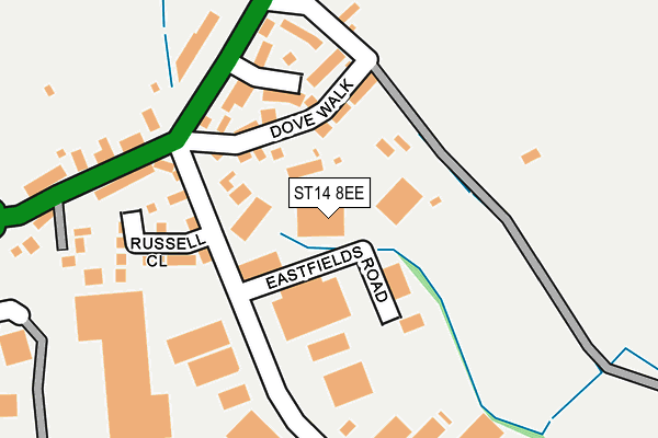
ST14 8EE is located in the Town electoral ward, within the local authority district of East Staffordshire and the English Parliamentary constituency of Burton. The Sub Integrated Care Board (ICB) Location is NHS Staffordshire and Stoke-on-Trent ICB - 05D and the police force is Staffordshire. This postcode has been in use since August 2021.


GetTheData
Source: OS OpenMap – Local (Ordnance Survey)
Source: OS VectorMap District (Ordnance Survey)
Licence: Open Government Licence (requires attribution)
| Easting | 409587 |
| Northing | 333802 |
| Latitude | 52.901591 |
| Longitude | -1.858916 |
GetTheData
Source: Open Postcode Geo
Licence: Open Government Licence
| Country | England |
| Postcode District | ST14 |
➜ See where ST14 is on a map ➜ Where is Uttoxeter? | |
GetTheData
Source: Land Registry Price Paid Data
Licence: Open Government Licence
Elevation or altitude of ST14 8EE as distance above sea level:
| Metres | Feet | |
|---|---|---|
| Elevation | 80m | 262ft |
Elevation is measured from the approximate centre of the postcode, to the nearest point on an OS contour line from OS Terrain 50, which has contour spacing of ten vertical metres.
➜ How high above sea level am I? Find the elevation of your current position using your device's GPS.
GetTheData
Source: Open Postcode Elevation
Licence: Open Government Licence
| Ward | Town |
| Constituency | Burton |
GetTheData
Source: ONS Postcode Database
Licence: Open Government Licence
3, SEVEN ACRES CLOSE, UTTOXETER, ST14 8EE 2021 14 SEP £250,000 |
2, SEVEN ACRES CLOSE, UTTOXETER, ST14 8EE 2021 3 SEP £260,000 |
4, SEVEN ACRES CLOSE, UTTOXETER, ST14 8EE 2021 20 AUG £250,000 |
GetTheData
Source: HM Land Registry Price Paid Data
Licence: Contains HM Land Registry data © Crown copyright and database right 2025. This data is licensed under the Open Government Licence v3.0.
| St Catherines Close (Derby Road) | Uttoxeter Town Centre | 194m |
| St Catherines Close (Derby Road) | Uttoxeter | 209m |
| Thomas Alleynes High School (Dove Bank (S)) | Uttoxeter Town Centre | 212m |
| Thomas Alleynes High School (Dove Bank (N)) | Uttoxeter Town Centre | 214m |
| Tesco Store (Town Meadows Way) | Uttoxeter Town Centre | 237m |
| Uttoxeter Station | 0.5km |
GetTheData
Source: NaPTAN
Licence: Open Government Licence
GetTheData
Source: ONS Postcode Database
Licence: Open Government Licence


➜ Get more ratings from the Food Standards Agency
GetTheData
Source: Food Standards Agency
Licence: FSA terms & conditions
| Last Collection | |||
|---|---|---|---|
| Location | Mon-Fri | Sat | Distance |
| Uttoxeter Post Office | 18:15 | 12:15 | 625m |
| Copes Way | 17:00 | 07:30 | 1,695m |
| Park Crescent | 16:00 | 08:00 | 2,052m |
GetTheData
Source: Dracos
Licence: Creative Commons Attribution-ShareAlike
The below table lists the International Territorial Level (ITL) codes (formerly Nomenclature of Territorial Units for Statistics (NUTS) codes) and Local Administrative Units (LAU) codes for ST14 8EE:
| ITL 1 Code | Name |
|---|---|
| TLG | West Midlands (England) |
| ITL 2 Code | Name |
| TLG2 | Shropshire and Staffordshire |
| ITL 3 Code | Name |
| TLG24 | Staffordshire CC |
| LAU 1 Code | Name |
| E07000193 | East Staffordshire |
GetTheData
Source: ONS Postcode Directory
Licence: Open Government Licence
The below table lists the Census Output Area (OA), Lower Layer Super Output Area (LSOA), and Middle Layer Super Output Area (MSOA) for ST14 8EE:
| Code | Name | |
|---|---|---|
| OA | E00168364 | |
| LSOA | E01029461 | East Staffordshire 003C |
| MSOA | E02006133 | East Staffordshire 003 |
GetTheData
Source: ONS Postcode Directory
Licence: Open Government Licence
| ST14 8EA | Derby Road | 50m |
| ST14 8HZ | Russell Close | 72m |
| ST14 8EB | Derby Road | 87m |
| ST14 8AJ | Roebuck Close | 124m |
| ST14 8DY | Dove Bank | 187m |
| ST14 8DZ | Dove Bank | 200m |
| ST14 8EF | St Catherines Close | 231m |
| ST14 8AF | Church Street | 251m |
| ST14 8EH | Dove Walk | 253m |
| ST14 8AA | Church Street | 292m |
GetTheData
Source: Open Postcode Geo; Land Registry Price Paid Data
Licence: Open Government Licence