ST13 8TG maps, stats, and open data
ST13 8TG lies on Buxton Road in Leek. ST13 8TG is located in the Leek East electoral ward, within the local authority district of Staffordshire Moorlands and the English Parliamentary constituency of Staffordshire Moorlands. The Sub Integrated Care Board (ICB) Location is NHS Staffordshire and Stoke-on-Trent ICB - 05G and the police force is Staffordshire. This postcode has been in use since January 1980.
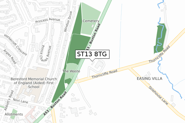
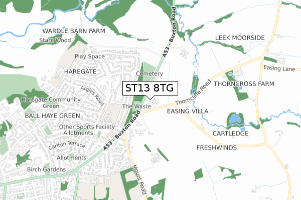
ST13 8TG maps


Licence: Open Government Licence (requires attribution)
Attribution: Contains OS data © Crown copyright and database right 2025
Source: Open Postcode Geo
Licence: Open Government Licence (requires attribution)
Attribution: Contains OS data © Crown copyright and database right 2025; Contains Royal Mail data © Royal Mail copyright and database right 2025; Source: Office for National Statistics licensed under the Open Government Licence v.3.0
ST13 8TG geodata
| Easting | 400176 |
| Northing | 357761 |
| Latitude | 53.117046 |
| Longitude | -1.998821 |
Where is ST13 8TG?
| Street | Buxton Road |
| Town/City | Leek |
| Country | England |
| Postcode District | ST13 |
ST13 8TG Elevation
Elevation or altitude of ST13 8TG as distance above sea level:
| Metres | Feet | |
|---|---|---|
| Elevation | 220m | 722ft |
Elevation is measured from the approximate centre of the postcode, to the nearest point on an OS contour line from OS Terrain 50, which has contour spacing of ten vertical metres.
➜ How high above sea level am I? Find the elevation of your current position using your device's GPS.
Politics
| Ward | Leek East |
|---|---|
| Constituency | Staffordshire Moorlands |
Transport
Nearest bus stops to ST13 8TG
| Thorncliffe Road (Butxon Road) | Leek | 599m |
| Thorncliffe Road (Buxton Road) | Leek | 618m |
| Shops (Queens Dr) | Haregate | 671m |
| Horsecroft Crescent (Queens Dr) | Haregate | 691m |
| Haregate Hall (Haregate Rd) | Haregate | 693m |
Broadband
Broadband access in ST13 8TG (2020 data)
| Percentage of properties with Next Generation Access | 100.0% |
| Percentage of properties with Superfast Broadband | 100.0% |
| Percentage of properties with Ultrafast Broadband | 0.0% |
| Percentage of properties with Full Fibre Broadband | 0.0% |
Superfast Broadband is between 30Mbps and 300Mbps
Ultrafast Broadband is > 300Mbps
Broadband limitations in ST13 8TG (2020 data)
| Percentage of properties unable to receive 2Mbps | 0.0% |
| Percentage of properties unable to receive 5Mbps | 0.0% |
| Percentage of properties unable to receive 10Mbps | 0.0% |
| Percentage of properties unable to receive 30Mbps | 0.0% |
Deprivation
34.6% of English postcodes are less deprived than ST13 8TG:Food Standards Agency
Three nearest food hygiene ratings to ST13 8TG (metres)


➜ Get more ratings from the Food Standards Agency
Nearest post box to ST13 8TG
| Last Collection | |||
|---|---|---|---|
| Location | Mon-Fri | Sat | Distance |
| Queens Drive | 17:00 | 11:00 | 631m |
| Windsor Drive | 17:00 | 11:00 | 840m |
| Ball Haye Green Post Office | 17:00 | 11:15 | 923m |
ST13 8TG ITL and ST13 8TG LAU
The below table lists the International Territorial Level (ITL) codes (formerly Nomenclature of Territorial Units for Statistics (NUTS) codes) and Local Administrative Units (LAU) codes for ST13 8TG:
| ITL 1 Code | Name |
|---|---|
| TLG | West Midlands (England) |
| ITL 2 Code | Name |
| TLG2 | Shropshire and Staffordshire |
| ITL 3 Code | Name |
| TLG24 | Staffordshire CC |
| LAU 1 Code | Name |
| E07000198 | Staffordshire Moorlands |
ST13 8TG census areas
The below table lists the Census Output Area (OA), Lower Layer Super Output Area (LSOA), and Middle Layer Super Output Area (MSOA) for ST13 8TG:
| Code | Name | |
|---|---|---|
| OA | E00151876 | |
| LSOA | E01029806 | Staffordshire Moorlands 001B |
| MSOA | E02006204 | Staffordshire Moorlands 001 |
Nearest postcodes to ST13 8TG
| ST13 7LW | Thorncliffe Road | 395m |
| ST13 6NN | Windsor Drive | 406m |
| ST13 6NW | Windsor Drive | 452m |
| ST13 6QB | Thorncliffe View | 535m |
| ST13 6PY | Haregate Road | 537m |
| ST13 6QA | Princess Avenue | 563m |
| ST13 6QD | Prince Charles Avenue | 587m |
| ST13 7LN | Buxton Road | 617m |
| ST13 6PX | Haregate Road | 620m |
| ST13 6QE | Prince Charles Avenue | 632m |