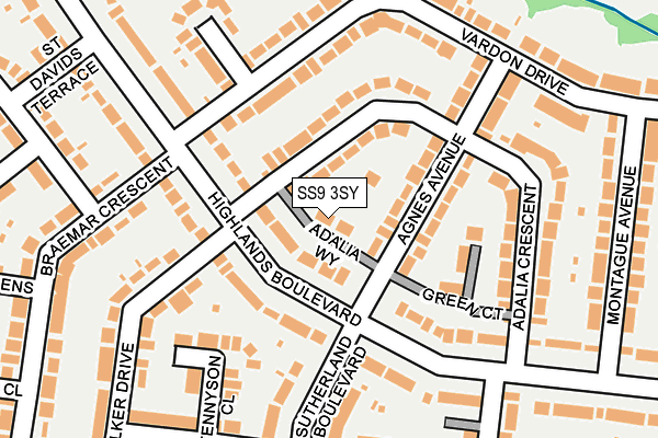
SS9 3SY lies on Adalia Way in Leigh-on-sea. SS9 3SY is located in the West Leigh electoral ward, within the unitary authority of Southend-on-Sea and the English Parliamentary constituency of Southend West. The Sub Integrated Care Board (ICB) Location is NHS Mid and South Essex ICB - 99G and the police force is Essex. This postcode has been in use since January 1980.


GetTheData
Source: OS OpenMap – Local (Ordnance Survey)
Source: OS VectorMap District (Ordnance Survey)
Licence: Open Government Licence (requires attribution)
| Easting | 582559 |
| Northing | 186962 |
| Latitude | 51.552006 |
| Longitude | 0.631786 |
GetTheData
Source: Open Postcode Geo
Licence: Open Government Licence
| Street | Adalia Way |
| Town/City | Leigh-on-sea |
| Country | England |
| Postcode District | SS9 |
➜ See where SS9 is on a map ➜ Where is Southend-on-Sea? | |
GetTheData
Source: Land Registry Price Paid Data
Licence: Open Government Licence
Elevation or altitude of SS9 3SY as distance above sea level:
| Metres | Feet | |
|---|---|---|
| Elevation | 50m | 164ft |
Elevation is measured from the approximate centre of the postcode, to the nearest point on an OS contour line from OS Terrain 50, which has contour spacing of ten vertical metres.
➜ How high above sea level am I? Find the elevation of your current position using your device's GPS.
GetTheData
Source: Open Postcode Elevation
Licence: Open Government Licence
| Ward | West Leigh |
| Constituency | Southend West |
GetTheData
Source: ONS Postcode Database
Licence: Open Government Licence
| Thames Drive (London Road) | Leigh-on-sea | 397m |
| Thames Drive (London Road) | Leigh-on-sea | 418m |
| Medway Crescent (London Road) | Leigh-on-sea | 446m |
| Thames Drive | Leigh-on-sea | 448m |
| Tattersall Gardens (London Road) | Leigh-on-sea | 484m |
| Leigh-on-Sea Station | 1.3km |
| Chalkwell Station | 3.1km |
| Westcliff-on-Sea Station | 4.5km |
GetTheData
Source: NaPTAN
Licence: Open Government Licence
| Percentage of properties with Next Generation Access | 100.0% |
| Percentage of properties with Superfast Broadband | 100.0% |
| Percentage of properties with Ultrafast Broadband | 0.0% |
| Percentage of properties with Full Fibre Broadband | 0.0% |
Superfast Broadband is between 30Mbps and 300Mbps
Ultrafast Broadband is > 300Mbps
| Percentage of properties unable to receive 2Mbps | 0.0% |
| Percentage of properties unable to receive 5Mbps | 0.0% |
| Percentage of properties unable to receive 10Mbps | 0.0% |
| Percentage of properties unable to receive 30Mbps | 0.0% |
GetTheData
Source: Ofcom
Licence: Ofcom Terms of Use (requires attribution)
GetTheData
Source: ONS Postcode Database
Licence: Open Government Licence


➜ Get more ratings from the Food Standards Agency
GetTheData
Source: Food Standards Agency
Licence: FSA terms & conditions
| Last Collection | |||
|---|---|---|---|
| Location | Mon-Fri | Sat | Distance |
| Adalia Crescent | 17:30 | 11:30 | 126m |
| Braemar Crescent | 17:30 | 11:30 | 165m |
| Henry Drive | 17:30 | 11:30 | 257m |
GetTheData
Source: Dracos
Licence: Creative Commons Attribution-ShareAlike
The below table lists the International Territorial Level (ITL) codes (formerly Nomenclature of Territorial Units for Statistics (NUTS) codes) and Local Administrative Units (LAU) codes for SS9 3SY:
| ITL 1 Code | Name |
|---|---|
| TLH | East |
| ITL 2 Code | Name |
| TLH3 | Essex |
| ITL 3 Code | Name |
| TLH31 | Southend-on-Sea |
| LAU 1 Code | Name |
| E06000033 | Southend-on-Sea |
GetTheData
Source: ONS Postcode Directory
Licence: Open Government Licence
The below table lists the Census Output Area (OA), Lower Layer Super Output Area (LSOA), and Middle Layer Super Output Area (MSOA) for SS9 3SY:
| Code | Name | |
|---|---|---|
| OA | E00080452 | |
| LSOA | E01015911 | Southend-on-Sea 008D |
| MSOA | E02003286 | Southend-on-Sea 008 |
GetTheData
Source: ONS Postcode Directory
Licence: Open Government Licence
| SS9 3TJ | Highlands Boulevard | 57m |
| SS9 3ST | Adalia Crescent | 62m |
| SS9 3SX | Agnes Avenue | 73m |
| SS9 3QP | Highlands Boulevard | 101m |
| SS9 3SU | Adalia Crescent | 107m |
| SS9 3QU | Highlands Boulevard | 135m |
| SS9 3SR | Vardon Drive | 150m |
| SS9 3QG | Tennyson Close | 151m |
| SS9 3SN | Adalia Crescent | 165m |
| SS9 3QW | Highlands Boulevard | 170m |
GetTheData
Source: Open Postcode Geo; Land Registry Price Paid Data
Licence: Open Government Licence