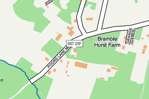
SS7 2XF lies on Poors Lane North in Benfleet. SS7 2XF is located in the Victoria electoral ward, within the local authority district of Castle Point and the English Parliamentary constituency of Castle Point. The Sub Integrated Care Board (ICB) Location is NHS Mid and South Essex ICB - 99F and the police force is Essex. This postcode has been in use since January 1980.


GetTheData
Source: OS OpenMap – Local (Ordnance Survey)
Source: OS VectorMap District (Ordnance Survey)
Licence: Open Government Licence (requires attribution)
| Easting | 582112 |
| Northing | 188111 |
| Latitude | 51.562475 |
| Longitude | 0.625969 |
GetTheData
Source: Open Postcode Geo
Licence: Open Government Licence
| Street | Poors Lane North |
| Town/City | Benfleet |
| Country | England |
| Postcode District | SS7 |
➜ See where SS7 is on a map | |
GetTheData
Source: Land Registry Price Paid Data
Licence: Open Government Licence
Elevation or altitude of SS7 2XF as distance above sea level:
| Metres | Feet | |
|---|---|---|
| Elevation | 60m | 197ft |
Elevation is measured from the approximate centre of the postcode, to the nearest point on an OS contour line from OS Terrain 50, which has contour spacing of ten vertical metres.
➜ How high above sea level am I? Find the elevation of your current position using your device's GPS.
GetTheData
Source: Open Postcode Elevation
Licence: Open Government Licence
| Ward | Victoria |
| Constituency | Castle Point |
GetTheData
Source: ONS Postcode Database
Licence: Open Government Licence
| Belgrave Road (Eastwood Old Road) | Belfairs | 890m |
| Belgrave Road (Eastwood Old Road) | Belfairs | 902m |
| Greenacres (Scrub Lane) | Hadleigh | 936m |
| Greenacres (Scrub Lane) | Hadleigh | 947m |
| Ewan Way (Woodfield Road) | Hadleigh | 975m |
| Leigh-on-Sea Station | 2.6km |
| Rayleigh Station | 3.5km |
| Chalkwell Station | 4.1km |
GetTheData
Source: NaPTAN
Licence: Open Government Licence
| Percentage of properties with Next Generation Access | 100.0% |
| Percentage of properties with Superfast Broadband | 22.2% |
| Percentage of properties with Ultrafast Broadband | 0.0% |
| Percentage of properties with Full Fibre Broadband | 0.0% |
Superfast Broadband is between 30Mbps and 300Mbps
Ultrafast Broadband is > 300Mbps
| Percentage of properties unable to receive 2Mbps | 0.0% |
| Percentage of properties unable to receive 5Mbps | 0.0% |
| Percentage of properties unable to receive 10Mbps | 0.0% |
| Percentage of properties unable to receive 30Mbps | 77.8% |
GetTheData
Source: Ofcom
Licence: Ofcom Terms of Use (requires attribution)
GetTheData
Source: ONS Postcode Database
Licence: Open Government Licence


➜ Get more ratings from the Food Standards Agency
GetTheData
Source: Food Standards Agency
Licence: FSA terms & conditions
| Last Collection | |||
|---|---|---|---|
| Location | Mon-Fri | Sat | Distance |
| Bramble Road | 17:00 | 12:00 | 232m |
| Thorndon Park Drive | 17:30 | 11:30 | 662m |
| Highlands Boulevard | 17:30 | 11:30 | 782m |
GetTheData
Source: Dracos
Licence: Creative Commons Attribution-ShareAlike
The below table lists the International Territorial Level (ITL) codes (formerly Nomenclature of Territorial Units for Statistics (NUTS) codes) and Local Administrative Units (LAU) codes for SS7 2XF:
| ITL 1 Code | Name |
|---|---|
| TLH | East |
| ITL 2 Code | Name |
| TLH3 | Essex |
| ITL 3 Code | Name |
| TLH37 | Essex Thames Gateway |
| LAU 1 Code | Name |
| E07000069 | Castle Point |
GetTheData
Source: ONS Postcode Directory
Licence: Open Government Licence
The below table lists the Census Output Area (OA), Lower Layer Super Output Area (LSOA), and Middle Layer Super Output Area (MSOA) for SS7 2XF:
| Code | Name | |
|---|---|---|
| OA | E00109370 | |
| LSOA | E01021532 | Castle Point 005D |
| MSOA | E02004477 | Castle Point 005 |
GetTheData
Source: ONS Postcode Directory
Licence: Open Government Licence
| SS7 2XD | Grange Avenue | 210m |
| SS7 2UU | Bramble Road | 309m |
| SS7 2UZ | Bramble Crescent | 398m |
| SS7 2UT | Haresland Close | 586m |
| SS9 4TE | Woodside Close | 613m |
| SS7 2UR | Bramble Road | 634m |
| SS9 4RE | Woodside | 641m |
| SS9 4TQ | Woodside | 645m |
| SS7 2JH | Woodland Close | 655m |
| SS9 4TD | Woodside | 656m |
GetTheData
Source: Open Postcode Geo; Land Registry Price Paid Data
Licence: Open Government Licence