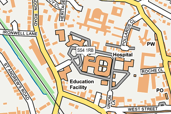
SS4 1RB is located in the Roche South electoral ward, within the local authority district of Rochford and the English Parliamentary constituency of Rochford and Southend East. The Sub Integrated Care Board (ICB) Location is NHS Mid and South Essex ICB - 99F and the police force is Essex. This postcode has been in use since December 1998.


GetTheData
Source: OS OpenMap – Local (Ordnance Survey)
Source: OS VectorMap District (Ordnance Survey)
Licence: Open Government Licence (requires attribution)
| Easting | 587349 |
| Northing | 190694 |
| Latitude | 51.583955 |
| Longitude | 0.702782 |
GetTheData
Source: Open Postcode Geo
Licence: Open Government Licence
| Country | England |
| Postcode District | SS4 |
➜ See where SS4 is on a map ➜ Where is Rochford? | |
GetTheData
Source: Land Registry Price Paid Data
Licence: Open Government Licence
Elevation or altitude of SS4 1RB as distance above sea level:
| Metres | Feet | |
|---|---|---|
| Elevation | 10m | 33ft |
Elevation is measured from the approximate centre of the postcode, to the nearest point on an OS contour line from OS Terrain 50, which has contour spacing of ten vertical metres.
➜ How high above sea level am I? Find the elevation of your current position using your device's GPS.
GetTheData
Source: Open Postcode Elevation
Licence: Open Government Licence
| Ward | Roche South |
| Constituency | Rochford And Southend East |
GetTheData
Source: ONS Postcode Database
Licence: Open Government Licence
| Railway Station (Church Street) | Rochford | 154m |
| Dalys Road | Rochford | 232m |
| Rochford Station Carpark (Church Street) | Rochford | 261m |
| North Street | Rochford | 306m |
| Roche Avenue (Ashingdon Road) | Rochford | 329m |
| Rochford Station | 0.3km |
| Southend Airport Station | 1.7km |
| Hockley Station | 3.7km |
GetTheData
Source: NaPTAN
Licence: Open Government Licence
GetTheData
Source: ONS Postcode Database
Licence: Open Government Licence


➜ Get more ratings from the Food Standards Agency
GetTheData
Source: Food Standards Agency
Licence: FSA terms & conditions
| Last Collection | |||
|---|---|---|---|
| Location | Mon-Fri | Sat | Distance |
| North Street Post Office | 17:30 | 12:00 | 297m |
| 14 West Street P.o. | 17:30 | 12:00 | 298m |
| Somerset Avenue | 17:30 | 12:30 | 420m |
GetTheData
Source: Dracos
Licence: Creative Commons Attribution-ShareAlike
The below table lists the International Territorial Level (ITL) codes (formerly Nomenclature of Territorial Units for Statistics (NUTS) codes) and Local Administrative Units (LAU) codes for SS4 1RB:
| ITL 1 Code | Name |
|---|---|
| TLH | East |
| ITL 2 Code | Name |
| TLH3 | Essex |
| ITL 3 Code | Name |
| TLH37 | Essex Thames Gateway |
| LAU 1 Code | Name |
| E07000075 | Rochford |
GetTheData
Source: ONS Postcode Directory
Licence: Open Government Licence
The below table lists the Census Output Area (OA), Lower Layer Super Output Area (LSOA), and Middle Layer Super Output Area (MSOA) for SS4 1RB:
| Code | Name | |
|---|---|---|
| OA | E00170008 | |
| LSOA | E01021955 | Rochford 004D |
| MSOA | E02004566 | Rochford 004 |
GetTheData
Source: ONS Postcode Directory
Licence: Open Government Licence
| SS4 1NJ | Ashingdon Road | 138m |
| SS4 1AS | West Street | 138m |
| SS4 1GH | Pollards Court | 154m |
| SS4 1GF | Pollards Close | 161m |
| SS4 1FP | Dalys Road | 169m |
| SS4 1RA | Dalys Road | 176m |
| SS4 1AU | West Street | 178m |
| SS4 1FF | Ashingdon Road | 188m |
| SS4 1XA | Heritage Way | 189m |
| SS4 1XB | Sovereign Close | 193m |
GetTheData
Source: Open Postcode Geo; Land Registry Price Paid Data
Licence: Open Government Licence