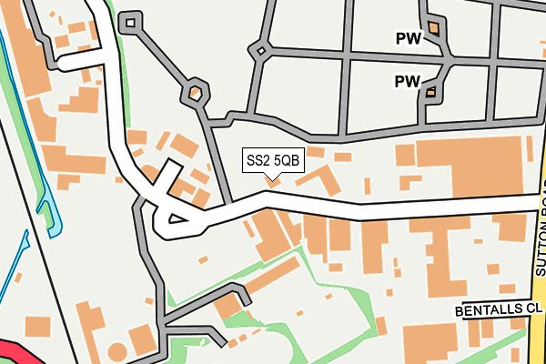
SS2 5QB is located in the St. Luke's electoral ward, within the unitary authority of Southend-on-Sea and the English Parliamentary constituency of Rochford and Southend East. The Sub Integrated Care Board (ICB) Location is NHS Mid and South Essex ICB - 99G and the police force is Essex. This postcode has been in use since January 1980.


GetTheData
Source: OS OpenMap – Local (Ordnance Survey)
Source: OS VectorMap District (Ordnance Survey)
Licence: Open Government Licence (requires attribution)
| Easting | 588085 |
| Northing | 187733 |
| Latitude | 51.557117 |
| Longitude | 0.711809 |
GetTheData
Source: Open Postcode Geo
Licence: Open Government Licence
| Country | England |
| Postcode District | SS2 |
➜ See where SS2 is on a map ➜ Where is Southend-on-Sea? | |
GetTheData
Source: Land Registry Price Paid Data
Licence: Open Government Licence
Elevation or altitude of SS2 5QB as distance above sea level:
| Metres | Feet | |
|---|---|---|
| Elevation | 20m | 66ft |
Elevation is measured from the approximate centre of the postcode, to the nearest point on an OS contour line from OS Terrain 50, which has contour spacing of ten vertical metres.
➜ How high above sea level am I? Find the elevation of your current position using your device's GPS.
GetTheData
Source: Open Postcode Elevation
Licence: Open Government Licence
| Ward | St. Luke's |
| Constituency | Rochford And Southend East |
GetTheData
Source: ONS Postcode Database
Licence: Open Government Licence
| Stock Close (Stock Road) | Temple Farm Ind Estate | 179m |
| Stock Road | Temple Farm Ind Estate | 193m |
| Bentalls Close (Sutton Road) | Temple Farm Ind Estate | 345m |
| Cemetery (Sutton Road) | Temple Farm Ind Estate | 359m |
| Ennismore Gardens (Eastern Avenue) | Prittlewell | 375m |
| Prittlewell Station | 0.7km |
| Southend Airport Station | 1.4km |
| Southend Victoria Station | 1.7km |
GetTheData
Source: NaPTAN
Licence: Open Government Licence
GetTheData
Source: ONS Postcode Database
Licence: Open Government Licence


➜ Get more ratings from the Food Standards Agency
GetTheData
Source: Food Standards Agency
Licence: FSA terms & conditions
| Last Collection | |||
|---|---|---|---|
| Location | Mon-Fri | Sat | Distance |
| Stock Road | 18:30 | 11:30 | 297m |
| Wentworth Road Post Office | 18:30 | 11:30 | 634m |
| Chandlers Way | 18:30 | 11:30 | 636m |
GetTheData
Source: Dracos
Licence: Creative Commons Attribution-ShareAlike
The below table lists the International Territorial Level (ITL) codes (formerly Nomenclature of Territorial Units for Statistics (NUTS) codes) and Local Administrative Units (LAU) codes for SS2 5QB:
| ITL 1 Code | Name |
|---|---|
| TLH | East |
| ITL 2 Code | Name |
| TLH3 | Essex |
| ITL 3 Code | Name |
| TLH31 | Southend-on-Sea |
| LAU 1 Code | Name |
| E06000033 | Southend-on-Sea |
GetTheData
Source: ONS Postcode Directory
Licence: Open Government Licence
The below table lists the Census Output Area (OA), Lower Layer Super Output Area (LSOA), and Middle Layer Super Output Area (MSOA) for SS2 5QB:
| Code | Name | |
|---|---|---|
| OA | E00080260 | |
| LSOA | E01015874 | Southend-on-Sea 006F |
| MSOA | E02003284 | Southend-on-Sea 006 |
GetTheData
Source: ONS Postcode Directory
Licence: Open Government Licence
| SS2 5QF | Stock Road | 77m |
| SS2 5QN | Stock Industrial Park | 232m |
| SS2 6QN | Priory Crescent | 302m |
| SS2 5QY | Eastern Close | 314m |
| SS2 5QX | Eastern Avenue | 326m |
| SS2 5PR | Sutton Road | 345m |
| SS2 5PX | Sutton Road | 365m |
| SS2 5QU | Eastern Avenue | 382m |
| SS2 5RH | Craftsman Square | 495m |
| SS2 5NN | Stock Road | 510m |
GetTheData
Source: Open Postcode Geo; Land Registry Price Paid Data
Licence: Open Government Licence