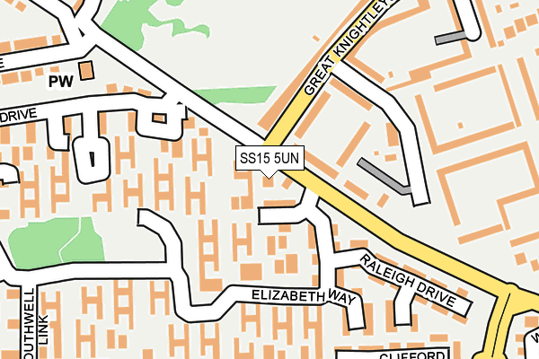
SS15 5UN lies on Laindon Link in Laindon, Basildon. SS15 5UN is located in the Lee Chapel North electoral ward, within the local authority district of Basildon and the English Parliamentary constituency of Basildon and Billericay. The Sub Integrated Care Board (ICB) Location is NHS Mid and South Essex ICB - 99E and the police force is Essex. This postcode has been in use since January 1980.


GetTheData
Source: OS OpenMap – Local (Ordnance Survey)
Source: OS VectorMap District (Ordnance Survey)
Licence: Open Government Licence (requires attribution)
| Easting | 568813 |
| Northing | 188431 |
| Latitude | 51.569479 |
| Longitude | 0.434423 |
GetTheData
Source: Open Postcode Geo
Licence: Open Government Licence
| Street | Laindon Link |
| Locality | Laindon |
| Town/City | Basildon |
| Country | England |
| Postcode District | SS15 |
➜ See where SS15 is on a map ➜ Where is Basildon? | |
GetTheData
Source: Land Registry Price Paid Data
Licence: Open Government Licence
Elevation or altitude of SS15 5UN as distance above sea level:
| Metres | Feet | |
|---|---|---|
| Elevation | 40m | 131ft |
Elevation is measured from the approximate centre of the postcode, to the nearest point on an OS contour line from OS Terrain 50, which has contour spacing of ten vertical metres.
➜ How high above sea level am I? Find the elevation of your current position using your device's GPS.
GetTheData
Source: Open Postcode Elevation
Licence: Open Government Licence
| Ward | Lee Chapel North |
| Constituency | Basildon And Billericay |
GetTheData
Source: ONS Postcode Database
Licence: Open Government Licence
| Falstones (Laindon Link) | Basildon | 70m |
| Falstones (Great Knightleys) | Basildon | 114m |
| Amanda Close (Laindon Link) | Basildon | 179m |
| Amanda Close (Laindon Link) | Basildon | 217m |
| Tyler Avenue (Laindon Link Busway) | Laindon | 268m |
| Laindon Station | 0.7km |
| Basildon Station | 1.6km |
GetTheData
Source: NaPTAN
Licence: Open Government Licence
| Percentage of properties with Next Generation Access | 100.0% |
| Percentage of properties with Superfast Broadband | 100.0% |
| Percentage of properties with Ultrafast Broadband | 66.7% |
| Percentage of properties with Full Fibre Broadband | 0.0% |
Superfast Broadband is between 30Mbps and 300Mbps
Ultrafast Broadband is > 300Mbps
| Percentage of properties unable to receive 2Mbps | 0.0% |
| Percentage of properties unable to receive 5Mbps | 0.0% |
| Percentage of properties unable to receive 10Mbps | 0.0% |
| Percentage of properties unable to receive 30Mbps | 0.0% |
GetTheData
Source: Ofcom
Licence: Ofcom Terms of Use (requires attribution)
GetTheData
Source: ONS Postcode Database
Licence: Open Government Licence


➜ Get more ratings from the Food Standards Agency
GetTheData
Source: Food Standards Agency
Licence: FSA terms & conditions
| Last Collection | |||
|---|---|---|---|
| Location | Mon-Fri | Sat | Distance |
| Somercotes | 17:30 | 11:45 | 221m |
| High Road/Samuel Road | 17:30 | 11:45 | 1,023m |
| Hornbeam Way | 17:45 | 12:00 | 1,191m |
GetTheData
Source: Dracos
Licence: Creative Commons Attribution-ShareAlike
The below table lists the International Territorial Level (ITL) codes (formerly Nomenclature of Territorial Units for Statistics (NUTS) codes) and Local Administrative Units (LAU) codes for SS15 5UN:
| ITL 1 Code | Name |
|---|---|
| TLH | East |
| ITL 2 Code | Name |
| TLH3 | Essex |
| ITL 3 Code | Name |
| TLH37 | Essex Thames Gateway |
| LAU 1 Code | Name |
| E07000066 | Basildon |
GetTheData
Source: ONS Postcode Directory
Licence: Open Government Licence
The below table lists the Census Output Area (OA), Lower Layer Super Output Area (LSOA), and Middle Layer Super Output Area (MSOA) for SS15 5UN:
| Code | Name | |
|---|---|---|
| OA | E00108144 | |
| LSOA | E01021292 | Basildon 017B |
| MSOA | E02004440 | Basildon 017 |
GetTheData
Source: ONS Postcode Directory
Licence: Open Government Licence
| SS15 5GP | Armada Close | 42m |
| SS15 5DY | Amberden | 80m |
| SS15 5ES | Great Knightleys | 85m |
| SS15 5GN | Elizabeth Way | 102m |
| SS15 5DR | Ward Close | 119m |
| SS15 5DD | Turner Close | 125m |
| SS15 5EU | Great Knightleys | 144m |
| SS15 5DX | Falstones | 168m |
| SS15 5DU | Falstones | 186m |
| SS15 5FL | Elizabeth Way | 198m |
GetTheData
Source: Open Postcode Geo; Land Registry Price Paid Data
Licence: Open Government Licence