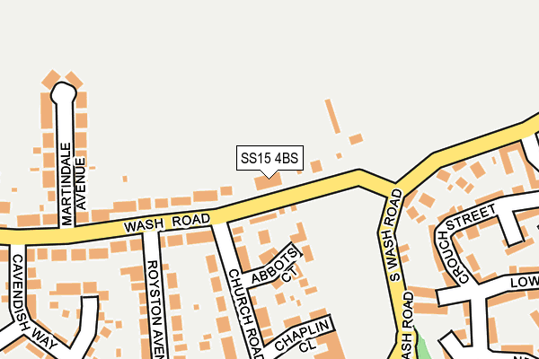
SS15 4BS is located in the Crouch electoral ward, within the local authority district of Basildon and the English Parliamentary constituency of Basildon and Billericay. The Sub Integrated Care Board (ICB) Location is NHS Mid and South Essex ICB - 99E and the police force is Essex. This postcode has been in use since January 1980.


GetTheData
Source: OS OpenMap – Local (Ordnance Survey)
Source: OS VectorMap District (Ordnance Survey)
Licence: Open Government Licence (requires attribution)
| Easting | 569036 |
| Northing | 190549 |
| Latitude | 51.588439 |
| Longitude | 0.438656 |
GetTheData
Source: Open Postcode Geo
Licence: Open Government Licence
| Country | England |
| Postcode District | SS15 |
➜ See where SS15 is on a map ➜ Where is Basildon? | |
GetTheData
Source: Land Registry Price Paid Data
Licence: Open Government Licence
Elevation or altitude of SS15 4BS as distance above sea level:
| Metres | Feet | |
|---|---|---|
| Elevation | 30m | 98ft |
Elevation is measured from the approximate centre of the postcode, to the nearest point on an OS contour line from OS Terrain 50, which has contour spacing of ten vertical metres.
➜ How high above sea level am I? Find the elevation of your current position using your device's GPS.
GetTheData
Source: Open Postcode Elevation
Licence: Open Government Licence
| Ward | Crouch |
| Constituency | Basildon And Billericay |
GetTheData
Source: ONS Postcode Database
Licence: Open Government Licence
| South Wash Road | Noak Bridge | 135m |
| South Wash Road | Noak Bridge | 176m |
| Church Road (Noak Hill Road) | Noak Bridge | 287m |
| Church Road (Noak Hill Road) | Noak Bridge | 324m |
| Lower Street (Bridge Street) | Noak Bridge | 400m |
| Laindon Station | 2.5km |
| Basildon Station | 2.6km |
| Billericay Station | 4.7km |
GetTheData
Source: NaPTAN
Licence: Open Government Licence
GetTheData
Source: ONS Postcode Database
Licence: Open Government Licence


➜ Get more ratings from the Food Standards Agency
GetTheData
Source: Food Standards Agency
Licence: FSA terms & conditions
| Last Collection | |||
|---|---|---|---|
| Location | Mon-Fri | Sat | Distance |
| Wash Road | 17:30 | 11:45 | 277m |
| Noak Bridge Post Office | 17:30 | 11:45 | 497m |
| Noak Hill Road | 16:30 | 11:45 | 878m |
GetTheData
Source: Dracos
Licence: Creative Commons Attribution-ShareAlike
The below table lists the International Territorial Level (ITL) codes (formerly Nomenclature of Territorial Units for Statistics (NUTS) codes) and Local Administrative Units (LAU) codes for SS15 4BS:
| ITL 1 Code | Name |
|---|---|
| TLH | East |
| ITL 2 Code | Name |
| TLH3 | Essex |
| ITL 3 Code | Name |
| TLH37 | Essex Thames Gateway |
| LAU 1 Code | Name |
| E07000066 | Basildon |
GetTheData
Source: ONS Postcode Directory
Licence: Open Government Licence
The below table lists the Census Output Area (OA), Lower Layer Super Output Area (LSOA), and Middle Layer Super Output Area (MSOA) for SS15 4BS:
| Code | Name | |
|---|---|---|
| OA | E00108009 | |
| LSOA | E01021262 | Basildon 010B |
| MSOA | E02004433 | Basildon 010 |
GetTheData
Source: ONS Postcode Directory
Licence: Open Government Licence
| SS15 4EA | Wash Road | 41m |
| SS15 5TA | Abbots Court | 81m |
| SS15 5TB | Abbots Court | 112m |
| SS15 4EJ | Chaplin Close | 157m |
| SS15 4EL | Church Road | 159m |
| SS15 4EH | Church Road | 168m |
| SS15 4EN | Wash Road | 170m |
| SS15 4BA | Crouch Street | 201m |
| SS15 4AU | Crouch Street | 223m |
| SS15 4EW | Royston Avenue | 228m |
GetTheData
Source: Open Postcode Geo; Land Registry Price Paid Data
Licence: Open Government Licence