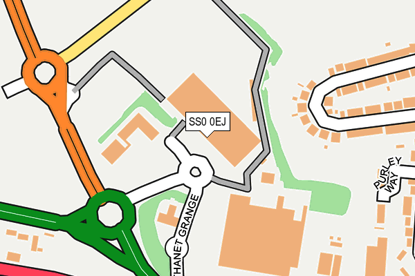
SS0 0EJ is located in the St Laurence electoral ward, within the unitary authority of Southend-on-Sea and the English Parliamentary constituency of Southend West. The Sub Integrated Care Board (ICB) Location is NHS Mid and South Essex ICB - 99G and the police force is Essex. This postcode has been in use since March 2003.


GetTheData
Source: OS OpenMap – Local (Ordnance Survey)
Source: OS VectorMap District (Ordnance Survey)
Licence: Open Government Licence (requires attribution)
| Easting | 586095 |
| Northing | 188243 |
| Latitude | 51.562357 |
| Longitude | 0.683406 |
GetTheData
Source: Open Postcode Geo
Licence: Open Government Licence
| Country | England |
| Postcode District | SS0 |
➜ See where SS0 is on a map ➜ Where is Southend-on-Sea? | |
GetTheData
Source: Land Registry Price Paid Data
Licence: Open Government Licence
Elevation or altitude of SS0 0EJ as distance above sea level:
| Metres | Feet | |
|---|---|---|
| Elevation | 20m | 66ft |
Elevation is measured from the approximate centre of the postcode, to the nearest point on an OS contour line from OS Terrain 50, which has contour spacing of ten vertical metres.
➜ How high above sea level am I? Find the elevation of your current position using your device's GPS.
GetTheData
Source: Open Postcode Elevation
Licence: Open Government Licence
| Ward | St Laurence |
| Constituency | Southend West |
GetTheData
Source: ONS Postcode Database
Licence: Open Government Licence
| Tesco (Supermarket Access Road) | Prittlewell | 135m |
| St Lawrence Way | Eastwood | 234m |
| St Lawrence Way | Eastwood | 242m |
| Badgers Close (Southbourne Grove) | Prittlewell | 344m |
| Prince Close (Prince Avenue) | Prittlewell | 348m |
| Southend Airport Station | 1.7km |
| Prittlewell Station | 2.3km |
| Rochford Station | 2.5km |
GetTheData
Source: NaPTAN
Licence: Open Government Licence
GetTheData
Source: ONS Postcode Database
Licence: Open Government Licence


➜ Get more ratings from the Food Standards Agency
GetTheData
Source: Food Standards Agency
Licence: FSA terms & conditions
| Last Collection | |||
|---|---|---|---|
| Location | Mon-Fri | Sat | Distance |
| Tesco | 17:30 | 11:30 | 173m |
| Prince Avenue Post Office | 17:30 | 12:00 | 340m |
| Hornby Avenue | 17:30 | 11:30 | 520m |
GetTheData
Source: Dracos
Licence: Creative Commons Attribution-ShareAlike
The below table lists the International Territorial Level (ITL) codes (formerly Nomenclature of Territorial Units for Statistics (NUTS) codes) and Local Administrative Units (LAU) codes for SS0 0EJ:
| ITL 1 Code | Name |
|---|---|
| TLH | East |
| ITL 2 Code | Name |
| TLH3 | Essex |
| ITL 3 Code | Name |
| TLH31 | Southend-on-Sea |
| LAU 1 Code | Name |
| E06000033 | Southend-on-Sea |
GetTheData
Source: ONS Postcode Directory
Licence: Open Government Licence
The below table lists the Census Output Area (OA), Lower Layer Super Output Area (LSOA), and Middle Layer Super Output Area (MSOA) for SS0 0EJ:
| Code | Name | |
|---|---|---|
| OA | E00080230 | |
| LSOA | E01015865 | Southend-on-Sea 002C |
| MSOA | E02003280 | Southend-on-Sea 002 |
GetTheData
Source: ONS Postcode Directory
Licence: Open Government Licence
| SS0 0JY | Purley Way | 269m |
| SS2 6TF | Feeches Road | 269m |
| SS2 6TQ | North Crescent | 277m |
| SS0 0JR | Prince Close | 284m |
| SS0 0JP | Prince Avenue | 288m |
| SS0 0ND | Prince Avenue | 307m |
| SS2 6TG | North Crescent | 311m |
| SS0 0NB | Prince Avenue | 318m |
| SS0 0JN | Prince Avenue | 328m |
| SS0 0AP | Badgers Close | 338m |
GetTheData
Source: Open Postcode Geo; Land Registry Price Paid Data
Licence: Open Government Licence