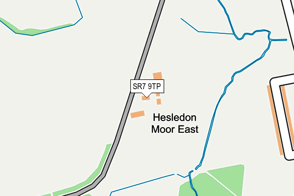
SR7 9TP is located in the Murton electoral ward, within the unitary authority of County Durham and the English Parliamentary constituency of Easington. The Sub Integrated Care Board (ICB) Location is NHS North East and North Cumbria ICB - 84H and the police force is Durham. This postcode has been in use since January 1980.


GetTheData
Source: OS OpenMap – Local (Ordnance Survey)
Source: OS VectorMap District (Ordnance Survey)
Licence: Open Government Licence (requires attribution)
| Easting | 439774 |
| Northing | 546404 |
| Latitude | 54.810927 |
| Longitude | -1.382671 |
GetTheData
Source: Open Postcode Geo
Licence: Open Government Licence
| Country | England |
| Postcode District | SR7 |
➜ See where SR7 is on a map | |
GetTheData
Source: Land Registry Price Paid Data
Licence: Open Government Licence
Elevation or altitude of SR7 9TP as distance above sea level:
| Metres | Feet | |
|---|---|---|
| Elevation | 100m | 328ft |
Elevation is measured from the approximate centre of the postcode, to the nearest point on an OS contour line from OS Terrain 50, which has contour spacing of ten vertical metres.
➜ How high above sea level am I? Find the elevation of your current position using your device's GPS.
GetTheData
Source: Open Postcode Elevation
Licence: Open Government Licence
| Ward | Murton |
| Constituency | Easington |
GetTheData
Source: ONS Postcode Database
Licence: Open Government Licence
| Mathews Road (Un-named Road To East Mr) | Murton | 319m |
| Dalton Terrace (Un-named Road To East Mr) | Murton | 427m |
| Dalton Terrace (Un-named Road To East Mr) | Murton | 456m |
| Colliery Inn (Woods Terrace) | Murton | 539m |
| Crossings (Un-named Road To East Mr) | Murton | 549m |
| Seaham Station | 3.9km |
GetTheData
Source: NaPTAN
Licence: Open Government Licence
GetTheData
Source: ONS Postcode Database
Licence: Open Government Licence


➜ Get more ratings from the Food Standards Agency
GetTheData
Source: Food Standards Agency
Licence: FSA terms & conditions
| Last Collection | |||
|---|---|---|---|
| Location | Mon-Fri | Sat | Distance |
| Dunelm Road, Hetton Le Hole | 17:30 | 11:45 | 1,936m |
| Old Post Office, | 16:00 | 11:30 | 2,013m |
| Hall Walks | 16:00 | 10:30 | 3,339m |
GetTheData
Source: Dracos
Licence: Creative Commons Attribution-ShareAlike
The below table lists the International Territorial Level (ITL) codes (formerly Nomenclature of Territorial Units for Statistics (NUTS) codes) and Local Administrative Units (LAU) codes for SR7 9TP:
| ITL 1 Code | Name |
|---|---|
| TLC | North East (England) |
| ITL 2 Code | Name |
| TLC1 | Tees Valley and Durham |
| ITL 3 Code | Name |
| TLC14 | Durham |
| LAU 1 Code | Name |
| E06000047 | County Durham |
GetTheData
Source: ONS Postcode Directory
Licence: Open Government Licence
The below table lists the Census Output Area (OA), Lower Layer Super Output Area (LSOA), and Middle Layer Super Output Area (MSOA) for SR7 9TP:
| Code | Name | |
|---|---|---|
| OA | E00171774 | |
| LSOA | E01033161 | County Durham 021D |
| MSOA | E02004323 | County Durham 021 |
GetTheData
Source: ONS Postcode Directory
Licence: Open Government Licence
| SR7 9DB | Barwick Street | 266m |
| SR7 9DD | Forster Avenue | 289m |
| SR7 9NY | Calstock Close | 298m |
| SR7 9DE | Forster Avenue | 325m |
| SR7 9DF | Matthews Road | 350m |
| SR7 9NB | Fairfield Grove | 380m |
| SR7 9DG | Matthews Road | 388m |
| SR7 9NR | Brooklyn Terrace | 397m |
| SR7 9NW | Fife Street | 400m |
| SR7 9NH | Grasmere Terrace | 402m |
GetTheData
Source: Open Postcode Geo; Land Registry Price Paid Data
Licence: Open Government Licence