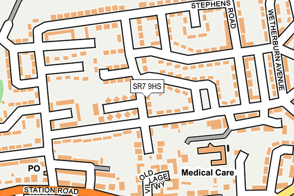
SR7 9HS lies on Farmer Crescent in Murton, Seaham. SR7 9HS is located in the Murton electoral ward, within the unitary authority of County Durham and the English Parliamentary constituency of Easington. The Sub Integrated Care Board (ICB) Location is NHS North East and North Cumbria ICB - 84H and the police force is Durham. This postcode has been in use since January 1980.


GetTheData
Source: OS OpenMap – Local (Ordnance Survey)
Source: OS VectorMap District (Ordnance Survey)
Licence: Open Government Licence (requires attribution)
| Easting | 438580 |
| Northing | 547300 |
| Latitude | 54.819072 |
| Longitude | -1.401129 |
GetTheData
Source: Open Postcode Geo
Licence: Open Government Licence
| Street | Farmer Crescent |
| Locality | Murton |
| Town/City | Seaham |
| Country | England |
| Postcode District | SR7 |
➜ See where SR7 is on a map ➜ Where is Murton? | |
GetTheData
Source: Land Registry Price Paid Data
Licence: Open Government Licence
Elevation or altitude of SR7 9HS as distance above sea level:
| Metres | Feet | |
|---|---|---|
| Elevation | 130m | 427ft |
Elevation is measured from the approximate centre of the postcode, to the nearest point on an OS contour line from OS Terrain 50, which has contour spacing of ten vertical metres.
➜ How high above sea level am I? Find the elevation of your current position using your device's GPS.
GetTheData
Source: Open Postcode Elevation
Licence: Open Government Licence
| Ward | Murton |
| Constituency | Easington |
GetTheData
Source: ONS Postcode Database
Licence: Open Government Licence
| Wellfield Road (Street Not Known) | Murton | 48m |
| Wellfield Road (Street Not Known) | Murton | 79m |
| Lumsden Square (Street Not Known) | Murton | 132m |
| Lumsden Square (Street Not Known) | Murton | 135m |
| Wellfield Road Club (Wellfield Road) | Murton | 145m |
| Seaham Station | 4.2km |
GetTheData
Source: NaPTAN
Licence: Open Government Licence
| Percentage of properties with Next Generation Access | 100.0% |
| Percentage of properties with Superfast Broadband | 100.0% |
| Percentage of properties with Ultrafast Broadband | 0.0% |
| Percentage of properties with Full Fibre Broadband | 0.0% |
Superfast Broadband is between 30Mbps and 300Mbps
Ultrafast Broadband is > 300Mbps
| Percentage of properties unable to receive 2Mbps | 0.0% |
| Percentage of properties unable to receive 5Mbps | 0.0% |
| Percentage of properties unable to receive 10Mbps | 0.0% |
| Percentage of properties unable to receive 30Mbps | 0.0% |
GetTheData
Source: Ofcom
Licence: Ofcom Terms of Use (requires attribution)
Estimated total energy consumption in SR7 9HS by fuel type, 2015.
| Consumption (kWh) | 117,537 |
|---|---|
| Meter count | 8 |
| Mean (kWh/meter) | 14,692 |
| Median (kWh/meter) | 15,074 |
| Consumption (kWh) | 18,898 |
|---|---|
| Meter count | 8 |
| Mean (kWh/meter) | 2,362 |
| Median (kWh/meter) | 2,179 |
GetTheData
Source: Postcode level gas estimates: 2015 (experimental)
Source: Postcode level electricity estimates: 2015 (experimental)
Licence: Open Government Licence
GetTheData
Source: ONS Postcode Database
Licence: Open Government Licence


➜ Get more ratings from the Food Standards Agency
GetTheData
Source: Food Standards Agency
Licence: FSA terms & conditions
| Last Collection | |||
|---|---|---|---|
| Location | Mon-Fri | Sat | Distance |
| Old Post Office, | 16:00 | 11:30 | 2,233m |
| Dunelm Road, Hetton Le Hole | 17:30 | 11:45 | 2,511m |
| Easington Lane | 17:15 | 11:45 | 2,597m |
GetTheData
Source: Dracos
Licence: Creative Commons Attribution-ShareAlike
The below table lists the International Territorial Level (ITL) codes (formerly Nomenclature of Territorial Units for Statistics (NUTS) codes) and Local Administrative Units (LAU) codes for SR7 9HS:
| ITL 1 Code | Name |
|---|---|
| TLC | North East (England) |
| ITL 2 Code | Name |
| TLC1 | Tees Valley and Durham |
| ITL 3 Code | Name |
| TLC14 | Durham |
| LAU 1 Code | Name |
| E06000047 | County Durham |
GetTheData
Source: ONS Postcode Directory
Licence: Open Government Licence
The below table lists the Census Output Area (OA), Lower Layer Super Output Area (LSOA), and Middle Layer Super Output Area (MSOA) for SR7 9HS:
| Code | Name | |
|---|---|---|
| OA | E00105429 | |
| LSOA | E01020776 | County Durham 021C |
| MSOA | E02004323 | County Durham 021 |
GetTheData
Source: ONS Postcode Directory
Licence: Open Government Licence
| SR7 9HJ | Farmer Crescent | 55m |
| SR7 9HH | Farmer Crescent | 64m |
| SR7 9TB | Station Estate East | 66m |
| SR7 9HR | Metcalf Crescent | 71m |
| SR7 9HL | Wellfield Road | 76m |
| SR7 9TE | Short Grove | 91m |
| SR7 9HQ | Metcalf Crescent | 107m |
| SR7 9TH | Meadow Lane | 108m |
| SR7 9HF | Metcalf Crescent | 111m |
| SR7 9HP | Lumsden Square | 132m |
GetTheData
Source: Open Postcode Geo; Land Registry Price Paid Data
Licence: Open Government Licence