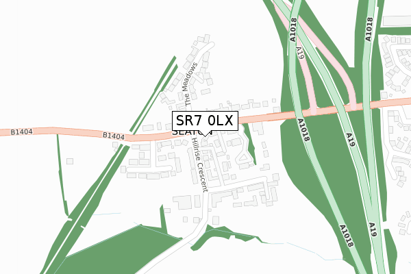
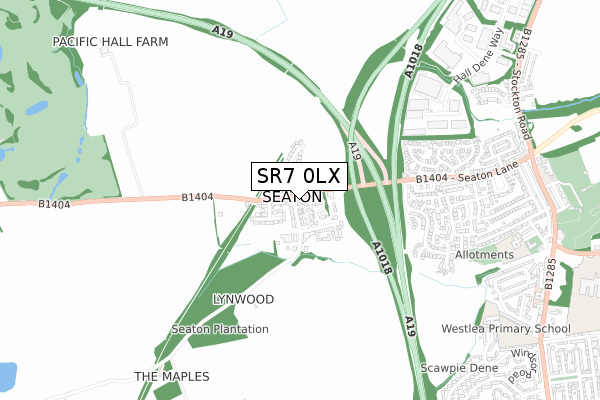
SR7 0LX lies on The Village in Seaton, Seaham. SR7 0LX is located in the Seaham electoral ward, within the unitary authority of County Durham and the English Parliamentary constituency of Easington. The Sub Integrated Care Board (ICB) Location is NHS North East and North Cumbria ICB - 84H and the police force is Durham. This postcode has been in use since January 1980.


GetTheData
Source: OS Open Zoomstack (Ordnance Survey)
Licence: Open Government Licence (requires attribution)
Attribution: Contains OS data © Crown copyright and database right 2025
Source: Open Postcode Geo
Licence: Open Government Licence (requires attribution)
Attribution: Contains OS data © Crown copyright and database right 2025; Contains Royal Mail data © Royal Mail copyright and database right 2025; Source: Office for National Statistics licensed under the Open Government Licence v.3.0
| Easting | 439719 |
| Northing | 550020 |
| Latitude | 54.843433 |
| Longitude | -1.383046 |
GetTheData
Source: Open Postcode Geo
Licence: Open Government Licence
| Street | The Village |
| Locality | Seaton |
| Town/City | Seaham |
| Country | England |
| Postcode District | SR7 |
➜ See where SR7 is on a map ➜ Where is Seaton? | |
GetTheData
Source: Land Registry Price Paid Data
Licence: Open Government Licence
Elevation or altitude of SR7 0LX as distance above sea level:
| Metres | Feet | |
|---|---|---|
| Elevation | 100m | 328ft |
Elevation is measured from the approximate centre of the postcode, to the nearest point on an OS contour line from OS Terrain 50, which has contour spacing of ten vertical metres.
➜ How high above sea level am I? Find the elevation of your current position using your device's GPS.
GetTheData
Source: Open Postcode Elevation
Licence: Open Government Licence
| Ward | Seaham |
| Constituency | Easington |
GetTheData
Source: ONS Postcode Database
Licence: Open Government Licence
DOWNDERRY, THE VILLAGE, SEATON, SEAHAM, SR7 0LX 2020 18 MAY £307,500 |
BRANKSOME, THE VILLAGE, SEATON, SEAHAM, SR7 0LX 1995 3 MAR £59,950 |
GetTheData
Source: HM Land Registry Price Paid Data
Licence: Contains HM Land Registry data © Crown copyright and database right 2025. This data is licensed under the Open Government Licence v3.0.
| Station (Seaton Lane) | Seaton | 47m |
| Station (Seaton Lane) | Seaton | 127m |
| Village (Off Hill Rise Crescent) | Seaton | 134m |
| Seaton Lane Inn (Seaton Lane) | Seaton | 165m |
| Seaton Crescent (Seaton Lane) | Seaton | 493m |
| Seaham Station | 2.4km |
GetTheData
Source: NaPTAN
Licence: Open Government Licence
| Percentage of properties with Next Generation Access | 100.0% |
| Percentage of properties with Superfast Broadband | 50.0% |
| Percentage of properties with Ultrafast Broadband | 0.0% |
| Percentage of properties with Full Fibre Broadband | 0.0% |
Superfast Broadband is between 30Mbps and 300Mbps
Ultrafast Broadband is > 300Mbps
| Percentage of properties unable to receive 2Mbps | 0.0% |
| Percentage of properties unable to receive 5Mbps | 0.0% |
| Percentage of properties unable to receive 10Mbps | 0.0% |
| Percentage of properties unable to receive 30Mbps | 50.0% |
GetTheData
Source: Ofcom
Licence: Ofcom Terms of Use (requires attribution)
GetTheData
Source: ONS Postcode Database
Licence: Open Government Licence


➜ Get more ratings from the Food Standards Agency
GetTheData
Source: Food Standards Agency
Licence: FSA terms & conditions
| Last Collection | |||
|---|---|---|---|
| Location | Mon-Fri | Sat | Distance |
| Station Road North | 16:45 | 11:30 | 3,005m |
| Ryhope Post Office | 17:15 | 11:45 | 3,210m |
| Marcross Drive | 17:30 | 12:00 | 3,645m |
GetTheData
Source: Dracos
Licence: Creative Commons Attribution-ShareAlike
The below table lists the International Territorial Level (ITL) codes (formerly Nomenclature of Territorial Units for Statistics (NUTS) codes) and Local Administrative Units (LAU) codes for SR7 0LX:
| ITL 1 Code | Name |
|---|---|
| TLC | North East (England) |
| ITL 2 Code | Name |
| TLC1 | Tees Valley and Durham |
| ITL 3 Code | Name |
| TLC14 | Durham |
| LAU 1 Code | Name |
| E06000047 | County Durham |
GetTheData
Source: ONS Postcode Directory
Licence: Open Government Licence
The below table lists the Census Output Area (OA), Lower Layer Super Output Area (LSOA), and Middle Layer Super Output Area (MSOA) for SR7 0LX:
| Code | Name | |
|---|---|---|
| OA | E00105481 | |
| LSOA | E01020786 | County Durham 016D |
| MSOA | E02004320 | County Durham 016 |
GetTheData
Source: ONS Postcode Directory
Licence: Open Government Licence
| SR7 0ND | Peartree Rise | 33m |
| SR7 0LR | Cairnside | 68m |
| SR7 0LZ | Hillrise Crescent | 71m |
| SR7 0LY | The Village | 79m |
| SR7 0PG | Hall Close | 82m |
| SR7 0LS | Seaton Lane | 95m |
| SR7 0LP | Seaton Lane | 105m |
| SR7 0QB | The Meadows | 138m |
| SR7 0LU | Seaton Grove | 155m |
| SR7 0NA | The Village | 156m |
GetTheData
Source: Open Postcode Geo; Land Registry Price Paid Data
Licence: Open Government Licence