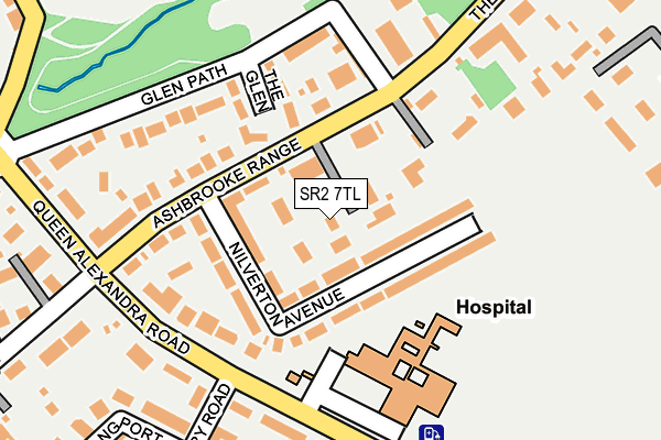
SR2 7TL lies on Bowtrees in Sunderland. SR2 7TL is located in the St Michael's electoral ward, within the metropolitan district of Sunderland and the English Parliamentary constituency of Sunderland Central. The Sub Integrated Care Board (ICB) Location is NHS North East and North Cumbria ICB - 00P and the police force is Northumbria. This postcode has been in use since April 1985.


GetTheData
Source: OS OpenMap – Local (Ordnance Survey)
Source: OS VectorMap District (Ordnance Survey)
Licence: Open Government Licence (requires attribution)
| Easting | 439735 |
| Northing | 555258 |
| Latitude | 54.890491 |
| Longitude | -1.382064 |
GetTheData
Source: Open Postcode Geo
Licence: Open Government Licence
| Street | Bowtrees |
| Town/City | Sunderland |
| Country | England |
| Postcode District | SR2 |
➜ See where SR2 is on a map ➜ Where is Sunderland? | |
GetTheData
Source: Land Registry Price Paid Data
Licence: Open Government Licence
Elevation or altitude of SR2 7TL as distance above sea level:
| Metres | Feet | |
|---|---|---|
| Elevation | 40m | 131ft |
Elevation is measured from the approximate centre of the postcode, to the nearest point on an OS contour line from OS Terrain 50, which has contour spacing of ten vertical metres.
➜ How high above sea level am I? Find the elevation of your current position using your device's GPS.
GetTheData
Source: Open Postcode Elevation
Licence: Open Government Licence
| Ward | St Michael's |
| Constituency | Sunderland Central |
GetTheData
Source: ONS Postcode Database
Licence: Open Government Licence
1, BOWTREES, SUNDERLAND, SR2 7TL 2020 3 JUL £530,000 |
2, BOWTREES, SUNDERLAND, SR2 7TL 1995 18 AUG £131,000 |
GetTheData
Source: HM Land Registry Price Paid Data
Licence: Contains HM Land Registry data © Crown copyright and database right 2025. This data is licensed under the Open Government Licence v3.0.
| Ashbrook Range (Ashbrooke Range) | Ashbrooke | 86m |
| Ashbrook Range (Ashbrooke Range) | Ashbrooke | 98m |
| The Cedars-beechholme Court (The Cedars) | Ashbrooke | 177m |
| Eye Infirmary (Queen Alexandra Road) | Hillview | 195m |
| Queen Alexandra Road-ashbrooke Range (Queen Alexandra Road) | Hillview | 197m |
| Park Lane (Tyne And Wear Metro Station) (Park Lane) | Park Lane | 1,321m |
| University (Tyne And Wear Metro Station) (A183 Chester Road) | University Of Sunderland | 1,522m |
| Sunderland Station | 1.7km |
| St Peters Station | 2.3km |
| Seaburn Station | 4.4km |
GetTheData
Source: NaPTAN
Licence: Open Government Licence
| Percentage of properties with Next Generation Access | 100.0% |
| Percentage of properties with Superfast Broadband | 100.0% |
| Percentage of properties with Ultrafast Broadband | 0.0% |
| Percentage of properties with Full Fibre Broadband | 0.0% |
Superfast Broadband is between 30Mbps and 300Mbps
Ultrafast Broadband is > 300Mbps
| Percentage of properties unable to receive 2Mbps | 0.0% |
| Percentage of properties unable to receive 5Mbps | 0.0% |
| Percentage of properties unable to receive 10Mbps | 0.0% |
| Percentage of properties unable to receive 30Mbps | 0.0% |
GetTheData
Source: Ofcom
Licence: Ofcom Terms of Use (requires attribution)
GetTheData
Source: ONS Postcode Database
Licence: Open Government Licence


➜ Get more ratings from the Food Standards Agency
GetTheData
Source: Food Standards Agency
Licence: FSA terms & conditions
| Last Collection | |||
|---|---|---|---|
| Location | Mon-Fri | Sat | Distance |
| Greystoke Avenue | 17:00 | 11:30 | 306m |
| Leechmere Road | 18:30 | 11:45 | 653m |
| The Avenue | 17:00 | 11:30 | 738m |
GetTheData
Source: Dracos
Licence: Creative Commons Attribution-ShareAlike
The below table lists the International Territorial Level (ITL) codes (formerly Nomenclature of Territorial Units for Statistics (NUTS) codes) and Local Administrative Units (LAU) codes for SR2 7TL:
| ITL 1 Code | Name |
|---|---|
| TLC | North East (England) |
| ITL 2 Code | Name |
| TLC2 | Northumberland, and Tyne and Wear |
| ITL 3 Code | Name |
| TLC23 | Sunderland |
| LAU 1 Code | Name |
| E08000024 | Sunderland |
GetTheData
Source: ONS Postcode Directory
Licence: Open Government Licence
The below table lists the Census Output Area (OA), Lower Layer Super Output Area (LSOA), and Middle Layer Super Output Area (MSOA) for SR2 7TL:
| Code | Name | |
|---|---|---|
| OA | E00044355 | |
| LSOA | E01008740 | Sunderland 022A |
| MSOA | E02001812 | Sunderland 022 |
GetTheData
Source: ONS Postcode Directory
Licence: Open Government Licence
| SR2 7TS | Nilverton Avenue | 47m |
| SR2 7TR | Ashbrooke Range | 50m |
| SR2 7TX | The Glen | 127m |
| SR2 9HW | Queen Alexandra Road | 151m |
| SR2 7TU | Glen Path | 152m |
| SR2 7TP | Ashbrooke Range | 162m |
| SR2 7UB | Beecholm Court | 171m |
| SR2 9HN | Queen Alexandra Road | 208m |
| SR2 9HR | Queen Alexandra Road | 212m |
| SR2 9AH | Queen Alexandra Road | 230m |
GetTheData
Source: Open Postcode Geo; Land Registry Price Paid Data
Licence: Open Government Licence