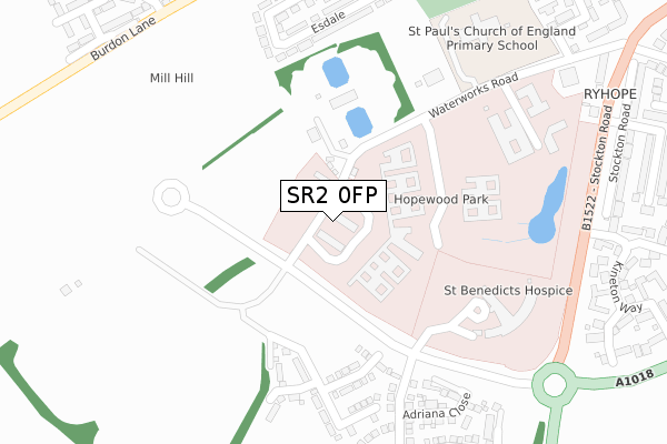
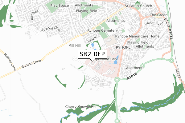
SR2 0FP is located in the Ryhope electoral ward, within the metropolitan district of Sunderland and the English Parliamentary constituency of Sunderland Central. The Sub Integrated Care Board (ICB) Location is NHS North East and North Cumbria ICB - 00P and the police force is Northumbria. This postcode has been in use since June 2019.


GetTheData
Source: OS Open Zoomstack (Ordnance Survey)
Licence: Open Government Licence (requires attribution)
Attribution: Contains OS data © Crown copyright and database right 2024
Source: Open Postcode Geo
Licence: Open Government Licence (requires attribution)
Attribution: Contains OS data © Crown copyright and database right 2024; Contains Royal Mail data © Royal Mail copyright and database right 2024; Source: Office for National Statistics licensed under the Open Government Licence v.3.0
| Easting | 440350 |
| Northing | 552004 |
| Latitude | 54.861210 |
| Longitude | -1.372944 |
GetTheData
Source: Open Postcode Geo
Licence: Open Government Licence
| Country | England |
| Postcode District | SR2 |
| ➜ SR2 open data dashboard ➜ See where SR2 is on a map ➜ Where is Sunderland? | |
GetTheData
Source: Land Registry Price Paid Data
Licence: Open Government Licence
| Ward | Ryhope |
| Constituency | Sunderland Central |
GetTheData
Source: ONS Postcode Database
Licence: Open Government Licence
2022 25 NOV £355,000 |
2021 19 MAR £347,995 |
1, GREENSTEM WAY, RYHOPE, SUNDERLAND, SR2 0FP 2020 20 NOV £329,995 |
2, GREENSTEM WAY, RYHOPE, SUNDERLAND, SR2 0FP 2020 25 SEP £347,995 |
6, GREENSTEM WAY, RYHOPE, SUNDERLAND, SR2 0FP 2020 25 SEP £434,995 |
4, GREENSTEM WAY, RYHOPE, SUNDERLAND, SR2 0FP 2020 28 AUG £358,995 |
29, GREENSTEM WAY, RYHOPE, SUNDERLAND, SR2 0FP 2019 31 OCT £249,995 |
30, GREENSTEM WAY, RYHOPE, SUNDERLAND, SR2 0FP 2019 25 OCT £254,995 |
28, GREENSTEM WAY, RYHOPE, SUNDERLAND, SR2 0FP 2019 25 SEP £288,995 |
GetTheData
Source: HM Land Registry Price Paid Data
Licence: Contains HM Land Registry data © Crown copyright and database right 2024. This data is licensed under the Open Government Licence v3.0.
| June 2022 | Violence and sexual offences | On or near Sports/Recreation Area | 43m |
| June 2022 | Violence and sexual offences | On or near Sports/Recreation Area | 43m |
| June 2022 | Vehicle crime | On or near Sports/Recreation Area | 43m |
| ➜ Get more crime data in our Crime section | |||
GetTheData
Source: data.police.uk
Licence: Open Government Licence
| Ryhope Hospital Grounds (Hospital Road) | Ryhope Village | 78m |
| Ryhope Hospital Grounds (Hospital Road) | Ryhope Village | 164m |
| Ryhope Hospital Grounds (Waterworks Road) | Ryhope Village | 185m |
| Ryhope Hospital Grounds (Waterworks Road) | Ryhope Village | 310m |
| Stockton Road-hawksley Grange (Stockton Road) | Ryhope Village | 432m |
| Seaham Station | 3km |
| Sunderland Station | 4.9km |
GetTheData
Source: NaPTAN
Licence: Open Government Licence
| Percentage of properties with Next Generation Access | 61.5% |
| Percentage of properties with Superfast Broadband | 61.5% |
| Percentage of properties with Ultrafast Broadband | 61.5% |
| Percentage of properties with Full Fibre Broadband | 61.5% |
Superfast Broadband is between 30Mbps and 300Mbps
Ultrafast Broadband is > 300Mbps
| Percentage of properties unable to receive 2Mbps | 0.0% |
| Percentage of properties unable to receive 5Mbps | 0.0% |
| Percentage of properties unable to receive 10Mbps | 0.0% |
| Percentage of properties unable to receive 30Mbps | 0.0% |
GetTheData
Source: Ofcom
Licence: Ofcom Terms of Use (requires attribution)
GetTheData
Source: ONS Postcode Database
Licence: Open Government Licence


➜ Get more ratings from the Food Standards Agency
GetTheData
Source: Food Standards Agency
Licence: FSA terms & conditions
| Last Collection | |||
|---|---|---|---|
| Location | Mon-Fri | Sat | Distance |
| Ryhope Post Office | 17:15 | 11:45 | 1,191m |
| Tunstall Vale | 17:00 | 11:30 | 2,495m |
| Leechmere Road | 18:30 | 11:45 | 2,826m |
GetTheData
Source: Dracos
Licence: Creative Commons Attribution-ShareAlike
| Facility | Distance |
|---|---|
| St Pauls Ce Primary School Waterworks Road, Waterworks Road, Ryhope, Sunderland Grass Pitches | 631m |
| Meadow Park Beechbrooke, Sunderland Grass Pitches | 736m |
| Onegym Ryhope Ryhope Street South, Sunderland Health and Fitness Gym | 1.1km |
GetTheData
Source: Active Places
Licence: Open Government Licence
| School | Phase of Education | Distance |
|---|---|---|
| St Paul's CofE Primary School Waterworks Road, Ryhope, Sunderland, SR2 0LW | Primary | 616m |
| St Patrick's Catholic Primary School, Ryhope Smith Street, Ryhope, Sunderland, SR2 0RQ | Primary | 971m |
| Ryhope Infant School Academy Shaftesbury Avenue, Ryhope, Sunderland, SR2 0RT | Primary | 1.2km |
GetTheData
Source: Edubase
Licence: Open Government Licence
The below table lists the International Territorial Level (ITL) codes (formerly Nomenclature of Territorial Units for Statistics (NUTS) codes) and Local Administrative Units (LAU) codes for SR2 0FP:
| ITL 1 Code | Name |
|---|---|
| TLC | North East (England) |
| ITL 2 Code | Name |
| TLC2 | Northumberland, and Tyne and Wear |
| ITL 3 Code | Name |
| TLC23 | Sunderland |
| LAU 1 Code | Name |
| E08000024 | Sunderland |
GetTheData
Source: ONS Postcode Directory
Licence: Open Government Licence
The below table lists the Census Output Area (OA), Lower Layer Super Output Area (LSOA), and Middle Layer Super Output Area (MSOA) for SR2 0FP:
| Code | Name | |
|---|---|---|
| OA | E00170229 | |
| LSOA | E01008766 | Sunderland 028C |
| MSOA | E02001818 | Sunderland 028 |
GetTheData
Source: ONS Postcode Directory
Licence: Open Government Licence
| SR2 0LH | Fulbroke Close | 460m |
| SR2 0LJ | Kineton Way | 492m |
| SR2 0LU | Yeldon Close | 528m |
| SR2 0JE | Esdale | 566m |
| SR2 0JF | Esdale | 596m |
| SR2 0NG | Viewforth Road | 609m |
| SR2 0NF | Stockton Road | 617m |
| SR2 0LT | Hopton Drive | 621m |
| SR2 0NE | Stockton Road | 637m |
| SR2 0JG | Cherribank | 644m |
GetTheData
Source: Open Postcode Geo; Land Registry Price Paid Data
Licence: Open Government Licence