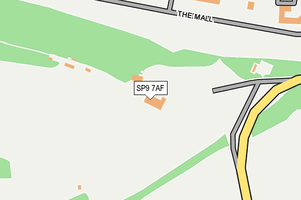
SP9 7AF is located in the Tidworth North & West electoral ward, within the unitary authority of Wiltshire and the English Parliamentary constituency of Devizes. The Sub Integrated Care Board (ICB) Location is NHS Bath and North East Somerset, Swindon and Wiltshire ICB - 92 and the police force is Wiltshire. This postcode has been in use since January 1993.


GetTheData
Source: OS OpenMap – Local (Ordnance Survey)
Source: OS VectorMap District (Ordnance Survey)
Licence: Open Government Licence (requires attribution)
| Easting | 422059 |
| Northing | 147577 |
| Latitude | 51.226961 |
| Longitude | -1.685480 |
GetTheData
Source: Open Postcode Geo
Licence: Open Government Licence
| Country | England |
| Postcode District | SP9 |
➜ See where SP9 is on a map | |
GetTheData
Source: Land Registry Price Paid Data
Licence: Open Government Licence
Elevation or altitude of SP9 7AF as distance above sea level:
| Metres | Feet | |
|---|---|---|
| Elevation | 130m | 427ft |
Elevation is measured from the approximate centre of the postcode, to the nearest point on an OS contour line from OS Terrain 50, which has contour spacing of ten vertical metres.
➜ How high above sea level am I? Find the elevation of your current position using your device's GPS.
GetTheData
Source: Open Postcode Elevation
Licence: Open Government Licence
| Ward | Tidworth North & West |
| Constituency | Devizes |
GetTheData
Source: ONS Postcode Database
Licence: Open Government Licence
| Happylands Golf Club (Bulford Road) | Tidworth | 385m |
| Happylands Golf Club (Bulford Road) | Tidworth | 442m |
| Home Farm (Bulford Road) | Tidworth | 561m |
| Home Farm (Bulford Road) | Tidworth | 570m |
| Delhi House (Bulford Road) | Tidworth | 911m |
GetTheData
Source: NaPTAN
Licence: Open Government Licence
GetTheData
Source: ONS Postcode Database
Licence: Open Government Licence


➜ Get more ratings from the Food Standards Agency
GetTheData
Source: Food Standards Agency
Licence: FSA terms & conditions
| Last Collection | |||
|---|---|---|---|
| Location | Mon-Fri | Sat | Distance |
| Tidworth Delivery Office | 16:15 | 12:00 | 1,301m |
| North Tidworth Post Office | 17:00 | 12:00 | 1,988m |
| Station Road | 17:00 | 12:00 | 2,027m |
GetTheData
Source: Dracos
Licence: Creative Commons Attribution-ShareAlike
The below table lists the International Territorial Level (ITL) codes (formerly Nomenclature of Territorial Units for Statistics (NUTS) codes) and Local Administrative Units (LAU) codes for SP9 7AF:
| ITL 1 Code | Name |
|---|---|
| TLK | South West (England) |
| ITL 2 Code | Name |
| TLK1 | Gloucestershire, Wiltshire and Bath/Bristol area |
| ITL 3 Code | Name |
| TLK15 | Wiltshire |
| LAU 1 Code | Name |
| E06000054 | Wiltshire |
GetTheData
Source: ONS Postcode Directory
Licence: Open Government Licence
The below table lists the Census Output Area (OA), Lower Layer Super Output Area (LSOA), and Middle Layer Super Output Area (MSOA) for SP9 7AF:
| Code | Name | |
|---|---|---|
| OA | E00166429 | |
| LSOA | E01031880 | Wiltshire 041E |
| MSOA | E02006643 | Wiltshire 041 |
GetTheData
Source: ONS Postcode Directory
Licence: Open Government Licence
| SP9 7AZ | The Mall | 273m |
| SP9 7AQ | Home Farm | 634m |
| SP9 7AN | Humber Lane | 695m |
| SP9 7AW | Humber Lane | 1086m |
| SP9 7RZ | Bulford Road | 1437m |
| SP9 7RY | Lady Godley Close | 1472m |
| SP9 7SA | Bulford Road | 1500m |
| SP9 7SB | The Oval | 1509m |
| SP9 7SD | Bulford Road | 1529m |
| SP9 7TE | Salisbury Road | 1545m |
GetTheData
Source: Open Postcode Geo; Land Registry Price Paid Data
Licence: Open Government Licence