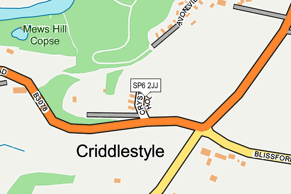
SP6 2JJ is located in the Fordingbridge, Godshill & Hyde electoral ward, within the local authority district of New Forest and the English Parliamentary constituency of New Forest West. The Sub Integrated Care Board (ICB) Location is NHS Hampshire and Isle of Wight ICB - D9Y0V and the police force is Hampshire. This postcode has been in use since October 2006.


GetTheData
Source: OS OpenMap – Local (Ordnance Survey)
Source: OS VectorMap District (Ordnance Survey)
Licence: Open Government Licence (requires attribution)
| Easting | 416592 |
| Northing | 114222 |
| Latitude | 50.927216 |
| Longitude | -1.765292 |
GetTheData
Source: Open Postcode Geo
Licence: Open Government Licence
| Country | England |
| Postcode District | SP6 |
➜ See where SP6 is on a map ➜ Where is Criddlestyle? | |
GetTheData
Source: Land Registry Price Paid Data
Licence: Open Government Licence
Elevation or altitude of SP6 2JJ as distance above sea level:
| Metres | Feet | |
|---|---|---|
| Elevation | 70m | 230ft |
Elevation is measured from the approximate centre of the postcode, to the nearest point on an OS contour line from OS Terrain 50, which has contour spacing of ten vertical metres.
➜ How high above sea level am I? Find the elevation of your current position using your device's GPS.
GetTheData
Source: Open Postcode Elevation
Licence: Open Government Licence
| Ward | Fordingbridge, Godshill & Hyde |
| Constituency | New Forest West |
GetTheData
Source: ONS Postcode Database
Licence: Open Government Licence
| Strawberry Farm (B3078 Roger Penny Way) | Godshill | 163m |
| Strawberry Farm (B3078 Roger Penny Way) | Godshill | 172m |
| Sandy Balls (B3078 Roger Penny Way) | Godshill | 509m |
| Sandy Balls (B3078 Roger Penny Way) | Godshill | 547m |
| Well Lane (B3078 Roger Penny Way) | Godshill | 969m |
GetTheData
Source: NaPTAN
Licence: Open Government Licence
| Percentage of properties with Next Generation Access | 100.0% |
| Percentage of properties with Superfast Broadband | 0.0% |
| Percentage of properties with Ultrafast Broadband | 0.0% |
| Percentage of properties with Full Fibre Broadband | 0.0% |
Superfast Broadband is between 30Mbps and 300Mbps
Ultrafast Broadband is > 300Mbps
| Median download speed | 10.3Mbps |
| Average download speed | 9.7Mbps |
| Maximum download speed | 11.68Mbps |
| Median upload speed | 1.1Mbps |
| Average upload speed | 1.1Mbps |
| Maximum upload speed | 1.24Mbps |
| Percentage of properties unable to receive 2Mbps | 0.0% |
| Percentage of properties unable to receive 5Mbps | 0.0% |
| Percentage of properties unable to receive 10Mbps | 100.0% |
| Percentage of properties unable to receive 30Mbps | 100.0% |
GetTheData
Source: Ofcom
Licence: Ofcom Terms of Use (requires attribution)
GetTheData
Source: ONS Postcode Database
Licence: Open Government Licence


➜ Get more ratings from the Food Standards Agency
GetTheData
Source: Food Standards Agency
Licence: FSA terms & conditions
| Last Collection | |||
|---|---|---|---|
| Location | Mon-Fri | Sat | Distance |
| Sandy Balls Holiday Camp | 16:30 | 10:30 | 497m |
| East Mills | 16:45 | 11:00 | 796m |
| Old Post Office Godshill | 16:30 | 10:30 | 979m |
GetTheData
Source: Dracos
Licence: Creative Commons Attribution-ShareAlike
The below table lists the International Territorial Level (ITL) codes (formerly Nomenclature of Territorial Units for Statistics (NUTS) codes) and Local Administrative Units (LAU) codes for SP6 2JJ:
| ITL 1 Code | Name |
|---|---|
| TLJ | South East (England) |
| ITL 2 Code | Name |
| TLJ3 | Hampshire and Isle of Wight |
| ITL 3 Code | Name |
| TLJ36 | Central Hampshire |
| LAU 1 Code | Name |
| E07000091 | New Forest |
GetTheData
Source: ONS Postcode Directory
Licence: Open Government Licence
The below table lists the Census Output Area (OA), Lower Layer Super Output Area (LSOA), and Middle Layer Super Output Area (MSOA) for SP6 2JJ:
| Code | Name | |
|---|---|---|
| OA | E00116991 | |
| LSOA | E01023023 | New Forest 001E |
| MSOA | E02004779 | New Forest 001 |
GetTheData
Source: ONS Postcode Directory
Licence: Open Government Licence
| SP6 2JT | Southampton Road | 335m |
| SP6 2JX | 359m | |
| SP6 2JY | Sandy Balls Holiday Centre | 452m |
| SP6 2JH | 517m | |
| SP6 2LA | Sandy Balls Estate | 626m |
| SP6 2JR | Fishes Heron | 654m |
| SP6 2LE | 701m | |
| SP6 2HG | 828m | |
| SP6 2JS | Southampton Road | 875m |
| SP6 2HF | 946m |
GetTheData
Source: Open Postcode Geo; Land Registry Price Paid Data
Licence: Open Government Licence