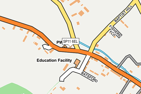
SP11 6EL lies on Old School Cottages in St Mary Bourne, Andover. SP11 6EL is located in the Evingar electoral ward, within the local authority district of Basingstoke and Deane and the English Parliamentary constituency of North West Hampshire. The Sub Integrated Care Board (ICB) Location is NHS Hampshire and Isle of Wight ICB - D9Y0V and the police force is Hampshire. This postcode has been in use since January 1980.


GetTheData
Source: OS OpenMap – Local (Ordnance Survey)
Source: OS VectorMap District (Ordnance Survey)
Licence: Open Government Licence (requires attribution)
| Easting | 441577 |
| Northing | 150813 |
| Latitude | 51.254970 |
| Longitude | -1.405591 |
GetTheData
Source: Open Postcode Geo
Licence: Open Government Licence
| Street | Old School Cottages |
| Locality | St Mary Bourne |
| Town/City | Andover |
| Country | England |
| Postcode District | SP11 |
➜ See where SP11 is on a map ➜ Where is St Mary Bourne? | |
GetTheData
Source: Land Registry Price Paid Data
Licence: Open Government Licence
Elevation or altitude of SP11 6EL as distance above sea level:
| Metres | Feet | |
|---|---|---|
| Elevation | 80m | 262ft |
Elevation is measured from the approximate centre of the postcode, to the nearest point on an OS contour line from OS Terrain 50, which has contour spacing of ten vertical metres.
➜ How high above sea level am I? Find the elevation of your current position using your device's GPS.
GetTheData
Source: Open Postcode Elevation
Licence: Open Government Licence
| Ward | Evingar |
| Constituency | North West Hampshire |
GetTheData
Source: ONS Postcode Database
Licence: Open Government Licence
| St Mary Bourne School (B3048) | Swampton | 36m |
| St Mary Bourne School (Gangbridge Lane) | Swampton | 40m |
| Queens Cottages (B3048) | Swampton | 190m |
| St Mary Bourne Memorial (B3048) | Swampton | 371m |
| Mulberry House (B3048) | Swampton | 533m |
| Whitchurch (Hants) Station | 5.1km |
GetTheData
Source: NaPTAN
Licence: Open Government Licence
| Percentage of properties with Next Generation Access | 100.0% |
| Percentage of properties with Superfast Broadband | 100.0% |
| Percentage of properties with Ultrafast Broadband | 0.0% |
| Percentage of properties with Full Fibre Broadband | 0.0% |
Superfast Broadband is between 30Mbps and 300Mbps
Ultrafast Broadband is > 300Mbps
| Percentage of properties unable to receive 2Mbps | 0.0% |
| Percentage of properties unable to receive 5Mbps | 0.0% |
| Percentage of properties unable to receive 10Mbps | 0.0% |
| Percentage of properties unable to receive 30Mbps | 0.0% |
GetTheData
Source: Ofcom
Licence: Ofcom Terms of Use (requires attribution)
GetTheData
Source: ONS Postcode Database
Licence: Open Government Licence


➜ Get more ratings from the Food Standards Agency
GetTheData
Source: Food Standards Agency
Licence: FSA terms & conditions
| Last Collection | |||
|---|---|---|---|
| Location | Mon-Fri | Sat | Distance |
| Swampton | 16:15 | 10:00 | 748m |
| St Mary Bourne Post Office | 16:15 | 10:30 | 1,648m |
| Stoke | 16:15 | 09:45 | 1,698m |
GetTheData
Source: Dracos
Licence: Creative Commons Attribution-ShareAlike
The below table lists the International Territorial Level (ITL) codes (formerly Nomenclature of Territorial Units for Statistics (NUTS) codes) and Local Administrative Units (LAU) codes for SP11 6EL:
| ITL 1 Code | Name |
|---|---|
| TLJ | South East (England) |
| ITL 2 Code | Name |
| TLJ3 | Hampshire and Isle of Wight |
| ITL 3 Code | Name |
| TLJ37 | North Hampshire |
| LAU 1 Code | Name |
| E07000084 | Basingstoke and Deane |
GetTheData
Source: ONS Postcode Directory
Licence: Open Government Licence
The below table lists the Census Output Area (OA), Lower Layer Super Output Area (LSOA), and Middle Layer Super Output Area (MSOA) for SP11 6EL:
| Code | Name | |
|---|---|---|
| OA | E00114468 | |
| LSOA | E01022514 | Basingstoke and Deane 020A |
| MSOA | E02004694 | Basingstoke and Deane 020 |
GetTheData
Source: ONS Postcode Directory
Licence: Open Government Licence
| SP11 6EH | The Rank | 84m |
| SP11 6AU | Haven Hill | 103m |
| SP11 6EN | 107m | |
| SP11 6BJ | Belle Vue Cottages | 114m |
| SP11 6AX | Batsford | 131m |
| SP11 6EQ | Pound Cottages | 166m |
| SP11 6DU | Stud Farm | 189m |
| SP11 6EG | Queens Cottages | 193m |
| SP11 6AT | Denham Terrace | 227m |
| SP11 6BQ | Baptist Hill | 249m |
GetTheData
Source: Open Postcode Geo; Land Registry Price Paid Data
Licence: Open Government Licence