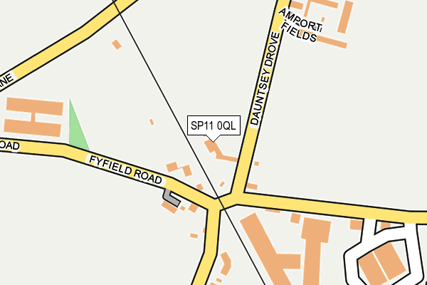
SP11 0QL lies on Dauntsey Drove in Weyhill, Andover. SP11 0QL is located in the Anna electoral ward, within the local authority district of Test Valley and the English Parliamentary constituency of North West Hampshire. The Sub Integrated Care Board (ICB) Location is NHS Hampshire and Isle of Wight ICB - D9Y0V and the police force is Hampshire. This postcode has been in use since January 1980.


GetTheData
Source: OS OpenMap – Local (Ordnance Survey)
Source: OS VectorMap District (Ordnance Survey)
Licence: Open Government Licence (requires attribution)
| Easting | 430326 |
| Northing | 146849 |
| Latitude | 51.220034 |
| Longitude | -1.567144 |
GetTheData
Source: Open Postcode Geo
Licence: Open Government Licence
| Street | Dauntsey Drove |
| Locality | Weyhill |
| Town/City | Andover |
| Country | England |
| Postcode District | SP11 |
➜ See where SP11 is on a map ➜ Where is Weyhill? | |
GetTheData
Source: Land Registry Price Paid Data
Licence: Open Government Licence
Elevation or altitude of SP11 0QL as distance above sea level:
| Metres | Feet | |
|---|---|---|
| Elevation | 90m | 295ft |
Elevation is measured from the approximate centre of the postcode, to the nearest point on an OS contour line from OS Terrain 50, which has contour spacing of ten vertical metres.
➜ How high above sea level am I? Find the elevation of your current position using your device's GPS.
GetTheData
Source: Open Postcode Elevation
Licence: Open Government Licence
| Ward | Anna |
| Constituency | North West Hampshire |
GetTheData
Source: ONS Postcode Database
Licence: Open Government Licence
FLEUR HOUSE, DAUNTSEY DROVE, WEYHILL, ANDOVER, SP11 0QL 2021 21 SEP £737,500 |
DOVE HOUSE, DAUNTSEY DROVE, WEYHILL, ANDOVER, SP11 0QL 2021 30 JUN £770,000 |
HEATHWOOD HOUSE, DAUNTSEY DROVE, WEYHILL, ANDOVER, SP11 0QL 2019 15 MAY £840,000 |
2016 21 APR £775,000 |
1998 29 MAY £289,000 |
THE LONG HOUSE, DAUNTSEY DROVE, WEYHILL, ANDOVER, SP11 0QL 1997 25 JUL £255,000 |
GetTheData
Source: HM Land Registry Price Paid Data
Licence: Contains HM Land Registry data © Crown copyright and database right 2025. This data is licensed under the Open Government Licence v3.0.
| Mayfield Industrial Estate (Fyfield Road) | Fyfield | 110m |
| Mayfield Industrial Estate (Fyfield Road) | Fyfield | 115m |
| White House | Fyfield | 421m |
| White House (A342 Andover Road) | Fyfield | 427m |
| Fairways (Fyfield Road) | Weyhill | 498m |
GetTheData
Source: NaPTAN
Licence: Open Government Licence
| Percentage of properties with Next Generation Access | 100.0% |
| Percentage of properties with Superfast Broadband | 100.0% |
| Percentage of properties with Ultrafast Broadband | 75.0% |
| Percentage of properties with Full Fibre Broadband | 0.0% |
Superfast Broadband is between 30Mbps and 300Mbps
Ultrafast Broadband is > 300Mbps
| Percentage of properties unable to receive 2Mbps | 0.0% |
| Percentage of properties unable to receive 5Mbps | 0.0% |
| Percentage of properties unable to receive 10Mbps | 0.0% |
| Percentage of properties unable to receive 30Mbps | 0.0% |
GetTheData
Source: Ofcom
Licence: Ofcom Terms of Use (requires attribution)
GetTheData
Source: ONS Postcode Database
Licence: Open Government Licence


➜ Get more ratings from the Food Standards Agency
GetTheData
Source: Food Standards Agency
Licence: FSA terms & conditions
| Last Collection | |||
|---|---|---|---|
| Location | Mon-Fri | Sat | Distance |
| Fyfield Road | 17:00 | 11:00 | 737m |
| Dauntsey Lane | 16:45 | 10:30 | 777m |
| Duncans Close | 17:00 | 11:00 | 860m |
GetTheData
Source: Dracos
Licence: Creative Commons Attribution-ShareAlike
The below table lists the International Territorial Level (ITL) codes (formerly Nomenclature of Territorial Units for Statistics (NUTS) codes) and Local Administrative Units (LAU) codes for SP11 0QL:
| ITL 1 Code | Name |
|---|---|
| TLJ | South East (England) |
| ITL 2 Code | Name |
| TLJ3 | Hampshire and Isle of Wight |
| ITL 3 Code | Name |
| TLJ36 | Central Hampshire |
| LAU 1 Code | Name |
| E07000093 | Test Valley |
GetTheData
Source: ONS Postcode Directory
Licence: Open Government Licence
The below table lists the Census Output Area (OA), Lower Layer Super Output Area (LSOA), and Middle Layer Super Output Area (MSOA) for SP11 0QL:
| Code | Name | |
|---|---|---|
| OA | E00117660 | |
| LSOA | E01023159 | Test Valley 007A |
| MSOA | E02004820 | Test Valley 007 |
GetTheData
Source: ONS Postcode Directory
Licence: Open Government Licence
| SP11 8EG | Dauntsey Bridge | 166m |
| SP11 0BF | Amport Fields | 209m |
| SP11 0QW | 275m | |
| SP11 8HU | Mayfield Avenue Industrial Park | 318m |
| SP11 0QQ | White Houses | 402m |
| SP11 8EB | Dauntsey Lane | 438m |
| SP11 8TB | Ordnance Lane | 523m |
| SP11 8DW | Fairways | 540m |
| SP11 9AE | Ludgershall Road | 549m |
| SP11 8EA | Amesbury Road | 572m |
GetTheData
Source: Open Postcode Geo; Land Registry Price Paid Data
Licence: Open Government Licence