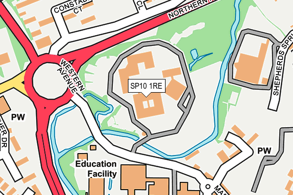
SP10 1RE is located in the Andover St Mary's electoral ward, within the local authority district of Test Valley and the English Parliamentary constituency of North West Hampshire. The Sub Integrated Care Board (ICB) Location is NHS Hampshire and Isle of Wight ICB - D9Y0V and the police force is Hampshire. This postcode has been in use since April 1987.


GetTheData
Source: OS OpenMap – Local (Ordnance Survey)
Source: OS VectorMap District (Ordnance Survey)
Licence: Open Government Licence (requires attribution)
| Easting | 436262 |
| Northing | 146052 |
| Latitude | 51.212527 |
| Longitude | -1.482244 |
GetTheData
Source: Open Postcode Geo
Licence: Open Government Licence
| Country | England |
| Postcode District | SP10 |
➜ See where SP10 is on a map ➜ Where is Andover? | |
GetTheData
Source: Land Registry Price Paid Data
Licence: Open Government Licence
Elevation or altitude of SP10 1RE as distance above sea level:
| Metres | Feet | |
|---|---|---|
| Elevation | 60m | 197ft |
Elevation is measured from the approximate centre of the postcode, to the nearest point on an OS contour line from OS Terrain 50, which has contour spacing of ten vertical metres.
➜ How high above sea level am I? Find the elevation of your current position using your device's GPS.
GetTheData
Source: Open Postcode Elevation
Licence: Open Government Licence
| Ward | Andover St Mary's |
| Constituency | North West Hampshire |
GetTheData
Source: ONS Postcode Database
Licence: Open Government Licence
| Constable Court (Artists Way) | Andover | 185m |
| Hepworth Close (Artists Way) | Andover | 191m |
| Constable Court (Artists Way) | Andover | 214m |
| Hepworth Close (Artists Way) | Andover | 222m |
| College Lay-by (Western Avenue) | Andover | 274m |
| Andover Station | 0.7km |
GetTheData
Source: NaPTAN
Licence: Open Government Licence
GetTheData
Source: ONS Postcode Database
Licence: Open Government Licence


➜ Get more ratings from the Food Standards Agency
GetTheData
Source: Food Standards Agency
Licence: FSA terms & conditions
| Last Collection | |||
|---|---|---|---|
| Location | Mon-Fri | Sat | Distance |
| Bishops Way | 17:30 | 12:00 | 376m |
| The High Street | 17:45 | 12:30 | 412m |
| High Street (Tesco) | 18:30 | 12:30 | 534m |
GetTheData
Source: Dracos
Licence: Creative Commons Attribution-ShareAlike
The below table lists the International Territorial Level (ITL) codes (formerly Nomenclature of Territorial Units for Statistics (NUTS) codes) and Local Administrative Units (LAU) codes for SP10 1RE:
| ITL 1 Code | Name |
|---|---|
| TLJ | South East (England) |
| ITL 2 Code | Name |
| TLJ3 | Hampshire and Isle of Wight |
| ITL 3 Code | Name |
| TLJ36 | Central Hampshire |
| LAU 1 Code | Name |
| E07000093 | Test Valley |
GetTheData
Source: ONS Postcode Directory
Licence: Open Government Licence
The below table lists the Census Output Area (OA), Lower Layer Super Output Area (LSOA), and Middle Layer Super Output Area (MSOA) for SP10 1RE:
| Code | Name | |
|---|---|---|
| OA | E00117908 | |
| LSOA | E01023204 | Test Valley 004E |
| MSOA | E02004817 | Test Valley 004 |
GetTheData
Source: ONS Postcode Directory
Licence: Open Government Licence
| SP10 1QX | College Mews | 198m |
| SP10 1QN | Shepherds Spring Lane | 216m |
| SP10 1QW | Shepherds Spring Lane | 231m |
| SP10 3PX | Constable Court | 239m |
| SP10 1DG | Marlborough Street | 259m |
| SP10 3TD | Hepworth Close | 262m |
| SP10 1DF | Marlborough Street | 272m |
| SP10 3RX | Heather Drive | 282m |
| SP10 3GE | Heather Drive | 289m |
| SP10 3HF | Junction Road | 296m |
GetTheData
Source: Open Postcode Geo; Land Registry Price Paid Data
Licence: Open Government Licence