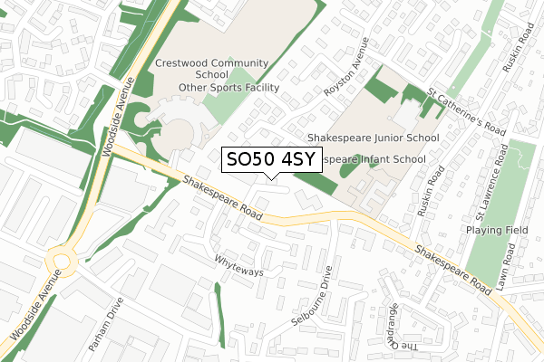
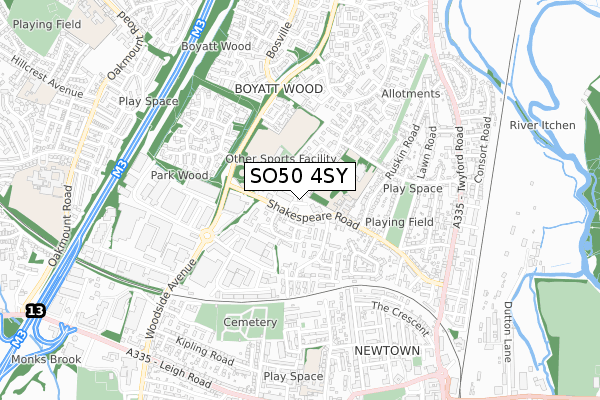
SO50 4SY lies on Arrow Close in Eastleigh. SO50 4SY is located in the Eastleigh North electoral ward, within the local authority district of Eastleigh and the English Parliamentary constituency of Eastleigh. The Sub Integrated Care Board (ICB) Location is NHS Hampshire and Isle of Wight ICB - D9Y0V and the police force is Hampshire. This postcode has been in use since December 1994.


GetTheData
Source: OS Open Zoomstack (Ordnance Survey)
Licence: Open Government Licence (requires attribution)
Attribution: Contains OS data © Crown copyright and database right 2025
Source: Open Postcode Geo
Licence: Open Government Licence (requires attribution)
Attribution: Contains OS data © Crown copyright and database right 2025; Contains Royal Mail data © Royal Mail copyright and database right 2025; Source: Office for National Statistics licensed under the Open Government Licence v.3.0
| Easting | 445100 |
| Northing | 119999 |
| Latitude | 50.977642 |
| Longitude | -1.358970 |
GetTheData
Source: Open Postcode Geo
Licence: Open Government Licence
| Street | Arrow Close |
| Town/City | Eastleigh |
| Country | England |
| Postcode District | SO50 |
➜ See where SO50 is on a map ➜ Where is Eastleigh? | |
GetTheData
Source: Land Registry Price Paid Data
Licence: Open Government Licence
Elevation or altitude of SO50 4SY as distance above sea level:
| Metres | Feet | |
|---|---|---|
| Elevation | 20m | 66ft |
Elevation is measured from the approximate centre of the postcode, to the nearest point on an OS contour line from OS Terrain 50, which has contour spacing of ten vertical metres.
➜ How high above sea level am I? Find the elevation of your current position using your device's GPS.
GetTheData
Source: Open Postcode Elevation
Licence: Open Government Licence
| Ward | Eastleigh North |
| Constituency | Eastleigh |
GetTheData
Source: ONS Postcode Database
Licence: Open Government Licence
UNIT 1-2, CHESIL HOUSE, ARROW CLOSE, EASTLEIGH, SO50 4SY 2003 22 APR £375,000 |
GetTheData
Source: HM Land Registry Price Paid Data
Licence: Contains HM Land Registry data © Crown copyright and database right 2025. This data is licensed under the Open Government Licence v3.0.
| Selbourne Drive (Shakespeare Road) | Boyatt Wood | 87m |
| Selbourne Drive (Shakespeare Road) | Boyatt Wood | 101m |
| The Arrow (Shakespeare Road) | Boyatt Wood | 119m |
| The Arrow (Shakespeare Road) | Boyatt Wood | 127m |
| Thorn Close (St Catherine's Road) | Boyatt Wood | 301m |
| Eastleigh Station | 1.1km |
| Chandlers Ford Station | 2km |
| Southampton Airport Parkway Station | 3km |
GetTheData
Source: NaPTAN
Licence: Open Government Licence
GetTheData
Source: ONS Postcode Database
Licence: Open Government Licence

➜ Get more ratings from the Food Standards Agency
GetTheData
Source: Food Standards Agency
Licence: FSA terms & conditions
| Last Collection | |||
|---|---|---|---|
| Location | Mon-Fri | Sat | Distance |
| Boyatt Wood Post Office | 17:30 | 11:45 | 81m |
| St Catherines Road | 17:00 | 11:45 | 411m |
| Goodwood Road | 18:00 | 12:30 | 512m |
GetTheData
Source: Dracos
Licence: Creative Commons Attribution-ShareAlike
The below table lists the International Territorial Level (ITL) codes (formerly Nomenclature of Territorial Units for Statistics (NUTS) codes) and Local Administrative Units (LAU) codes for SO50 4SY:
| ITL 1 Code | Name |
|---|---|
| TLJ | South East (England) |
| ITL 2 Code | Name |
| TLJ3 | Hampshire and Isle of Wight |
| ITL 3 Code | Name |
| TLJ35 | South Hampshire |
| LAU 1 Code | Name |
| E07000086 | Eastleigh |
GetTheData
Source: ONS Postcode Directory
Licence: Open Government Licence
The below table lists the Census Output Area (OA), Lower Layer Super Output Area (LSOA), and Middle Layer Super Output Area (MSOA) for SO50 4SY:
| Code | Name | |
|---|---|---|
| OA | E00115245 | |
| LSOA | E01022674 | Eastleigh 004E |
| MSOA | E02004715 | Eastleigh 004 |
GetTheData
Source: ONS Postcode Directory
Licence: Open Government Licence
| SO50 4PX | Selwyn Gardens | 71m |
| SO50 4NS | Winston Close | 96m |
| SO50 4QR | Shakespeare Road | 115m |
| SO50 4NQ | Whyteways | 151m |
| SO50 4PW | Tiptree Close | 163m |
| SO50 4NY | Swanley Close | 163m |
| SO50 4NJ | Royston Avenue | 191m |
| SO50 4NR | Whyteways | 194m |
| SO50 4PH | Selbourne Drive | 200m |
| SO50 4FZ | Shakespeare Road | 214m |
GetTheData
Source: Open Postcode Geo; Land Registry Price Paid Data
Licence: Open Government Licence