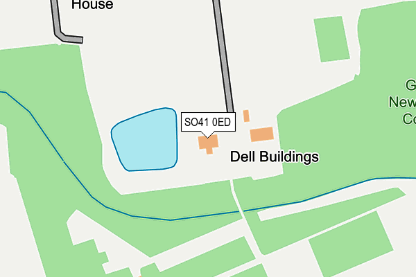
SO41 0ED is located in the Milford & Hordle electoral ward, within the local authority district of New Forest and the English Parliamentary constituency of New Forest West. The Sub Integrated Care Board (ICB) Location is NHS Hampshire and Isle of Wight ICB - D9Y0V and the police force is Hampshire. This postcode has been in use since July 2009.


GetTheData
Source: OS OpenMap – Local (Ordnance Survey)
Source: OS VectorMap District (Ordnance Survey)
Licence: Open Government Licence (requires attribution)
| Easting | 430340 |
| Northing | 93477 |
| Latitude | 50.740106 |
| Longitude | -1.571385 |
GetTheData
Source: Open Postcode Geo
Licence: Open Government Licence
| Country | England |
| Postcode District | SO41 |
➜ See where SO41 is on a map | |
GetTheData
Source: Land Registry Price Paid Data
Licence: Open Government Licence
Elevation or altitude of SO41 0ED as distance above sea level:
| Metres | Feet | |
|---|---|---|
| Elevation | 10m | 33ft |
Elevation is measured from the approximate centre of the postcode, to the nearest point on an OS contour line from OS Terrain 50, which has contour spacing of ten vertical metres.
➜ How high above sea level am I? Find the elevation of your current position using your device's GPS.
GetTheData
Source: Open Postcode Elevation
Licence: Open Government Licence
| Ward | Milford & Hordle |
| Constituency | New Forest West |
GetTheData
Source: ONS Postcode Database
Licence: Open Government Licence
| Efford Nursery (Milford Road) | Pennington | 503m |
| Efford Nursery (Milford Road) | Pennington | 509m |
| Efford Bridge (Milford Road) | Pennington | 675m |
| Efford Bridge (Milford Road) | Pennington | 678m |
| Efford Cottage (Milford Road) | Everton | 902m |
| Lymington Town Station | 3.3km |
| Lymington Pier Station | 3.6km |
| Sway Station | 5.7km |
GetTheData
Source: NaPTAN
Licence: Open Government Licence
GetTheData
Source: ONS Postcode Database
Licence: Open Government Licence


➜ Get more ratings from the Food Standards Agency
GetTheData
Source: Food Standards Agency
Licence: FSA terms & conditions
| Last Collection | |||
|---|---|---|---|
| Location | Mon-Fri | Sat | Distance |
| Efford Hill | 17:30 | 07:00 | 691m |
| Braxton Court Yard | 16:15 | 08:30 | 1,077m |
| Everton Corner | 16:15 | 09:45 | 1,213m |
GetTheData
Source: Dracos
Licence: Creative Commons Attribution-ShareAlike
The below table lists the International Territorial Level (ITL) codes (formerly Nomenclature of Territorial Units for Statistics (NUTS) codes) and Local Administrative Units (LAU) codes for SO41 0ED:
| ITL 1 Code | Name |
|---|---|
| TLJ | South East (England) |
| ITL 2 Code | Name |
| TLJ3 | Hampshire and Isle of Wight |
| ITL 3 Code | Name |
| TLJ36 | Central Hampshire |
| LAU 1 Code | Name |
| E07000091 | New Forest |
GetTheData
Source: ONS Postcode Directory
Licence: Open Government Licence
The below table lists the Census Output Area (OA), Lower Layer Super Output Area (LSOA), and Middle Layer Super Output Area (MSOA) for SO41 0ED:
| Code | Name | |
|---|---|---|
| OA | E00117127 | |
| LSOA | E01023051 | New Forest 023B |
| MSOA | E02004801 | New Forest 023 |
GetTheData
Source: ONS Postcode Directory
Licence: Open Government Licence
| SO41 0JF | Milford Road | 468m |
| SO41 0JE | Efford Hill Cottages | 691m |
| SO41 0JD | Milford Road | 765m |
| SO41 0TT | Agarton Lane | 833m |
| SO41 0JG | Milford Road | 976m |
| SO41 0TX | Lymore Lane | 979m |
| SO41 0TW | Lymore Valley | 1004m |
| SO41 8DP | Milford Road | 1009m |
| SO41 0ZR | The Grange | 1108m |
| SO41 0TY | Grange Close | 1111m |
GetTheData
Source: Open Postcode Geo; Land Registry Price Paid Data
Licence: Open Government Licence