SO40 3RY open data databoard
SO40 3RY is located in the Totton North electoral ward, within the local authority district of New Forest and the English Parliamentary constituency of New Forest East. The Sub Integrated Care Board (ICB) Location is NHS Hampshire and Isle of Wight ICB - D9Y0V and the police force is Hampshire. This postcode has been in use since December 1994.
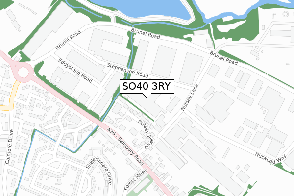
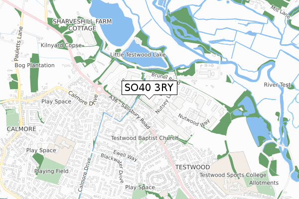
SO40 3RY maps


Licence: Open Government Licence (requires attribution)
Attribution: Contains OS data © Crown copyright and database right 2025
Source: Open Postcode Geo
Licence: Open Government Licence (requires attribution)
Attribution: Contains OS data © Crown copyright and database right 2025; Contains Royal Mail data © Royal Mail copyright and database right 2025; Source: Office for National Statistics licensed under the Open Government Licence v.3.0
SO40 3RY geodata
| Easting | 434885 |
| Northing | 114898 |
| Latitude | 50.932474 |
| Longitude | -1.504944 |
Where is SO40 3RY?
| Country | England |
| Postcode District | SO40 |
SO40 3RY Elevation
Elevation or altitude of SO40 3RY as distance above sea level:
| Metres | Feet | |
|---|---|---|
| Elevation | 10m | 33ft |
Elevation is measured from the approximate centre of the postcode, to the nearest point on an OS contour line from OS Terrain 50, which has contour spacing of ten vertical metres.
➜ How high above sea level am I? Find the elevation of your current position using your device's GPS.
Politics
| Ward | Totton North |
|---|---|
| Constituency | New Forest East |
Transport
Nearest bus stops to SO40 3RY
| Testwood Crescent (Salisbury Road) | Calmore | 120m |
| Testwood Crescent (Salisbury Roadt) | Calmore | 163m |
| Embley Close (Calmore Drive) | Calmore | 361m |
| Embley Close (Calmore Drive) | Calmore | 365m |
| Stanley Road (Salisbury Road) | Testwood | 376m |
Nearest railway stations to SO40 3RY
| Totton Station | 2.3km |
| Redbridge (Hants) Station | 2.8km |
| Ashurst New Forest Station | 5km |
Deprivation
37% of English postcodes are less deprived than SO40 3RY:Food Standards Agency
Three nearest food hygiene ratings to SO40 3RY (metres)


➜ Get more ratings from the Food Standards Agency
Nearest post box to SO40 3RY
| Last Collection | |||
|---|---|---|---|
| Location | Mon-Fri | Sat | Distance |
| South Hants Industrial Park | 18:30 | 12:15 | 226m |
| So40 South Hampshire Industrial Park | 18:45 | 226m | |
| Shakespeare Drive | 17:00 | 11:30 | 338m |
SO40 3RY ITL and SO40 3RY LAU
The below table lists the International Territorial Level (ITL) codes (formerly Nomenclature of Territorial Units for Statistics (NUTS) codes) and Local Administrative Units (LAU) codes for SO40 3RY:
| ITL 1 Code | Name |
|---|---|
| TLJ | South East (England) |
| ITL 2 Code | Name |
| TLJ3 | Hampshire and Isle of Wight |
| ITL 3 Code | Name |
| TLJ36 | Central Hampshire |
| LAU 1 Code | Name |
| E07000091 | New Forest |
SO40 3RY census areas
The below table lists the Census Output Area (OA), Lower Layer Super Output Area (LSOA), and Middle Layer Super Output Area (MSOA) for SO40 3RY:
| Code | Name | |
|---|---|---|
| OA | E00117284 | |
| LSOA | E01023080 | New Forest 003B |
| MSOA | E02004781 | New Forest 003 |
Nearest postcodes to SO40 3RY
| SO40 3ND | Salisbury Road | 120m |
| SO40 3SA | South Hampshire Industrial Park | 134m |
| SO40 3NA | Nutsey Avenue | 140m |
| SO40 3NH | Testwood Crescent | 191m |
| SO40 3NJ | Testwood Crescent | 200m |
| SO40 3NF | Salisbury Road | 207m |
| SO40 2QU | Longbridge Court | 221m |
| SO40 3NG | Testwood Crescent | 228m |
| SO40 3LZ | Salisbury Road | 254m |
| SO40 2QY | Longbridge Close | 258m |