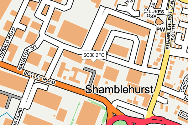
SO30 2FQ is located in the Hedge End North electoral ward, within the local authority district of Eastleigh and the English Parliamentary constituency of Eastleigh. The Sub Integrated Care Board (ICB) Location is NHS Hampshire and Isle of Wight ICB - D9Y0V and the police force is Hampshire. This postcode has been in use since December 1994.


GetTheData
Source: OS OpenMap – Local (Ordnance Survey)
Source: OS VectorMap District (Ordnance Survey)
Licence: Open Government Licence (requires attribution)
| Easting | 448906 |
| Northing | 114104 |
| Latitude | 50.924318 |
| Longitude | -1.305540 |
GetTheData
Source: Open Postcode Geo
Licence: Open Government Licence
| Country | England |
| Postcode District | SO30 |
➜ See where SO30 is on a map ➜ Where is Hedge End? | |
GetTheData
Source: Land Registry Price Paid Data
Licence: Open Government Licence
Elevation or altitude of SO30 2FQ as distance above sea level:
| Metres | Feet | |
|---|---|---|
| Elevation | 30m | 98ft |
Elevation is measured from the approximate centre of the postcode, to the nearest point on an OS contour line from OS Terrain 50, which has contour spacing of ten vertical metres.
➜ How high above sea level am I? Find the elevation of your current position using your device's GPS.
GetTheData
Source: Open Postcode Elevation
Licence: Open Government Licence
| Ward | Hedge End North |
| Constituency | Eastleigh |
GetTheData
Source: ONS Postcode Database
Licence: Open Government Licence
| Herald Industrial Estate (Botley Road) | Wildern | 151m |
| Herald Industrial Estate (Botley Road) | Wildern | 154m |
| Navigators Way (Shamblehurst Lane South) | Wildern | 217m |
| Shamblehurst Lane | Wildern | 230m |
| Navigators Way (Shamblehurst Lane South) | Wildern | 231m |
| Hedge End Station | 1.2km |
| Botley Station | 3.4km |
| Bursledon Station | 4.5km |
GetTheData
Source: NaPTAN
Licence: Open Government Licence
GetTheData
Source: ONS Postcode Database
Licence: Open Government Licence


➜ Get more ratings from the Food Standards Agency
GetTheData
Source: Food Standards Agency
Licence: FSA terms & conditions
| Last Collection | |||
|---|---|---|---|
| Location | Mon-Fri | Sat | Distance |
| Grange Park | 16:30 | 07:30 | 228m |
| Herald Industrial Estate | 17:30 | 12:15 | 294m |
| Westward Road | 17:15 | 07:45 | 323m |
GetTheData
Source: Dracos
Licence: Creative Commons Attribution-ShareAlike
The below table lists the International Territorial Level (ITL) codes (formerly Nomenclature of Territorial Units for Statistics (NUTS) codes) and Local Administrative Units (LAU) codes for SO30 2FQ:
| ITL 1 Code | Name |
|---|---|
| TLJ | South East (England) |
| ITL 2 Code | Name |
| TLJ3 | Hampshire and Isle of Wight |
| ITL 3 Code | Name |
| TLJ35 | South Hampshire |
| LAU 1 Code | Name |
| E07000086 | Eastleigh |
GetTheData
Source: ONS Postcode Directory
Licence: Open Government Licence
The below table lists the Census Output Area (OA), Lower Layer Super Output Area (LSOA), and Middle Layer Super Output Area (MSOA) for SO30 2FQ:
| Code | Name | |
|---|---|---|
| OA | E00115390 | |
| LSOA | E01022700 | Eastleigh 011C |
| MSOA | E02004722 | Eastleigh 011 |
GetTheData
Source: ONS Postcode Directory
Licence: Open Government Licence
| SO30 2FX | Solent Industrial Estate | 86m |
| SO30 2HE | Botley Road | 100m |
| SO30 2AP | Haileybury Gardens | 240m |
| SO30 2FN | Shamblehurst Lane South | 242m |
| SO30 2AN | Haileybury Gardens | 254m |
| SO30 2AR | Birchwood Gardens | 267m |
| SO30 2GQ | Chichester Close | 318m |
| SO30 4HW | Charles Watts Way | 329m |
| SO30 4NN | Bader Close | 330m |
| SO30 4NQ | Westward Road | 335m |
GetTheData
Source: Open Postcode Geo; Land Registry Price Paid Data
Licence: Open Government Licence